File:Landssjúkrahúsið Tórshavn 2012.jpg
Jump to navigation
Jump to search


Size of this preview: 800 × 600 pixels. Other resolutions: 320 × 240 pixels | 640 × 480 pixels | 1,024 × 768 pixels | 1,280 × 960 pixels | 2,560 × 1,920 pixels | 4,608 × 3,456 pixels.
Original file (4,608 × 3,456 pixels, file size: 6.56 MB, MIME type: image/jpeg)
Summary
| Description |
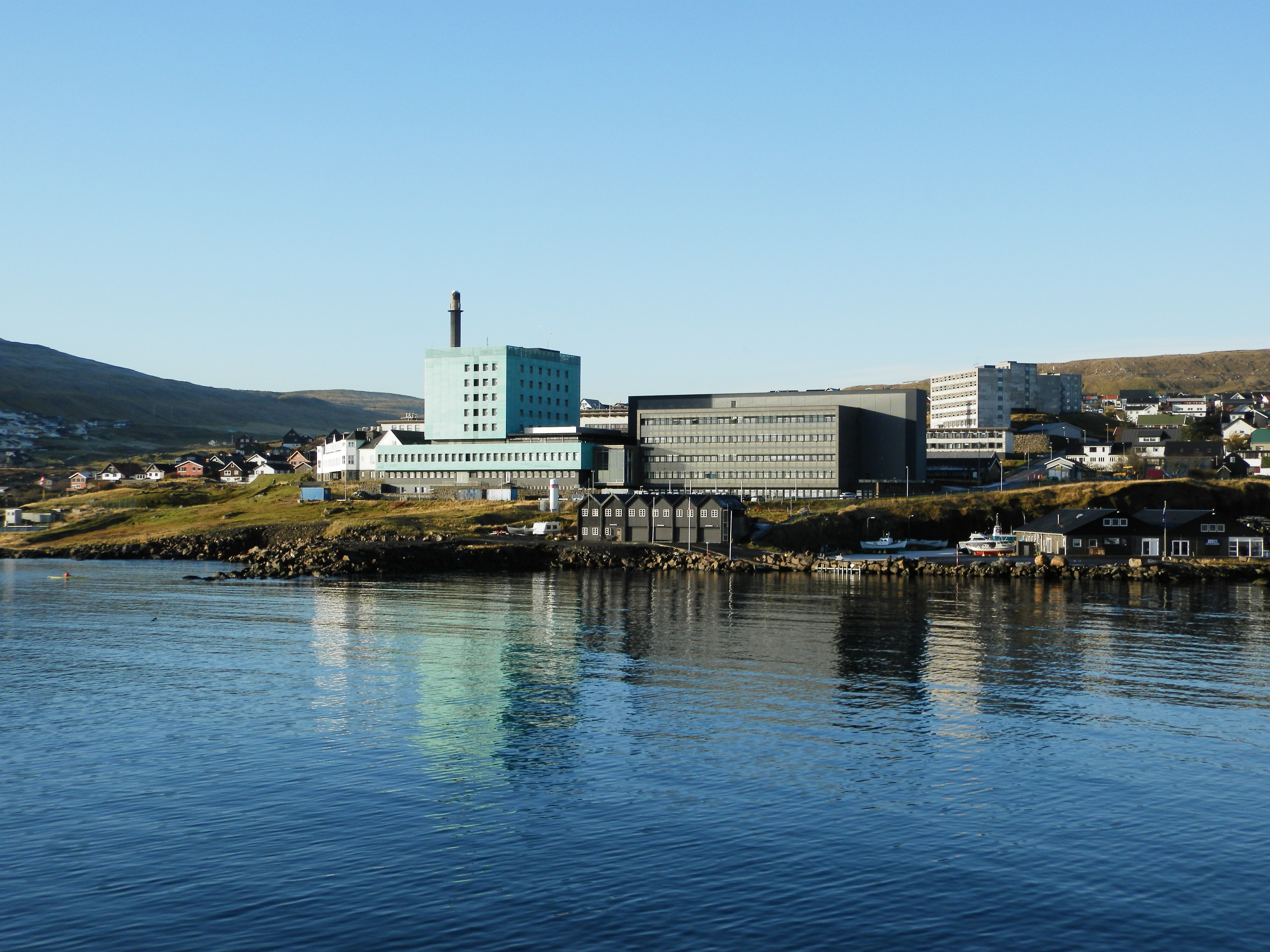
English: Landssjúkrahúsið is the National Hospital of the Faroe Islands, located in Tórshavn, the capital.This photo was taken from the ferry Smyril M/S on route from Suduroy to Tórshavn. The oldest building of the hospital is the white building to the left, built in 1924, at that time it was called "Dronning Alexandrines Hospial", named after a Danish queen. Before that there was the " Færø Amts Hospital", built in 1829. The green building was built later, in the 1960s and the dark gray building to the right was built in the 2000s, opened in 2004. Føroyskt: Landssjúkrahúsið í Havn. Dansk: Landssygehuset i Thorshavn, Færøerne, set fra færgen Smyril M/S. Den ældste bygning er til venstre, Dronning Alexandrines Hospial, som åbnede i 1924. Den grønne bygning blev bygget fra 1962 til 1968/70. Den psykiatriske afdeling ligger i en anden bygning i Eirargarður lidt længere oppe i en af de høje hvide bygninger, de andre bygninger er boligblokke til Landssygehusets sundhedspersonale. Bygningen til højre, den mørkegrå, er den nyeste, den åbnede i 2004. Landsssygehuset er Færøernes største arbejdsplads med ca. 850 ansatte. |
| Date | |
| Source | Own work |
| Author | EileenSanda |
| Object location | | View this and other nearby images on: OpenStreetMap |
|---|
Licensing
I, the copyright holder of this work, hereby publish it under the following license:
This file is licensed under the Creative Commons Attribution-Share Alike 3.0 Unported license.
- You are free:
- to share – to copy, distribute and transmit the work
- to remix – to adapt the work
- Under the following conditions:
- attribution – You must give appropriate credit, provide a link to the license, and indicate if changes were made. You may do so in any reasonable manner, but not in any way that suggests the licensor endorses you or your use.
- share alike – If you remix, transform, or build upon the material, you must distribute your contributions under the same or compatible license as the original.
File history
Click on a date/time to view the file as it appeared at that time.
| Date/Time | Thumbnail | Dimensions | User | Comment | |
|---|---|---|---|---|---|
| current | 13:14, 17 April 2013 | | 4,608 × 3,456 (6.56 MB) | wikimediacommons>EileenSanda | User created page with UploadWizard |
File usage
The following 2 pages use this file: