Metropolitan Baburg: Difference between revisions
Jump to navigation
Jump to search
No edit summary |
No edit summary |
||
| Line 26: | Line 26: | ||
| photo4d = | | photo4d = | ||
| photo4e = | | photo4e = | ||
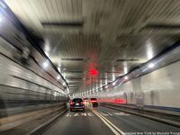
| photo5a = Sullivan Tunnel. | | photo5a = Sullivan Tunnel 2.jpg | ||
| photo5b = | | photo5b = | ||
| photo5c = | | photo5c = | ||
| Line 51: | Line 51: | ||
}} | }} | ||
|image_alt = | |image_alt = | ||
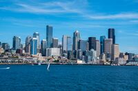
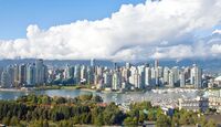
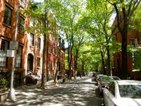
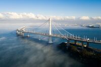
|image_caption = Clockwise to the left: Baburg Skyline, Shanta Skyline, Treelined Street in the city of Nectar Park, Skylink Bridge (2016), | |image_caption = Clockwise to the left: Baburg Skyline, Shanta Skyline, Treelined Street in the city of Nectar Park, Skylink Bridge (2016) connecting Baburg and Oryonne Islands, Sullivan Tunnel (1952) connecting Baburg and Oryonne Islands, | ||
|image_flag = | |image_flag = | ||
|flag_alt = | |flag_alt = | ||
Revision as of 19:04, 27 November 2021
Metropolitan Baburg
Metropolano Baburg | |
|---|---|
Metropolitan Area | |
Clockwise to the left: Baburg Skyline, Shanta Skyline, Treelined Street in the city of Nectar Park, Skylink Bridge (2016) connecting Baburg and Oryonne Islands, Sullivan Tunnel (1952) connecting Baburg and Oryonne Islands, | |
| Country | Kingdom of Vita |
| Provinces | Baburg, Oryonne |
| Islands | Baburg, Oryonne |
| Established | 1960 |
| Area | |
| • Urban | 255 sq mi (660 km2) |
| • Rural | 130 sq mi (300 km2) |
| • Metro | 385 sq mi (1,000 km2) |
| Elevation | 161 ft (49 m) |
| Population (2021) | |
| • Metropolitan Area | 5 million |
| • Density | 12,987/sq mi (5,014/km2) |
