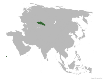
Altai Soviet Socialist Republic: Difference between revisions
Jump to navigation
Jump to search
mNo edit summary |
mNo edit summary |
||
| (One intermediate revision by the same user not shown) | |||
| Line 2: | Line 2: | ||
|micronation = <!--yes if a micronation--> | |micronation = <!--yes if a micronation--> | ||
|conventional_long_name = <!--Formal or official full name of the country in English--> Altai Soviet Socialist Republic | |conventional_long_name = <!--Formal or official full name of the country in English--> Altai Soviet Socialist Republic | ||
|native_name = <!--Country's name (usually full name) in its official/defacto language(s), hence in italics (double quotemarks)--> Алтай | |native_name = <!--Country's name (usually full name) in its official/defacto language(s), hence in italics (double quotemarks)--> {{native name|alt|Алтай Совет Социалистік Республикасы}}<br>''Altay Sovyet Sotsialistik Respublikasi'' | ||
|common_name = <!--Common name in English (used for wikilinks, captions, and to produce a default iso3166 code)--> | |common_name = <!--Common name in English (used for wikilinks, captions, and to produce a default iso3166 code)--> | ||
|status = <!--Status of country--> | |status = <!--Status of country--> | ||
| Line 29: | Line 29: | ||
|map_caption2 = <!--Caption to place below second map--> | |map_caption2 = <!--Caption to place below second map--> | ||
|image_map2_size = <!--Map size in number of pixels--> | |image_map2_size = <!--Map size in number of pixels--> | ||
|capital = <!--Name of country/territory's capital, wikilinked if link exists--> | |capital = <!--Name of country/territory's capital, wikilinked if link exists--> Kyzyl-Tuu | ||
|coordinates = <!-- Coordinates for capital, using {{tl|coord}} --> | |coordinates = <!-- Coordinates for capital, using {{tl|coord}} --> | ||
|largest_city = <!--Name of country/territory's largest city. Use "capital" (without quotation marks) if it's the capital.--> | |largest_city = <!--Name of country/territory's largest city. Use "capital" (without quotation marks) if it's the capital.--> | ||
| Line 127: | Line 127: | ||
{{Weather box | {{Weather box | ||
|location = | |location = Kyzyl-Tuu | ||
|metric first = y | |metric first = y | ||
|single line = y | |single line = y | ||
Latest revision as of 18:38, 16 September 2024
Altai Soviet Socialist Republic | |
|---|---|
| Anthem: | |
 | |
| Capital | Kyzyl-Tuu |
| Area | |
• Total | 260,899 km2 (100,734 sq mi) |
| Population | |
• Estimate | 2,374,617 |
| HDI | very high |
| Internet TLD | .at |
| Climate data for Kyzyl-Tuu | |||||||||||||
|---|---|---|---|---|---|---|---|---|---|---|---|---|---|
| Month | Jan | Feb | Mar | Apr | May | Jun | Jul | Aug | Sep | Oct | Nov | Dec | Year |
| Average high °C (°F) | 32.1 (89.8) |
33.8 (92.8) |
34.7 (94.5) |
37.2 (99.0) |
37.5 (99.5) |
39.4 (102.9) |
42.3 (108.1) |
38.6 (101.5) |
36.1 (97.0) |
35.0 (95.0) |
32.9 (91.2) |
31.2 (88.2) |
35.9 (96.6) |
| Daily mean °C (°F) | 23.5 (74.3) |
24.9 (76.8) |
25.4 (77.7) |
27.2 (81.0) |
28.4 (83.1) |
28.4 (83.1) |
30.0 (86.0) |
28.1 (82.6) |
26.4 (79.5) |
25.4 (77.7) |
24.3 (75.7) |
23.4 (74.1) |
26.3 (79.3) |
| Average low °C (°F) | 15.0 (59.0) |
16.1 (61.0) |
16.2 (61.2) |
17.3 (63.1) |
17.4 (63.3) |
17.5 (63.5) |
17.7 (63.9) |
17.6 (63.7) |
16.8 (62.2) |
15.9 (60.6) |
15.8 (60.4) |
15.7 (60.3) |
16.6 (61.9) |
| Average precipitation mm (inches) | 39.5 (1.56) |
34.8 (1.37) |
35.5 (1.40) |
57.5 (2.26) |
98.3 (3.87) |
116.6 (4.59) |
145.5 (5.73) |
112.2 (4.42) |
83.5 (3.29) |
76.5 (3.01) |
66.4 (2.61) |
54.5 (2.15) |
920.8 (36.26) |
| Source: [NAME OF THE WEBSITE] | |||||||||||||