Brativas: Difference between revisions
Slovertia12 (talk | contribs) No edit summary |
Slovertia12 (talk | contribs) |
||
| (4 intermediate revisions by the same user not shown) | |||
| Line 6: | Line 6: | ||
| settlement_type = [[Capital city]] | | settlement_type = [[Capital city]] | ||
<!-- images, nicknames, motto --> | <!-- images, nicknames, motto --> | ||
| image_skyline = {{ | | image_skyline = {{image frame|content={{Photomontage | ||
| photo1a = PalaceModello.jpg | |||
| photo2a = Baška018.jpg | |||
| photo2b = Jagiellonska street, Old Town, Krakow, Poland.jpg | |||
| photo3a = 4 Świętej Barbary Street, Warsaw, Poland 02.jpg | |||
| photo3b = Windows of Turkish house in Rijeka Croatia 002.JPG | |||
| photo4a = Sławkowska Street in Kraków, Poland, September 2019.jpg | |||
}}}} | |||
}} | |||
| image_caption = | | image_caption = | ||
| image_flag = | | image_flag = | ||
| Line 90: | Line 87: | ||
'''Brativas''' the capital and second largest city of Slovertia. Officially, the population of the city is about 1,100,000 Brativas is in northwestern Slovertia, occupying the banks of the River Stará rieka. Over the course of its history Brativas has swung between being under the Sovereignty of [[South Mazuria|Mazuria]] and [[Slovertia]]. It has changed nations approximately twelve times but has been a part of Slovertia consistently from 1815. | '''Brativas''' the capital and second largest city of Slovertia. Officially, the population of the city is about 1,100,000 Brativas is in northwestern Slovertia, occupying the banks of the River Stará rieka. Over the course of its history Brativas has swung between being under the Sovereignty of [[South Mazuria|Mazuria]] and [[Slovertia]]. It has changed nations approximately twelve times but has been a part of Slovertia consistently from 1815. | ||
==History== | ==History== | ||
| Line 101: | Line 92: | ||
==Geography== | ==Geography== | ||
Brativas is situated in | Brativas is situated in Slovertia's north west only a few miles from the border with Nikolia. To the city's north east lie the Srebrogora mountains which are visible all around the city. To the west west and south west lies the Kojbakvy ridge an area of less steep upland that can be seen from the west of the city. Brativas is generally quite hilly and lies on the Stara Rieka valley in between the two ranges. | ||
===Climate=== | ===Climate=== | ||
Brativas | Brativas like Slovertia as a whole experiences a continental climate with relatively watm summers and cold winters. Due to its higher altitude Brativas experiences colder winters than other Sloverti citoes such as [[Kojbakvy (City)|Kojbakvy]]. | ||
==Location== | ==Location== | ||
Latest revision as of 11:58, 20 May 2022
Brativas | |
|---|---|
| Nicknames: Beauty on the Stará rieka | |
| Country | Slovertia |
| Region | Brativas region |
| First mentioned | 910 |
| Government | |
| • Mayor of Brativas | Matúš Obecy |
| Area | |
| • Capital city | 534.584 km2 (206.404 sq mi) |
| • Urban | 420.15 km2 (162.22 sq mi) |
| • Metro | 1,051 km2 (auto sq mi) |
| Elevation | 278 m (912 ft) |
| Population (2018-) | |
| • Capital city | 1,100,000 |
| • Density | 2,100/km2 (5,300/sq mi) |
| • Urban | 644,000 |
| • Urban density | 1,500/km2 (4,000/sq mi) |
| • Metro | 456,000 |
| • Metro density | 430/km2 (1,100/sq mi) |
| Demonym | Brativascan |
| Time zone | UTC+1 |
| • Summer (DST) | UTC+2 |
| Postal code | 9AT XX |
| GRP (Metro) | 2018 |
| – Total | €21 billion ($Template:To USDB) |
| – Per capita | €42,800 ($Template:To USD) |
Brativas the capital and second largest city of Slovertia. Officially, the population of the city is about 1,100,000 Brativas is in northwestern Slovertia, occupying the banks of the River Stará rieka. Over the course of its history Brativas has swung between being under the Sovereignty of Mazuria and Slovertia. It has changed nations approximately twelve times but has been a part of Slovertia consistently from 1815.
History
Geography
Brativas is situated in Slovertia's north west only a few miles from the border with Nikolia. To the city's north east lie the Srebrogora mountains which are visible all around the city. To the west west and south west lies the Kojbakvy ridge an area of less steep upland that can be seen from the west of the city. Brativas is generally quite hilly and lies on the Stara Rieka valley in between the two ranges.
Climate
Brativas like Slovertia as a whole experiences a continental climate with relatively watm summers and cold winters. Due to its higher altitude Brativas experiences colder winters than other Sloverti citoes such as Kojbakvy.
Location
Cityscape
The cityscape of Brativas is characterised by medieval towers and 20th-century buildings, but it underwent profound changes in a construction boom at the start of the 21st century.
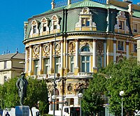
Most historical buildings are concentrated in the Old Town. Brativas' Town Hall is a complex of three buildings erected in the 14th–16th centuries and now hosts the Sloveti National Museum. The old city walls are the only thing that has been preserved from the medieval fortifications, and it ranks among the oldest of the town's buildings. Brativas' old town also includes the Cathedral of Brativas and the Sloverti State Library as well as the National Assembly Buildings.
The city's walls are amongst the oldest in Astyria although they have been rebuilt several times over the last 400 years due to various sieges.


