Leiphofen: Difference between revisions
No edit summary |
No edit summary |
||
| Line 4: | Line 4: | ||
|native_name = <!--Country's name (usually full name) in its native language, hence in italics (double quotemarks)--> | |native_name = <!--Country's name (usually full name) in its native language, hence in italics (double quotemarks)--> | ||
|common_name = <!--Common name in English (used for wikilinks and to produce a default iso3166 code)--> | |common_name = <!--Common name in English (used for wikilinks and to produce a default iso3166 code)--> | ||
|image_flag = File: | |image_flag = File:POL Kętrzyn flag.svg<!--e.g. Flag of country.svg--> | ||
|image_coat = <!--e.g. Coat of arms of country.svg--> | |image_coat = File:POL Kętrzyn COA 1.svg<!--e.g. Coat of arms of country.svg--> | ||
|national_motto = <!--in inverted commas and wikilinked if link exists--> | |national_motto = <!--in inverted commas and wikilinked if link exists--> | ||
|national_anthem = <!--in italics (double quotemarks) and wikilinked if link exists--> | |national_anthem = <!--in italics (double quotemarks) and wikilinked if link exists--> | ||
Revision as of 16:09, 19 October 2022
This article is incomplete because it is pending further input from participants, or it is a work-in-progress by one author. Please comment on this article's talk page to share your input, comments and questions. Note: To contribute to this article, you may need to seek help from the author(s) of this page. |
Grand Duchy of Leiphofen-Scharnau | |
|---|---|
| Capital | Leiphofen |
| Largest city | Scharnau |
| Official languages | Scharnauer |
| Government | Monarchy |
• Grand Duke | Leopold XIX |
| Population | |
• Estimate | 49,699,000 |
| Currency | Leiphofen-Scharnauer Lev |
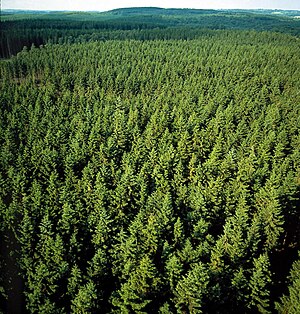
Leiphofen-Scharnau, officially the Grand Duchy of Leiphofen-Scharnau or the Grand Duchy of Leiphofen and Scharnau, is a sovereign state located within the Süd Depths. Located east of Hrastče and south of Hafodmark, Leiphofen-Scharnau enjoys a temperate climate, with a majority of the nation being covered in temperate rainforests and seperated by land cleared for agriculture.
Geography
Sudervik and all islands and islets within are located in a body of water called the Süd Depths, where its name is derived. Most of the islands are represented by forested hilly landscapes with jagged and rocky coasts. Almost all of the islands are covered by temperate coniferous rainforests, dominated by pine, spruce, fir and larch. Some portions of the islands are wetlands or meadows, especially near the numerous rivers. A number of areas of the kingdom have been designated as Royal Preserves, protected natural areas for use of the royal family only. Along the rock-bound coasts are lighthouses, beaches, fishing villages, and thousands of offshore islands. There are jagged rocks and cliffs and many bays and inlets. Geologists describe this type of landscape as a "drowned coast", where a rising sea level has invaded former land features, creating bays out of valleys and islands out of mountain tops.
There are a large number of wild animals present on the islands, with the most common being deer, coyotes, foxes, pine squirrels and beavers. Sudervik is home to a great number of birds including Golden Eagles, Cardinals, Bluebirds, and Westland Petrels. Many species of fish live in the ocean waters surrounding the islands, and the fishing industry is a major part of the economy, including commercial whaling.
Climate
The climate of Sudervik is humid continental climate and a cool summer subtype. Surface water temperatures around the islands reach a summer average of 12 °C (54 °F) inshore and 9 °C (48 °F) offshore to winter lows of −1 °C (30 °F) inshore and 2 °C (36 °F) offshore. The sea keeps winter temperatures slightly higher and summer temperatures a little lower on the coast than inland. The maritime climate produces more variable weather, ample precipitation in a variety of forms, greater humidity, lower visibility, more clouds, less sunshine, and higher winds than a continental climate. Light to heavy fog is a common and near daily occurance on the islands
