Etheulia: Difference between revisions
mNo edit summary |
m (→Climate) |
||
| Line 186: | Line 186: | ||
|May precipitation mm = 172.0 | |May precipitation mm = 172.0 | ||
|Jun precipitation mm = 65.0 | |Jun precipitation mm = 65.0 | ||
|Jul precipitation mm = | |Jul precipitation mm = 68.0 | ||
|Aug precipitation mm = | |Aug precipitation mm = 77.0 | ||
|Sep precipitation mm = 51.0 | |Sep precipitation mm = 51.0 | ||
|Oct precipitation mm = 180.0 | |Oct precipitation mm = 180.0 | ||
Latest revision as of 02:35, 25 March 2023
United States of Etheulia | |
|---|---|
| Motto: Όπου υπάρχει Έλληνας, αυτό είναι το έδαφός μας (Greek) Wherever there is a Greek, that is our territory. | |
 | |
| Capital | Erythrephyrian |
| Official languages | Greek |
| Recognised regional languages | Turkish English |
| Demonym(s) | Etheulian |
| Government | Unitary one-party republic under totalitarian fascist dictatorship |
• Duce | Stelios Christodoulides |
• Prime Minister | Themistoklis Romaniadis |
• Representative to Turkish-speaking community | Akintan Karaduman |
| Legislature | None |
| Gini | 9.6 low |
| HDI | low |
Etheulia formally the United States of Etheulia, is a country located in Southeast Europe, between the Balkan Peninsula and with a large coast in between the Aegean, Mediterranean and Ionian Sea. It mostly consists in archipielagos, however it has a peninsula in the east.
History
On April 20 [O.S. April 7] 1966, a group of high-ranked soldiers, many of them linked with far-right organizations, led a coup against the then Etheulian monarchy and the Prime Minister, who were overthrown during a bloody and violent coup. The King Giorgios II and his family resulted killed and the then Prime Minister Kimon Perropoulos commited suicide when the putschists tried to arrest him in the government office.
Geography
Climate
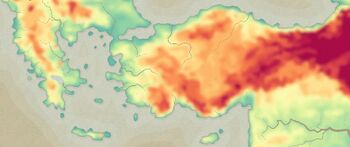
Etheulia is characterized by at least three different climates: Tropical monsoon climate (Am), Humid Subtropical (Cfa) and Highland subtropical climate (Cwb). In the east coast, some cities have hot summer mediterranean climate (Csa).
| Climate data for Erythrephyrian | |||||||||||||
|---|---|---|---|---|---|---|---|---|---|---|---|---|---|
| Month | Jan | Feb | Mar | Apr | May | Jun | Jul | Aug | Sep | Oct | Nov | Dec | Year |
| Average high °C (°F) | 32.7 (90.9) |
33.2 (91.8) |
33.3 (91.9) |
33.5 (92.3) |
33.6 (92.5) |
33.7 (92.7) |
33.9 (93.0) |
32.8 (91.0) |
31.7 (89.1) |
31.6 (88.9) |
31.2 (88.2) |
31.1 (88.0) |
32.7 (90.9) |
| Daily mean °C (°F) | 25.8 (78.4) |
26.6 (79.9) |
26.6 (79.9) |
26.7 (80.1) |
26.8 (80.2) |
27.3 (81.1) |
28.4 (83.1) |
27.9 (82.2) |
26.3 (79.3) |
25.8 (78.4) |
25.6 (78.1) |
25.5 (77.9) |
26.6 (79.9) |
| Average low °C (°F) | 19.0 (66.2) |
20.0 (68.0) |
20.0 (68.0) |
20.0 (68.0) |
20.0 (68.0) |
21.0 (69.8) |
23.0 (73.4) |
23.0 (73.4) |
21.0 (69.8) |
20.0 (68.0) |
20.0 (68.0) |
20.0 (68.0) |
20.6 (69.1) |
| Average precipitation mm (inches) | 176.0 (6.93) |
118.0 (4.65) |
150.0 (5.91) |
193.0 (7.60) |
172.0 (6.77) |
65.0 (2.56) |
68.0 (2.68) |
77.0 (3.03) |
51.0 (2.01) |
180.0 (7.09) |
175.0 (6.89) |
125.0 (4.92) |
1,550 (61.04) |

