Territories of Meridon: Difference between revisions
| Line 42: | Line 42: | ||
|[[Alexandria Island]] | |[[Alexandria Island]] | ||
|[[Port Sistine]] | |[[Port Sistine]] | ||
| | |101,193,150 | ||
|1, | |1,610,987.5 | ||
| | |62.81 | ||
|- | |- | ||
|[[Mahine Territory]] | |[[Mahine Territory]] | ||
| Line 51: | Line 51: | ||
|[[Mahine Island]] | |[[Mahine Island]] | ||
|[[Kohina]] | |[[Kohina]] | ||
| | |60,131,825 | ||
| | |771,443.75 | ||
| | |77.95 | ||
|- | |- | ||
|[[Smith Island Territory]] | |[[Smith Island Territory]] | ||
| Line 60: | Line 60: | ||
|[[Smith Island]] | |[[Smith Island]] | ||
|[[Tullamarina]] | |[[Tullamarina]] | ||
| | |36,394,900 | ||
| | |596,806.25 | ||
| | |47.18 | ||
|- | |- | ||
|[[Helena Territory]] | |[[Helena Territory]] | ||
| Line 69: | Line 69: | ||
|[[Helena Island]] | |[[Helena Island]] | ||
|[[Kohaku]] | |[[Kohaku]] | ||
| | |30,153,075 | ||
| | |274,968.75 | ||
| | |109.66 | ||
|- | |- | ||
|[[Kalua Territory]] | |[[Kalua Territory]] | ||
| Line 78: | Line 78: | ||
|[[Kalua Island]] | |[[Kalua Island]] | ||
|[[Makohine]] | |[[Makohine]] | ||
| | |18,762,476 | ||
| | |246,650 | ||
| | |76.07 | ||
|- | |- | ||
|[[Redbird Territory]] | |[[Redbird Territory]] | ||
| Line 87: | Line 87: | ||
|[[Redbird Island]] | |[[Redbird Island]] | ||
|[[Baymark]] | |[[Baymark]] | ||
| | |14,120,756 | ||
| | |228,800 | ||
| | |61.72 | ||
|- | |- | ||
| Line 97: | Line 97: | ||
|[[Ohawe Island]] | |[[Ohawe Island]] | ||
|[[Otahu]] | |[[Otahu]] | ||
| | |10,332,970 | ||
| | |342,718.75 | ||
| | |30.15 | ||
|- | |- | ||
|[[Silvers Island Territory]] | |[[Silvers Island Territory]] | ||
| Line 106: | Line 106: | ||
|[[Silvers Island]] | |[[Silvers Island]] | ||
|[[Radenton]] | |[[Radenton]] | ||
| | |9,189,150 | ||
| | |509,318.75 | ||
| | |18.04 | ||
|- | |- | ||
|[[Taikorea Territory]] | |[[Taikorea Territory]] | ||
| Line 115: | Line 115: | ||
|[[Taikorea Island]] | |[[Taikorea Island]] | ||
|[[Misanui]] | |[[Misanui]] | ||
| | |7,717,707 | ||
| | |147,568.75 | ||
| | |52.30 | ||
|- | |- | ||
|[[Southern Islands Territory]] | |[[Southern Islands Territory]] | ||
| Line 124: | Line 124: | ||
|[[Southern Islands]] | |[[Southern Islands]] | ||
|[[Barretton]] | |[[Barretton]] | ||
| | |71,548 | ||
| | |8,737.5 | ||
| | |8.19 | ||
|- | |- | ||
|[[Eastern Islands Territory]] | |[[Eastern Islands Territory]] | ||
| Line 133: | Line 133: | ||
|[[Eastern Islands]] | |[[Eastern Islands]] | ||
|[[Kisanui]] | |[[Kisanui]] | ||
| | |255,731 | ||
| | |23,343.75 | ||
| | |1.11 | ||
|- | |- | ||
|} | |} | ||
Revision as of 23:06, 11 December 2023
| Territories of Meridon | |
|---|---|
 | |
| Category | Primary administrative divisions |
| Location | |
| Number | 11 |
| Government | Territorial Government structures |
| Subdivisions | Local administrative units of Meridon |
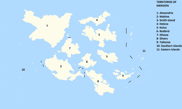
The territories of Meridon are the primary political and administrative divisors of areas in Meridon's federal system. All areas administrated by the Federal Republic are organized into territories, except for the Cordelia Federal District, which is administrated specially. Territories are usually divided into island administrations, or in the case of larger islands or administrations, are separated into districts and metro areas, which are comprised of a variety of further subdivisions, including townships.
The Territories of Meridon were generally recognized at least informally in the years following the Third Colonial War. They were first formally codified in the First Articles of Union in 1666, and have existed with minimal changes in these forms since that time. The territories of the Southern and Eastern Islands were formed in 1884 with the merger of a large amount of administrative areas over individual islands, and were the last major change to the number or design of territories since.
Characteristics
Territories are lead by a governor, who is selected in varying methods depending on an individual territories' processes. 5 territorial governors are elected through parliamentary vote ( Alexandria, Silvers Island, Smith Island,Kalua, and Helena), 4 governors are elected through direct election (Southern Islands, Eastern Islands, Mahine, and Redbird), 1 rotates between a number of chief ministers regularly (Ohawe) and 1 operates an executive council consisting of 5 members (Taikorea). Federal legislation mandates territories to have and provide for a number of services, including medical, educational, law enforcement, transpiration, and environmental services, and also mandates federal standards for each of these to meet. Within these confines, provinces are responsible for organizing and operating said sources, including the provision of funding (which may in some cases be supplemented by Federal aid). Territories are empowered to set their own budgets, taxes, and expenditure within said confines.
Territorial governments generally consist of a legislature which may be parliamentary or not, and elect their representation through electoral districts or through island or district elections. Generally, terms for legislative members last anywhere from 4 to 6 years.
List of Territories
| Territory | Flag | Territory Code Number | Jurisdiction | Capital | Population | Area (mi²) | Population Density (per mi²) |
|---|---|---|---|---|---|---|---|
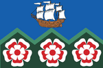
| Alexandria Territory | 
|
AX | Alexandria Island | Port Sistine | 101,193,150 | 1,610,987.5 | 62.81 |
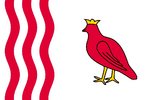
| Mahine Territory | 
|
MH | Mahine Island | Kohina | 60,131,825 | 771,443.75 | 77.95 |
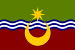
| Smith Island Territory | 
|
SM | Smith Island | Tullamarina | 36,394,900 | 596,806.25 | 47.18 |
| Helena Territory | 
|
HL | Helena Island | Kohaku | 30,153,075 | 274,968.75 | 109.66 |
| Kalua Territory | 
|
KL | Kalua Island | Makohine | 18,762,476 | 246,650 | 76.07 |
| Redbird Territory | 
|
RB | Redbird Island | Baymark | 14,120,756 | 228,800 | 61.72 |
| Ohawe Territory | 
|
OW | Ohawe Island | Otahu | 10,332,970 | 342,718.75 | 30.15 |
| Silvers Island Territory | 
|
SL | Silvers Island | Radenton | 9,189,150 | 509,318.75 | 18.04 |
| Taikorea Territory | 
|
TK | Taikorea Island | Misanui | 7,717,707 | 147,568.75 | 52.30 |
| Southern Islands Territory | 
|
SI | Southern Islands | Barretton | 71,548 | 8,737.5 | 8.19 |
| Eastern Islands Territory | 
|
EI | Eastern Islands | Kisanui | 255,731 | 23,343.75 | 1.11 |