Bunkaiia
Jump to navigation
Jump to search
Mazdakian People's Noocracy of Bunkaiia Wuàtouraïa Mastakei là Bàñkaïa | |
|---|---|
Emblem
| |
| n/a n/a | |
| Capital and largest city | Ponaiga |
| Official languages | Bunkaiian, Italian, English |
| Protected regional or minority languages | Doyani, Tulu, Pinoni Hebrew |
| Ethnic groups (2019) | |
| Religion (2019) |
|
| Demonym(s) | Bunkaiian |
| Government | Parliamentarian Theocratic-Noocracy |
| Legislature | Gouwul |
| Independence from United_Kingdom | |
• Declared | 1960's |
| Area | |
• Total | [convert: invalid number] |
| Population | |
• 2020 estimate | 412,060 |
• 2010 census | 391.213 |
• Density | 51.5 per[convert: unknown unit] |
| Currency | Màrgareita (BMG) (BMG) |
| Time zone | UTC+04:00, D (Bunkaiia Time) |
| Date format | dd/mm/yyyy |
| Driving side | left |
| Calling code | +292 |
| ISO 3166 code | BK |
| Internet TLD | .bk |
Bunkaiia
Bunkaiia [/ˈbəŋkaɪˈja/ BUNG-kay-yah] (alternatively written as Bunkaïa) , officially the Mazdakian People's Noocracy of Bunkaiia (Shibung: Wàtouraïa Mastakei là Bàñkaïa), is an archipelagous country in the northern Indian Ocean. Situated North of Seychelles and South-East off of the Yemeni island of Socotra.
   1 Etymology
   2 Geography & Climate
       2.1 Geography
       2.2 Climate
       2.3 Weather
   3 History
       3.1 Prehistory
       3.2 Early Austronesians
       3.3 Mazdakite Sanctuary
       3.4 Swahilification
       3.5 Colonial Wars
       3.6 Modern history
           3.6.1 Italian Colonization
           3.6.2 British Liberation
           3.6.3 Independence
           3.4.6 2000–present
   4 Government & Politics
       4.1 Government
       4.2 Political Parties
       4.3 Administrative Districts
       4.4 Cities
   5 Economy
       5.1 Tourism
           5.1.1 Ecotourism
           5.1.2 Nightlife
           5.1.3 Sextourism
       5.2 Agriculture
           5.2.1 Aquaculture
           5.2.2 Terrestrial Agriculture
           5.2.3 Cavern Agriculture
       5.3 Industry
           5.3.1 Gemstones
           5.3.2 Pearls & Corals
           5.3.3 Sea Salt
           5.3.4 Clay, Sand & Stone
           5.3.5 Dye
           5.3.6 Hemp, Reed & Bamboo
           5.3.7 Construction
       5.4 Manufacturing
           5.4.1 Canned Goods
           5.4.2 Incense & Fragrances
       5.5 Transportation
   6 Demographics
       6.1 Ethnic groups
       6.2 Religions
       6.3 Languages
   7 Culture
       7.1 Cuisine & Foodways
       7.2 Sex & Sexuality
       7.3 Art & Music
       7.3 Gardening
       7.5 Festivals & Holidays
       7.6 Architecture
   8 Education
   9 Flora & Fauna
       9.1 Flora
       9.2 Fauna
       9.3 Invasive Species
   10 International Relations
1. Etymology
Do the multicultural and ancient origins, the etymology of Bunkaiia is of uncertain origin. In the notes to his translation of the Periplus of the Erythraean Sea, G.W.B. Huntingford remarks that the names of Bunkaiia/Pankhaia is clearly not of Greek in origin.
There are the etymological interpretations that are hotly contested.
- The First is from Middle Persian بندر (bandar) meaning "Port/Enclosed area" and Persian 𐬔𐬀𐬌𐬌𐬊 [ˈɡaɪ.o] meaning “life”, thereby leading to the interpretation of "Port of Life", as it's ports were invaluable for the long-distance trade experditions taking place in Antiquity along the Monsoon trade routes.
- The Second is from Malayo-Polynesian banua meaning "land/village/house/country/sky/heaven" and kaya meaning force/wealth/power, thereby leading to the interpretation of "Land of Wealth", as its geographic location along the trade routes surely economically benefitted the native populace in the eyes of the intrepid traders.
- The Third (and most controversially) is from Proto-Ongan *baŋnan meaning "flat surface" and kaya meaning mother.
2. Geography & Climate
2.1 Geography
The archipelago can easily be split into three main groups.
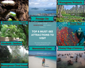
- The main island of Bunakiia, which contains the Woongyewa Wetlands (a large mangrove-swamp-marsh bio-hotspot) that seasonally floods and dries, the constantly humid cloud forest along the Southern slopes of the Eastern mountains, the Western canyons and South-eastern plateau, the central forests and the northern desiccated coast. For a relatively small island it has an astonishing array of geographic diversity. Most of the population lives rather dispersed in the Western portion of the island with the only settlements in East being the floating city of Tsumba and the coastal city of Doleish.
- The pair of Hashadoomani islands in the North are extremely arid and sparsely populated but was once home to an independent Nestorian Christian theocracy.
- The 300+ Doyan islets & atolls are sparsely populated by the native Austronesian Doyans and are known for their stilted or "floating" villages. The beaches, inlets, lagoons and reefs are major attractions for ecotourists and sea turtles and dugongs are commonly spotted.
5.1 Tourism

