File:Alte prager huette pano.jpg
Jump to navigation
Jump to search


Size of this preview: 800 × 320 pixels. Other resolutions: 320 × 128 pixels | 640 × 256 pixels | 1,024 × 410 pixels | 1,280 × 512 pixels | 5,000 × 2,000 pixels.
Original file (5,000 × 2,000 pixels, file size: 2.54 MB, MIME type: image/jpeg)
| Description |
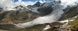
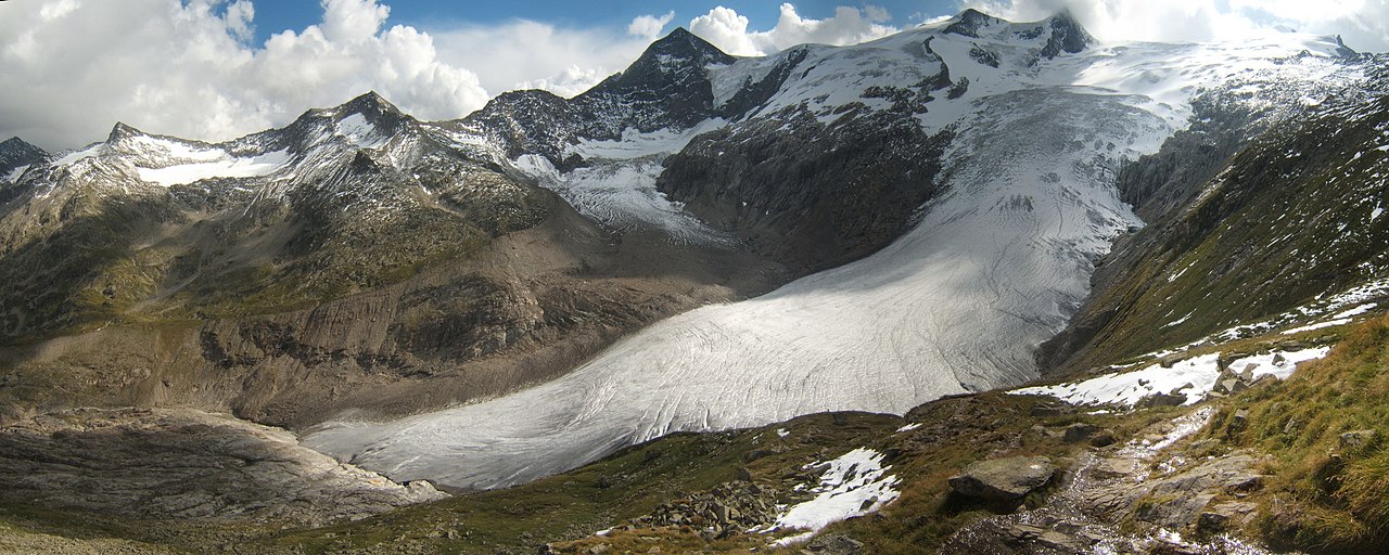
Deutsch: Blick von der Alten Prager Hütte auf den Gletscher Schlatenkees und den Großvenediger. Hohe Tauern, Alpen; Osttirol, Tirol, Österreich. Zusammengefügt aus 5 hochformatigen Einzelbildern
English: View from the Alte Prager Hütte to the glacier Schlatenkees and the Großvenediger. Hohe Tauern, Alps, Austria. Stitched from 5 pics
Français : Vue du Großvenediger et du glacier de Schlatenkees depuis le refuge de Alte Prager. Image obtenue en combinant 5 clichés. Massif du Hohe Tauern (Alpes du Tyrol autrichien). |
||||||||
| Date | |||||||||
| Source | Own work | ||||||||
| Author | Rafael Brix (SehLax) | ||||||||
| Permission (Reusing this file) |
|

| Camera location | | View this and other nearby images on: OpenStreetMap |
|---|
|
This image was selected as picture of the day on Wikimedia Commons for 19 January 2007. It was captioned as follows: Other languages:
Dansk: Großvenediger og Schlatenkeesgletsjerren i Østrig. Italiano: Il monte Großvenediger e il ghacciaio Schlatenkees, Austria. Magyar: A Schlatenkees gleccser a Großvenediger hegyen, Ausztria Sicilianu: Lu munti Großvenediger e lu ghacciaru Schlatenkees, Àustria. Svenska: Großvenediger och Schlatenkeesglaciären i Österrike. Türkçe: Großvenediger ve Schlatenkees buzulu. Avusturya |
| Annotations | This image is annotated: View the annotations at Commons |
File history
Click on a date/time to view the file as it appeared at that time.
| Date/Time | Thumbnail | Dimensions | User | Comment | |
|---|---|---|---|---|---|
| current | 10:19, 24 August 2005 | 5,000 × 2,000 (2.54 MB) | wikimediacommons>SehLax | View from the de:Alte Prager Hütte to the de:Großvenedigermassiv. Hohe Tauern, Alps, Austria Source: taken by SehLax on 18/08/2005, stitched from 5 pics {{GFDL}} Category:Glaciers\ |
File usage
The following page uses this file: