File:Bondeska palatset June 2011.jpg
Jump to navigation
Jump to search


Size of this preview: 800 × 560 pixels. Other resolutions: 320 × 224 pixels | 640 × 448 pixels | 1,024 × 716 pixels | 1,280 × 895 pixels | 2,622 × 1,834 pixels.
Original file (2,622 × 1,834 pixels, file size: 1.62 MB, MIME type: image/jpeg)
Summary
| Description |
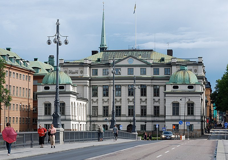
English: The Bonde Palace (Swedish Bondeska palatset) is a palace in Gamla stan, the old town in central Stockholm, Sweden. Originally design by en:Nicodemus Tessin the Elder and en:Jean De la Vallée in 1662-1667 as the private residence of the en:Lord High Treasurer of Sweden en:Gustaf Bonde (1620–1667) it still bears his name, while it accommodated the en:Stockholm Court House from the 18th century and since 1949 houses the en:Supreme Court of Sweden.
Source: Bonde Palace |
| Date | |
| Source | Own work |
| Author | Ankara |
| Camera location | | View this and other nearby images on: OpenStreetMap |
|---|
Licensing
I, the copyright holder of this work, hereby publish it under the following license:
This file is licensed under the Creative Commons Attribution-Share Alike 3.0 Unported license.
- You are free:
- to share – to copy, distribute and transmit the work
- to remix – to adapt the work
- Under the following conditions:
- attribution – You must give appropriate credit, provide a link to the license, and indicate if changes were made. You may do so in any reasonable manner, but not in any way that suggests the licensor endorses you or your use.
- share alike – If you remix, transform, or build upon the material, you must distribute your contributions under the same or compatible license as the original.
This image has been assessed using the Quality image guidelines and is considered a Quality image.
|
File history
Click on a date/time to view the file as it appeared at that time.
| Date/Time | Thumbnail | Dimensions | User | Comment | |
|---|---|---|---|---|---|
| current | 21:36, 10 July 2011 | | 2,622 × 1,834 (1.62 MB) | wikimediacommons>Ankara | tilt+sharpness |
File usage
The following page uses this file: