File:Bundesarchiv Bild 183-L23001, Amsterdam, Durchmarsch deutscher Truppen.jpg

Jump to navigation Jump to search

Bundesarchiv_Bild_183-L23001,_Amsterdam,_Durchmarsch_deutscher_Truppen.jpg(795 × 544 pixels, file size: 71 KB, MIME type: image/jpeg)

This file is from Wikimedia Commons and may be used by other projects. The description on its file description page there is shown below.

Summary

Camera location52° 22′ 20.41″ N, 4° 53′ 34.48″ E Kartographer map based on OpenStreetMap.View this and other nearby images on: OpenStreetMapinfo
Photographer
Jäger
Original caption
For documentary purposes the German Federal Archive often retained the original image captions, which may be erroneous, biased, obsolete or politically extreme.
Amsterdam, Durchmarsch deutscher Truppen

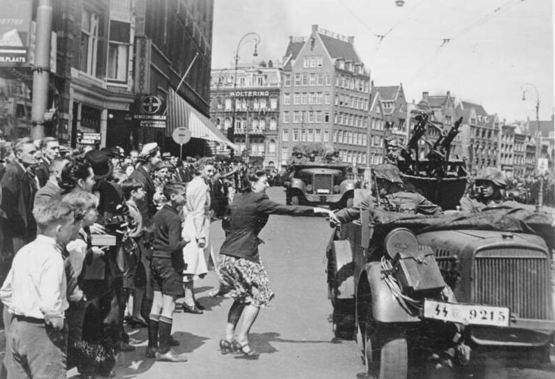
Krieg im Westen: Durchmarsch der deutschen Truppen durch Amsterdam. PK-Jäger- Scherl Bilderdienst Mai 1940

1207-41
Description
Information added by Wikimedia users.
German troops entry in Amsterdam (Dam Square, viewpoint Rokin)
Depicted place Amsterdam
Date May 1940
date QS:P571,+1940-05-00T00:00:00Z/10
institution QS:P195,Q685753
Current location
Allgemeiner Deutscher Nachrichtendienst - Zentralbild (Bild 183)
Accession number
Source

Licensing

w:en:Creative Commons
attribution share alike
This file is licensed under the Creative Commons Attribution-Share Alike 3.0 Germany license.
Attribution: Bundesarchiv, Bild 183-L23001 / CC-BY-SA 3.0
You are free:
  • to share – to copy, distribute and transmit the work
  • to remix – to adapt the work
Under the following conditions:
  • attribution – You must give appropriate credit, provide a link to the license, and indicate if changes were made. You may do so in any reasonable manner, but not in any way that suggests the licensor endorses you or your use.
  • share alike – If you remix, transform, or build upon the material, you must distribute your contributions under the same or compatible license as the original.
Annotations
InfoField
This image is annotated: View the annotations at Commons

Captions

Add a one-line explanation of what this file represents

在此檔案描寫的項目

depicts

52°22'20.410"N, 4°53'34.480"E

52°22'20.41000"N, 4°53'34.48000"E

image/jpeg

6890ff7e0d34cc176301db840b53ce12d7dbcfba

72,691 byte

544 pixel

795 pixel

File history

Click on a date/time to view the file as it appeared at that time.

Date/TimeThumbnailDimensionsUserComment
current17:14, 15 October 2023Thumbnail for version as of 17:14, 15 October 2023795 × 544 (71 KB)wikimediacommons>Gunnar.offelCropped 1 % horizontally, 5 % vertically using CropTool with precise mode.

The following page uses this file:

Metadata