File:Nørre Vorupør Coast one third sky 2012-11-18.jpg
Jump to navigation
Jump to search


Size of this preview: 800 × 351 pixels. Other resolutions: 320 × 141 pixels | 640 × 281 pixels | 1,024 × 450 pixels | 1,280 × 562 pixels | 2,560 × 1,124 pixels | 4,910 × 2,156 pixels.
Original file (4,910 × 2,156 pixels, file size: 4.07 MB, MIME type: image/jpeg)
Summary
| Description |
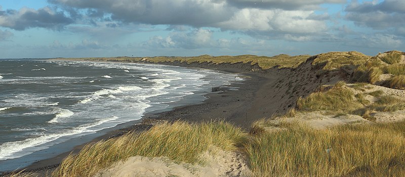
English: North Sea coastline at Nørre Vorupør, Denmark.
Español: Litoral del mar del Norte cerca de la localidad de Nørre Vorupør, Jutlandia Septentrional, Dinamarca.
Português: Litoral do mar do Norte perto da cidade de Nørre Vorupør, região da Jutlândia do Norte, Dinamarca.
Italiano: La costa del Mare del Nord nei pressi del villaggio di Nørre Vorupør nel comune di Thisted, in Danimarca.
|
| Date | |
| Source | Crop of File:Nørre Vorupør Coast 2012-11-18.jpg |
| Author | Slaunger |
| Other versions |
Derivative works of this file: Nørre Vorupør banner Coast one third sky.jpg
|

| Camera location | | View this and other nearby images on: OpenStreetMap |
|---|
Assessment
This image was selected as picture of the day on Wikimedia Commons for 18 November 2016. It was captioned as follows: Other languages:
Español: Litoral del mar del Norte cerca de la localidad de Nørre Vorupør, Jutlandia Septentrional, Dinamarca. Italiano: La costa del Mare del Nord nei pressi del villaggio di Nørre Vorupør nel comune di Thisted, in Danimarca. Português: Litoral do mar do Norte perto da cidade de Nørre Vorupør, região da Jutlândia do Norte, Dinamarca. |
|
This image has been assessed using the Quality image guidelines and is considered a Quality image.
|
Licensing
I, the copyright holder of this work, hereby publish it under the following license:
This file is licensed under the Creative Commons Attribution-Share Alike 3.0 Unported license.
- You are free:
- to share – to copy, distribute and transmit the work
- to remix – to adapt the work
- Under the following conditions:
- attribution – You must give appropriate credit, provide a link to the license, and indicate if changes were made. You may do so in any reasonable manner, but not in any way that suggests the licensor endorses you or your use.
- share alike – If you remix, transform, or build upon the material, you must distribute your contributions under the same or compatible license as the original.
File history
Click on a date/time to view the file as it appeared at that time.
| Date/Time | Thumbnail | Dimensions | User | Comment | |
|---|---|---|---|---|---|
| current | 07:35, 20 November 2012 | | 4,910 × 2,156 (4.07 MB) | wikimediacommons>Slaunger | User created page with UploadWizard |