File:Santa Catalina Arch - Antigua Guatemala Feb 2020.jpg

Original file (6,993 × 4,664 pixels, file size: 33.58 MB, MIME type: image/jpeg)
Summary
| Description |
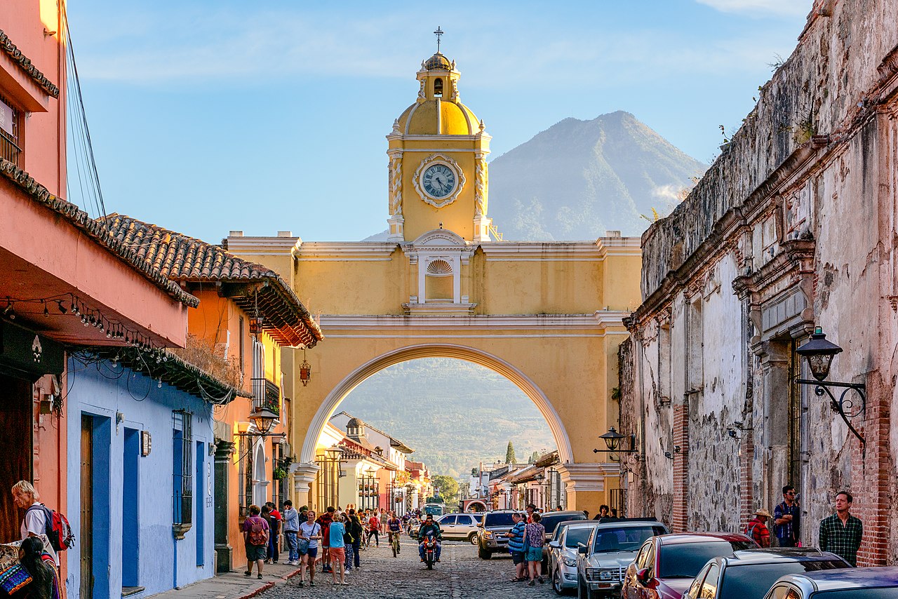
English: The Santa Catalina Arch is one of the distinguishable landmarks in Antigua Guatemala, Guatemala, located on 5th Avenue North. Built in the 17th century, it originally connected the Santa Catalina convent to a school, allowing the cloistered nuns to pass from one building to the other without going out on the street. A clock on top was added in the era of the Central American Federation, in the 1830s. Source: en.wikipedia.org/wiki/Arco_de_Santa_Catalina
In the background is Volcán de Agua (also known as Hunahpú by Maya) is a stratovolcano located in the departments of Sacatepéquez and Escuintla in Guatemala. At 3,760 m (12,340 ft), Agua Volcano towers more than 3,500 m (11,500 ft) above the Pacific coastal plain to the south and 2,000 m (6,600 ft) above the Guatemalan Highlands to the north. It dominates the local landscape except when hidden by cloud cover. The volcano is within 5 to 10 km (3.1 to 6.2 mi) of the city of Antigua Guatemala and several other large towns situated on its northern apron. These towns have a combined population of nearly 100,000. It is within about 20 km of Escuintla (population, ca. 150,000) to the south. Source: en.wikipedia.org/wiki/Volc%C3%A1n_de_Agua |
| Date | |
| Source | https://www.flickr.com/photos/146321178@N05/49640785242/ |
| Author | Chad Davis |
| Other versions |
| Camera location | | View this and other nearby images on: OpenStreetMap |
|---|
Licensing
- You are free:
- to share – to copy, distribute and transmit the work
- to remix – to adapt the work
- Under the following conditions:
- attribution – You must give appropriate credit, provide a link to the license, and indicate if changes were made. You may do so in any reasonable manner, but not in any way that suggests the licensor endorses you or your use.
- share alike – If you remix, transform, or build upon the material, you must distribute your contributions under the same or compatible license as the original.
| This image was originally posted to Flickr by chaddavis.photography at https://flickr.com/photos/146321178@N05/49640785242. It was reviewed on 16 March 2020 by FlickreviewR 2 and was confirmed to be licensed under the terms of the cc-by-sa-2.0. |
File history
Click on a date/time to view the file as it appeared at that time.
| Date/Time | Thumbnail | Dimensions | User | Comment | |
|---|---|---|---|---|---|
| current | 02:56, 13 March 2020 | | 6,993 × 4,664 (33.58 MB) | wikimediacommons>Infrogmation | Uploaded a work by Chad Davis from https://www.flickr.com/photos/146321178@N05/49640785242/ with UploadWizard |
File usage
The following page uses this file: