File:Uranium enrichment map Menghe.jpg
Jump to navigation
Jump to search

Size of this preview: 633 × 600 pixels.
Original file (800 × 758 pixels, file size: 35 KB, MIME type: image/jpeg)
Summary
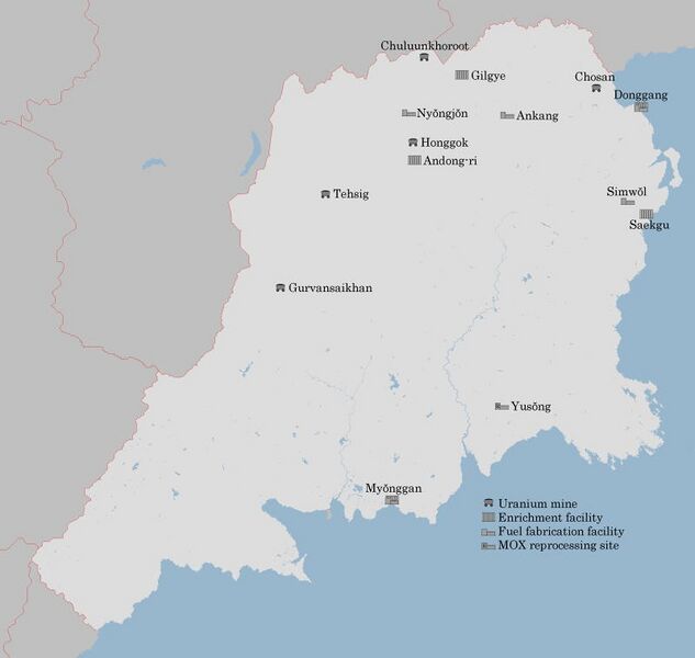
Map of facilities along Menghe's nuclear fuel chain, including some facilities which are under construction.
File history
Click on a date/time to view the file as it appeared at that time.
| Date/Time | Thumbnail | Dimensions | User | Comment | |
|---|---|---|---|---|---|
| current | 06:21, 13 January 2020 | | 800 × 758 (35 KB) | Soode (talk | contribs) | Map of facilities along Menghe's nuclear fuel chain, including some facilities which are under construction. |
You cannot overwrite this file.
File usage
The following page uses this file: