File:Waldenburg1945edit.jpg
Jump to navigation
Jump to search


Size of this preview: 490 × 599 pixels. Other resolutions: 196 × 240 pixels | 393 × 480 pixels | 628 × 768 pixels | 837 × 1,024 pixels | 2,412 × 2,949 pixels.
Original file (2,412 × 2,949 pixels, file size: 2.53 MB, MIME type: image/jpeg)
Summary
|
| Description |
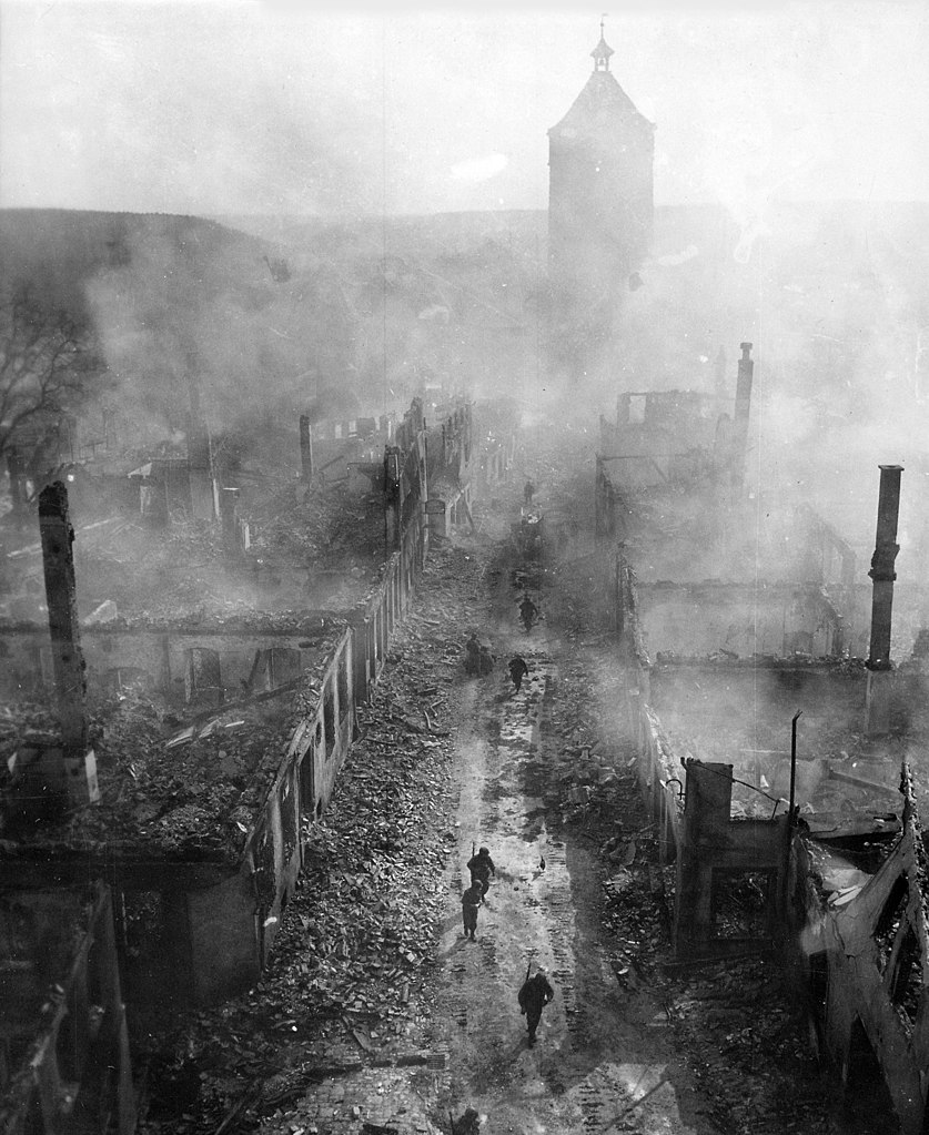
Deutsch: Infanteristen des amerikanischen 255. Infanterieregiments in Waldenburg nach einem Angriff der 63. Division.
English: "Infantrymen of the 255th Infantry Regiment move down a street in Waldenburg to hunt out the Hun after a recent raid by 63rd Division".
Français : Combats de rue à Waldenburg, au Bade-Wurtemberg (Allemagne) à la fin de la seconde guerre mondiale. Légende originale: "Fantassins du 255e régiment descendant une rue de Waldenburg, pourchassant les Huns après un raid de la 63e Division." |
| Date | Taken on 16 April 1945 |
| Source | https://www.archives.gov/research/ww2/photos/images/ww2-119.jpg (English text from https://www.archives.gov/research/ww2/photos/). Originally from de.wikipedia; description page is/was here. |
| Author | 2d Lt. Jacob Harris. This edit (remove stains and catalogue number, slight contrast and sharpness enhancement) by mixpix 09:53, 18 January 2008 (UTC) |
| Other versions |
this edit based on Image:Ww2-Waldenburg.jpg (with cat number) Image:Waldenburgapl1945.jpg (larger file, poorly retouched) Image:Waldenburgapl1945a.jpg (cleaned-up version of larger file) |
| Camera location | | View this and other nearby images on: OpenStreetMap |
|---|
Licensing
This file is a work of a U.S. Army soldier or employee, taken or made as part of that person's official duties. As a work of the U.S. federal government, it is in the public domain in the United States.
|
 |
File history
Click on a date/time to view the file as it appeared at that time.
| Date/Time | Thumbnail | Dimensions | User | Comment | |
|---|---|---|---|---|---|
| current | 23:02, 6 December 2008 | | 2,412 × 2,949 (2.53 MB) | wikimediacommons>Movieevery | uncropped full resolution |
File usage
The following page uses this file: