File:Wat Rong Khun - Chiang Rai.jpg
Jump to navigation
Jump to search


Size of this preview: 800 × 400 pixels. Other resolutions: 320 × 160 pixels | 640 × 320 pixels | 1,024 × 512 pixels | 1,280 × 640 pixels | 2,560 × 1,280 pixels | 5,120 × 2,560 pixels.
Original file (5,120 × 2,560 pixels, file size: 9.48 MB, MIME type: image/jpeg)
Summary
|
Sections 37 to 38 of the Copyright Act, BE 2537 (1994) (translation) state that:
|
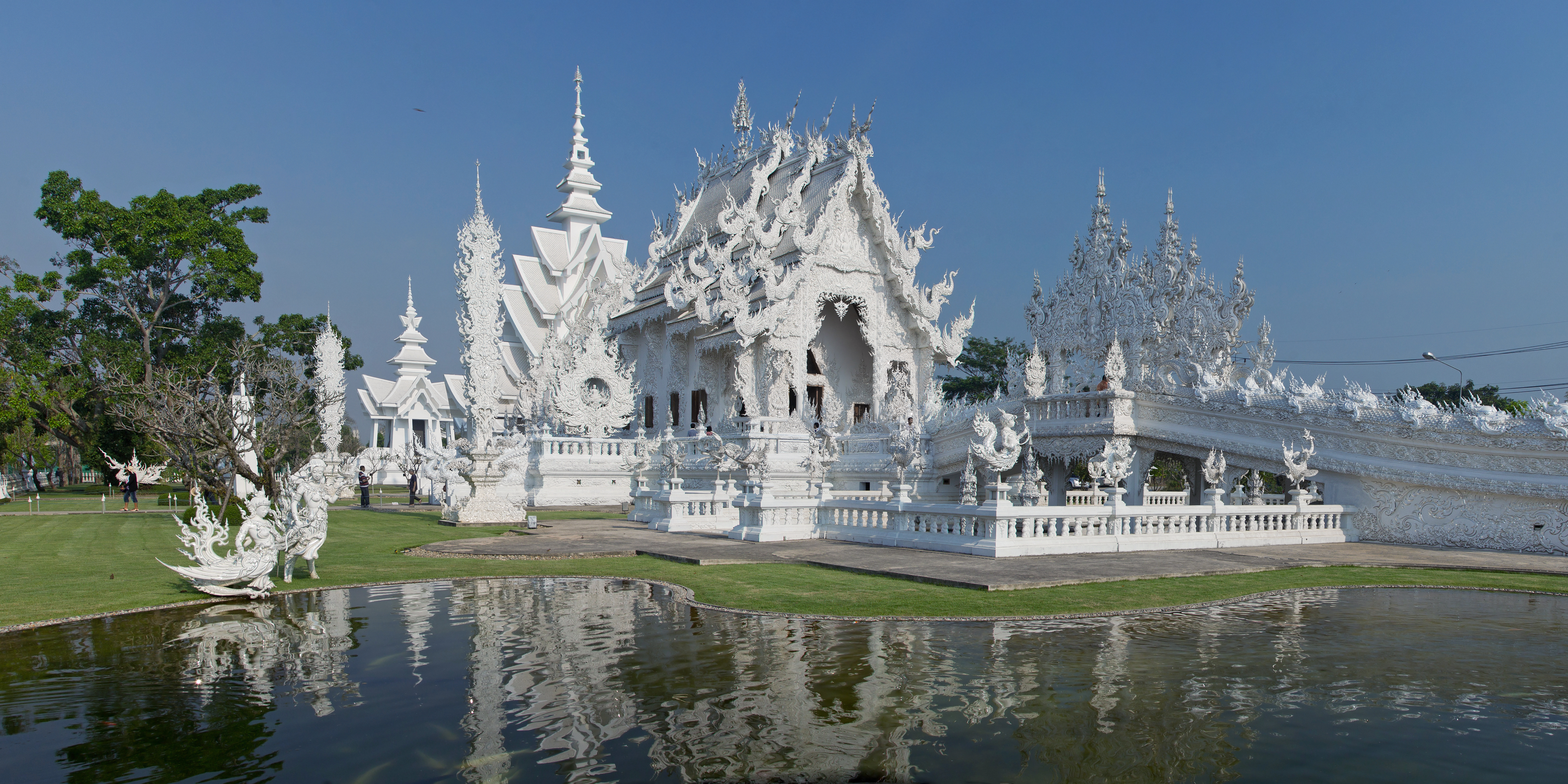
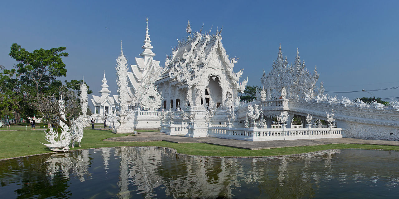
| Description | Wat Rong Khun, Chiang Rai, Chiang Rai Province, Thailand |
| Date | |
| Source | Own work |
| Author | JJ Harrison (https://www.jjharrison.com.au/) |
| Camera location | | View this and other nearby images on: OpenStreetMap |
|---|
Licensing
This file is licensed under the Creative Commons Attribution-Share Alike 3.0 Unported license.
- You are free:
- to share – to copy, distribute and transmit the work
- to remix – to adapt the work
- Under the following conditions:
- attribution – You must give appropriate credit, provide a link to the license, and indicate if changes were made. You may do so in any reasonable manner, but not in any way that suggests the licensor endorses you or your use.
- share alike – If you remix, transform, or build upon the material, you must distribute your contributions under the same or compatible license as the original.
File history
Click on a date/time to view the file as it appeared at that time.
| Date/Time | Thumbnail | Dimensions | User | Comment | |
|---|---|---|---|---|---|
| current | 11:18, 12 May 2013 | | 5,120 × 2,560 (9.48 MB) | wikimediacommons>JJ Harrison |
File usage
The following page uses this file: