New England: Difference between revisions
(→States) |
|||
| Line 95: | Line 95: | ||
===States=== | ===States=== | ||
{| class="wikitable sortable plainrowheaders" style="text-align: center;" | |||
|+ States of the Commonwealth of New England | |||
|- | |||
!scope="col" colspan=2 rowspan=2|Flag, name &<br>[[List of U.S. state abbreviations|postal abbreviation]]<ref name=USPSabbreviations>{{cite web| url=https://pe.usps.com/text/pub28/28apb.htm| title=Appendix B: Two–Letter State and possession Abbreviations| work=Postal Addressing Standards| publisher=United States Postal Service| location=Washington, D.C.| date=May 2015| accessdate=March 3, 2018| archive-url=https://web.archive.org/web/20180305202445/https://pe.usps.com/text/pub28/28apb.htm| archive-date=March 5, 2018| url-status=live| df=mdy-all}}</ref> | |||
!scope="col" colspan=2|Cities | |||
!scope="col" rowspan=2|Ratification<br/>or admission{{efn-ua|The original 13 states became [[Sovereignty|sovereign]] in July 1776 upon agreeing to the [[United States Declaration of Independence]], and each joined the first Union of states between 1777 and 1781, upon ratifying the [[Articles of Confederation]].<ref>{{cite book| last = Jensen| first = Merrill| title = The Articles of Confederation: An Interpretation of the Social-Constitutional History of the American Revolution, 1774–1781| year = 1959| publisher = University of Wisconsin Press| isbn = 978-0-299-00204-6| pages = xi, 184 }}</ref> These states are presented in the order in which each ratified the 1787 Constitution, thus joining the present federal Union of states. Subsequent states are listed in the order of their admission to the Union, and the date given is the official establishment date set by [[Act of Congress]]. ''For further details, see [[List of U.S. states by date of admission to the Union]]''}} | |||
!scope="col" rowspan=2|Population<br>{{efn-ua|2019 estimate}}<ref name="AnnualEstUS">{{cite web |url=https://www2.census.gov/programs-surveys/popest/tables/2010-2019/state/totals/nst-est2019-01.xlsx?# |title=Annual Estimates of the Resident Population for the United States, Regions, States, and Puerto Rico: April 1, 2010 to July 1, 2019 |format= |website=2010-2019 Population Estimates |publisher=[[United States Census Bureau]], Population Division |date=December 30, 2019 |accessdate=January 27, 2020}}</ref> | |||
!scope="col" colspan=2|Total area<ref name=areameasurements>{{cite web| title=State Area Measurements and Internal Point Coordinates| url=https://www.census.gov/geo/reference/state-area.html| publisher=U.S. Census Bureau| location=Washington, D.C.| quote=... provides land, water and total area measurements for the 50 states, the District of Columbia, Puerto Rico and the Island Areas. The area measurements were derived from the Census Bureau's Master Address File/Topologically Integrated Geographic Encoding and Referencing (MAF/TIGER®) database. The land and water areas, ... reflect base feature updates made in the MAF/TIGER® database through August, 2010.| accessdate=March 3, 2018| archive-url=https://web.archive.org/web/20180316004512/https://www.census.gov/geo/reference/state-area.html| archive-date=March 16, 2018| url-status=live| df=mdy-all}}</ref> | |||
!scope="col" colspan=2|Land area<ref name=areameasurements/> | |||
!scope="col" colspan=2|Water area<ref name=areameasurements/> | |||
!scope="col" rowspan=2|[[List of United States congressional districts|Number<br>of Reps.]] | |||
|- | |||
!scope="col"|Capital | |||
!scope="col"|Largest<ref name="State and Local Government Finances and Employment">{{cite web| url=https://www.census.gov/compendia/statab/2012/tables/12s0448.pdf| archive-url=https://web.archive.org/web/20111017142616/http://www.census.gov/compendia/statab/2012/tables/12s0448.pdf| url-status=dead| archive-date=October 17, 2011| title=State and Local Government Finances and Employment| year=2012| publisher=[[United States Census Bureau]]| page=284| accessdate=July 8, 2013}}</ref> | |||
!scope="col" class="unsortable"|mi<sup>2</sup> | |||
!scope="col"|km<sup>2</sup> | |||
!scope="col" class="unsortable"|mi<sup>2</sup> | |||
!scope="col"|km<sup>2</sup> | |||
!scope="col" class="unsortable"|mi<sup>2</sup> | |||
!scope="col"|km<sup>2</sup> | |||
|- | |||
!scope="row"|{{flagicon image|Flag of Connecticut.svg}} | |||
|CT | |||
|[[Hartford, Connecticut|Hartford]] | |||
|[[Bridgeport, Connecticut|Bridgeport]] | |||
|{{dts|Jan 9, 1788}} | |||
|{{right|2,016,719}} | |||
|{{cvt|5543.41|mi2|km2|0|adj=ri0|abbr=values|sortable=on|disp=table}} | |||
|{{cvt|4842.36|mi2|km2|0|adj=ri0|abbr=values|sortable=on|disp=table}} | |||
|{{cvt|701.06|mi2|km2|0|adj=ri0|abbr=values|sortable=on|disp=table}} | |||
|{{right|6}} | |||
|- | |||
!scope="row"|{{flagicon image|Flag of Maine.svg}} | |||
|ME | |||
|[[Augusta, Maine|Augusta]] | |||
|[[Portland, Maine|Portland]] | |||
|{{dts|Mar 15, 1820}} | |||
|{{right|917,865}} | |||
|{{cvt|35379.74|mi2|km2|0|adj=ri0|abbr=values|sortable=on|disp=table}} | |||
|{{cvt|30842.92|mi2|km2|0|adj=ri0|abbr=values|sortable=on|disp=table}} | |||
|{{cvt|4536.82|mi2|km2|0|adj=ri0|abbr=values|sortable=on|disp=table}} | |||
|{{right|3}} | |||
|- | |||
!scope="row"|{{nowrap|{{flagicon image|Flag of Massachusetts.svg}}{{efn-ua|name=statenomenclature}}}} | |||
|MA | |||
|colspan=2|[[Boston]] | |||
|{{dts|Feb 6, 1788}} | |||
|{{right|4,686,213}} | |||
|{{cvt|10554.39|mi2|km2|0|adj=ri0|abbr=values|sortable=on|disp=table}} | |||
|{{cvt|7800.06|mi2|km2|0|adj=ri0|abbr=values|sortable=on|disp=table}} | |||
|{{cvt|2754.33|mi2|km2|0|adj=ri0|abbr=values|sortable=on|disp=table}} | |||
|{{right|12}} | |||
|- | |||
!scope="row"|{{flagicon image|Flag of New Hampshire.svg}} | |||
|NH | |||
|[[Concord, New Hampshire|Concord]] | |||
|[[Manchester, New Hampshire|Manchester]] | |||
|{{dts|Jun 21, 1788}} | |||
|{{right|532,143}} | |||
|{{cvt|9349.16|mi2|km2|0|adj=ri0|abbr=values|sortable=on|disp=table}} | |||
|{{cvt|8952.65|mi2|km2|0|adj=ri0|abbr=values|sortable=on|disp=table}} | |||
|{{cvt|396.51|mi2|km2|0|adj=ri0|abbr=values|sortable=on|disp=table}} | |||
|{{right|2}} | |||
|- | |||
!scope="row"|{{flagicon image|Flag of New Jersey.svg}} | |||
|NJ | |||
|[[Trenton, New Jersey|Trenton]] | |||
|[[Newark, New Jersey|Newark]] | |||
|{{dts|Dec 18, 1787}} | |||
|{{right|4,872,962}} | |||
|{{cvt|8722.58|mi2|km2|0|adj=ri0|abbr=values|sortable=on|disp=table}} | |||
|{{cvt|7354.22|mi2|km2|0|adj=ri0|abbr=values|sortable=on|disp=table}} | |||
|{{cvt|1368.36|mi2|km2|0|adj=ri0|abbr=values|sortable=on|disp=table}} | |||
|{{right|14}} | |||
|- | |||
!scope="row"|{{flagicon image|Flag of New York.svg}} | |||
|NY | |||
|[[Albany, New York|Albany]] | |||
|[[New York City|New York]] | |||
|{{dts|Jul 26, 1788}} | |||
|{{right|14,861,392}} | |||
|{{cvt|54554.98|mi2|km2|0|adj=ri0|abbr=values|sortable=on|disp=table}} | |||
|{{cvt|47126.4|mi2|km2|0|adj=ri0|abbr=values|sortable=on|disp=table}} | |||
|{{cvt|7428.58|mi2|km2|0|adj=ri0|abbr=values|sortable=on|disp=table}} | |||
|{{right|45}} | |||
|- | |||
!scope="row"|{{flagicon image|Flag of Pennsylvania.svg}}{{efn-ua|name=statenomenclature}} | |||
|PA | |||
|colspan=2|[[Philadelphia]] | |||
|{{dts|Dec 12, 1787}} | |||
|{{right|4,204,477}} | |||
|{{cvt|46054.34|mi2|km2|0|adj=ri0|abbr=values|sortable=on|disp=table}} | |||
|{{cvt|44742.7|mi2|km2|0|adj=ri0|abbr=values|sortable=on|disp=table}} | |||
|{{cvt|1311.64|mi2|km2|0|adj=ri0|abbr=values|sortable=on|disp=table}} | |||
|{{right|13}} | |||
|- | |||
!scope="row"|{{flagicon image|Flag of Rhode Island.svg}}{{efn-ua|Officially the "State of Rhode Island and Providence Plantations".}} | |||
|RI | |||
|colspan=2|[[Providence, Rhode Island|Providence]] | |||
|{{dts|May 29, 1790}} | |||
|{{right|786,211}} | |||
|{{cvt|1544.89|mi2|km2|0|adj=ri0|abbr=values|sortable=on|disp=table}} | |||
|{{cvt|1033.81|mi2|km2|0|adj=ri0|abbr=values|sortable=on|disp=table}} | |||
|{{cvt|511.07|mi2|km2|0|adj=ri0|abbr=values|sortable=on|disp=table}} | |||
|{{right|2}} | |||
|- | |||
!scope="row"|{{flagicon image|Flag of Vermont.svg}} | |||
|VT | |||
|[[Montpelier, Vermont|Montpelier]] | |||
|[[Burlington, Vermont|Burlington]] | |||
|{{dts|Mar 4, 1791}} | |||
|{{right|379,683}} | |||
|{{cvt|9616.36|mi2|km2|0|adj=ri0|abbr=values|sortable=on|disp=table}} | |||
|{{cvt|9216.66|mi2|km2|0|adj=ri0|abbr=values|sortable=on|disp=table}} | |||
|{{cvt|399.71|mi2|km2|0|adj=ri0|abbr=values|sortable=on|disp=table}} | |||
|{{right|1}} | |||
|- | |||
|} | |||
===Cities=== | ===Cities=== | ||
===Geographic Areas=== | ===Geographic Areas=== | ||
Revision as of 23:51, 14 April 2020
This article is incomplete because it is pending further input from participants, or it is a work-in-progress by one author. Please comment on this article's talk page to share your input, comments and questions. Note: To contribute to this article, you may need to seek help from the author(s) of this page. |
The Commonwealth of New England | |
|---|---|
Coat of Arms
| |
Motto: An appeal to heaven "Invocātiō apud caelum" | |
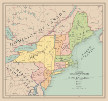 Map of the Commonwealth | |
| Capital | New Haven |
| Largest city | Boston |
| Official languages | English |
| Ethnic groups | Irish American: 18.4% Franco-American: 1.2% Italian American: 20.1% Polish American: 6.3% Jewish American: 5.9% German American: 10.9% African American: 7.8% Anglo-American: 29.3% Asian American: 0.1% |
| Demonym(s) | New English |
| Government | Constitutional Federal Republic |
• President | W. Avarell Harriman |
• Vice President | Maurice Tobin |
| Legislature | Congress |
| Senate | |
| House of Representatives | |
| History | |
• The Unilateral Declaration of Independence | July 16th, 1937 |
• The Second Hartford Convention | August 10th - October 31st, 1937 |
• The First New England Federal Election | November 5th, 1940 |
• New York Admitted | 1941 |
• New Jersey and Greater Philadelphia | 1943 |
• Observer Status in British Commonwealth established | 1945 |
• Victory in Europe Day | June 22nd, 1946 |
| Area | |
• | 149,136 sq mi (386,260 km2) |
| Population | |
• 1950 estimate | 33,252,000 |
• Density | 222.96/sq mi (86.1/km2) |
| GDP (nominal) | 1950 estimate |
• Total | 286,698,744,000 |
• Per capita | 8,622 |
| Currency | New England Dollar ($) (NED) |
| Time zone | UTC-4 (EST) |
| Driving side | right |
| Calling code | +1 |
New England, officially the Commonwealth of New England, is a sovereign nation located in North America. New England is bordered by the Dominion of Canada to her north and The Union of Syndicalist American Republics (USAR) to her south. The population of the country is concentrated in its large metropolitan areas. The most populous areas are the New York City metropolitan area followed by the Boston metropolitan area and Philadelphia metropolitan area. The New England hinterland in the northern states have towns scattered throughout the various mountainous and forested regions. Aside from these, much of New England is rural and marked by large national parks and historic sites. New England is a constitutional federal republic with its capital located in New Haven. The largest city in New England is New York City which serves as the nation's economic hub and which alongside the second largest city of Boston serve as cultural and commercial centers. New England has a separation of powers between its Executive, Judicial and Legislative branches.
History
Birth of a Commonwealth
New England had been the Northeastern region of the United States of America prior to the Second American Civil War which saw the downfall of the United States. An interstate gridlock had taken shape in May, 1937 due to the controversial coup d'etat launched by General Douglas MacArthur on April 28th. Despite attempts at negotiations, soon a civil war had broken out between the MacArthurists, Syndicalists, Longists and a movement in the Pacific saw the secession of California, Oregon, Washington and Nevada to form the Pacific States of America. In the midst of the gridlock between states, a meeting between New England Governors took place on June 8th in which the Governors resolved to write a letter to the Dominion of Canada requesting protection during the hardships. The Canadian Government approved this request and sent a military detachment across the American Border on June 16th. Despite orders from General Douglas MacArthur to leave sovereign American soil, National Guard divisions from each of the New England States stood by the decision of their respective governors and the New England states ceased contact with the Federal Government.
As the Second American Civil War began to brew, the states resolved to select a Provisional President who would coordinate state efforts, and Percival P. Baxter was selected to serve as the first Provisional President on June 21st and was to direct coordinating efforts from Boston. President Baxter was granted powers to merge New England State National Guard forces into the New England Defense Force which was mobilized and sent to the New York border to deter any attempts at attacking the New English. By July it was clear that the Civil War was not to be brief as the Federal forces had been routed from the Carolinas and pockets had begun to take shape as Syndicalist militias surrounded federal garrisons in Kentucky and Missouri. Therefore it was resolved that the New English would need to be prepared for the worst. With approval in each of the State Legislatures, a Unilateral Declaration of Independence from the United States was signed on July 16th, and President Baxter called for a Second Hartford Convention to establish an American continuity government in New England. Adopting the American Constitution as its basis, the Hartford Convention carried on until October 31st organizing a New England federal government, declaring itself the Commonwealth of New England, adopting a flag and new currency and concluding with a Halloween Resolution which established New Haven as the 'indefinite provisional capital'.
Post-War New England
(1946)
Geography
States
| Flag, name & postal abbreviation[1] |
Cities | Ratification or admission[upper-alpha 1] |
Population [upper-alpha 2][3] |
Total area[4] | Land area[4] | Water area[4] | Number of Reps. | |||||
|---|---|---|---|---|---|---|---|---|---|---|---|---|
| Capital | Largest[5] | mi2 | km2 | mi2 | km2 | mi2 | km2 | |||||
| CT | Hartford | Bridgeport | Jan 9, 1788 | 2,016,719 | 5,543 | 14,357 | 4,842 | 12,542 | 701 | 1,816 | 6 | |
| ME | Augusta | Portland | Mar 15, 1820 | 917,865 | 35,380 | 91,633 | 30,843 | 79,883 | 4,537 | 11,750 | 3 | |
| MA | Boston | Feb 6, 1788 | 4,686,213 | 10,554 | 27,336 | 7,800 | 20,202 | 2,754 | 7,134 | 12 | ||
| NH | Concord | Manchester | Jun 21, 1788 | 532,143 | 9,349 | 24,214 | 8,953 | 23,187 | 397 | 1,027 | 2 | |
| NJ | Trenton | Newark | Dec 18, 1787 | 4,872,962 | 8,723 | 22,591 | 7,354 | 19,047 | 1,368 | 3,544 | 14 | |
| NY | Albany | New York | Jul 26, 1788 | 14,861,392 | 54,555 | 141,297 | 47,126 | 122,057 | 7,429 | 19,240 | 45 | |
| PA | Philadelphia | Dec 12, 1787 | 4,204,477 | 46,054 | 119,280 | 44,743 | 115,883 | 1,312 | 3,397 | 13 | ||
| RI | Providence | May 29, 1790 | 786,211 | 1,545 | 4,001 | 1,034 | 2,678 | 511 | 1,324 | 2 | ||
| VT | Montpelier | Burlington | Mar 4, 1791 | 379,683 | 9,616 | 24,906 | 9,217 | 23,871 | 400 | 1,035 | 1 | |
Cities
Geographic Areas
Politics
Political Parties in New England
| Party | Position | Idealogy | Leader | Seats in the House of Representatives | Seats in the Senate | Bloc |
|---|---|---|---|---|---|---|
| Democratic Party |
Center-Right | Populism, Immigrant Interests, Trade Unionism, Protectionism | W. Averell Harriman | 55 / 103 |
7 / 18 |
|
| Republican Party |
Center-Left | Conservatism, Free Trade, Internationalism, Pro-Entente | Thomas E. Dewey | 31 / 103 |
10 / 18 |
|
| Constitution Party |
Center | State's Rights, Opposition to Welfare, Deregulation, Constitutionalism, Skepticism towards Entente | Sean Lawrie | 10 / 103 |
1 / 18 |
|
| Commonwealth Party |
Right | Social Conservatism, Anglo-American Interests, Pro-Business, Full Commonwealth Membership | Clark Kensington | 4 / 103 |
0 / 18 |
Foreign Relations
The Entente
The British Commonwealth
Union of Syndicalist American Republics
New England Armed Forces
Army
(For further reading, see main article: New England Army)
The New England Army is the land-based component of the New English Armed Forces, and represents the largest portion of its personnel. It is responsible to the Government of the Commonwealth of New England and headed by the Chief of the New English Army, [Insert Name Here], who reports to the Minister of War [Insert Name Here], who reports directly to the President of the Commonwealth of New England.
As of 1950, the New England Army employs numberxhere personnel including the Army Air Corps, New England National Guard, and New England Fire Brigades. Though limited conscription exists in New England, the New England Army is a majority volunteer force and therefore soldiers are considered professionals.
Army Air Corps
National Guard
Fire Brigades
Coast Guard
Merchant Marine
Coastal Defense Corps
Civil Defense Force
Civil Air Patrol
Equipment
Weapons
| Weapon | Picture | Origin | Type | Notes | ||
|---|---|---|---|---|---|---|
| Pistols | ||||||
| Colt M1911 | 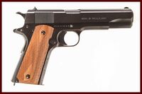
|
Handgun | Used throughout the New England Armed Forces as service pistol. | |||
| Submachine guns | ||||||
| Thompson Submachinegun | 
|
Submachinegun | Used by New England Army ground forces. | |||
| Sterling mk4 Submachinegun | 
|
Submachinegun | Used by New England Army ground forces. | |||
| Rifles | ||||||
| M1903 Springfield Rifle | 
|
Battle Rifle | Used by National Guard and Reservists, currently being stockpiled and exported. | |||
| M1 Garand | 
|
Battle rifle | Used throughout New English Army as standard issue rifle. | |||
| M1 Carbine | 
|
Battle rifle | Used throughout New English Army, being stockpiled to succeed M1 Garand. | |||
| Winchester Model 70 | Marksman Rifle | Used by marksmen in New English Army | ||||
| Shotguns | ||||||
| Browning Auto-5 | Shotgun | Used by New English Army special forces. | ||||
| Machine guns | ||||||
| M1941 Johnson Machine gun | 
|
Light Machine gun | Used by New English Army | |||
| M1919 Browning Machinegun | 
|
Medium Machine gun | Used by New English Army | |||
| M2 Browning | 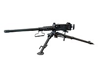
|
Heavy machine gun | Used by New English Army | |||
| Anti-materiel weapons | ||||||
| Boys anti-tank rifle Mk I | 
|
Anti-Material Rifle | ||||
| M1 Bazooka | 
|
Anti-tank rocket launcher | ||||
| M1 Mortar | 
|
Mortar | ||||
| Special Weapons | ||||||
| M2 Flamethrower | 
|
Flamethrower | ||||
Ground Vehicles
| Vehicle | Picture | Origin | Type | In service | Notes | |
|---|---|---|---|---|---|---|
| Armour | ||||||
| M2 Light Tank | 
|
Light Tank | 102 | Relegated to training operations, being exported to British colonies for auxiliary use. | ||
| M24 Light Tank | 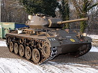
|
Light Tank | 1,028 | Thousands exported to Entente members | ||
| M46 Patriot | 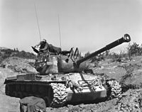
|
Medium Tank | 660 | |||
| Armoured Cars | ||||||
| M3 Scout Car | 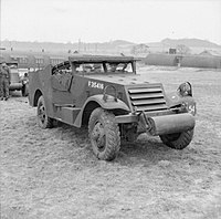
|
Armored Car | 2,875 | Originally produced by United States Army, variants exist globally | ||
| M8 Greyhound | 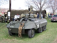
|
Armored Car | 907 | Originally produced by United States Army, variants exist globally | ||
| S1 Scout Car | 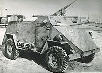
|
Armored Car | 24 | Produced by Ford's Australasian Division, used for training purposes. | ||
| Armored Carriers | ||||||
| M3 Half Track | 
|
Armoured Carrier | 2,280 | |||
| Universal Carrier | 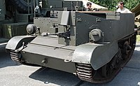
|
Armored Carrier | 1,520 | |||
| Trucks | ||||||
| Dodge WC Series | 
|
Truck | 6,422 | |||
| Unarmoured Vehicles | ||||||
| Willy's MB | 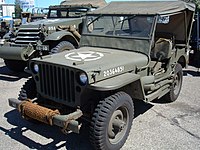
|
Utility Truck | 3,422 | |||
| Artillery | ||||||
| M39 Armored Utility Vehicle | 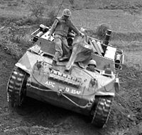
|
Artillery Tractor | 450 | Converted from Hellcat tractors | ||
Demographics
Ethnic Groups
Languages
Religion
Economy
Transport
Culture
Dress
Men
Women
Literature
Media
Sport
Symbols
Public Holidays
- ↑ "Appendix B: Two–Letter State and possession Abbreviations". Postal Addressing Standards. Washington, D.C.: United States Postal Service. May 2015. Archived from the original on March 5, 2018. Retrieved March 3, 2018.
- ↑ Jensen, Merrill (1959). The Articles of Confederation: An Interpretation of the Social-Constitutional History of the American Revolution, 1774–1781. University of Wisconsin Press. pp. xi, 184. ISBN 978-0-299-00204-6.
- ↑ "Annual Estimates of the Resident Population for the United States, Regions, States, and Puerto Rico: April 1, 2010 to July 1, 2019". 2010-2019 Population Estimates. United States Census Bureau, Population Division. December 30, 2019. Retrieved January 27, 2020.
- ↑ 4.0 4.1 4.2 "State Area Measurements and Internal Point Coordinates". Washington, D.C.: U.S. Census Bureau. Archived from the original on March 16, 2018. Retrieved March 3, 2018.
... provides land, water and total area measurements for the 50 states, the District of Columbia, Puerto Rico and the Island Areas. The area measurements were derived from the Census Bureau's Master Address File/Topologically Integrated Geographic Encoding and Referencing (MAF/TIGER®) database. The land and water areas, ... reflect base feature updates made in the MAF/TIGER® database through August, 2010.
- ↑ "State and Local Government Finances and Employment" (PDF). United States Census Bureau. 2012. p. 284. Archived from the original (PDF) on October 17, 2011. Retrieved July 8, 2013.
Cite error: <ref> tags exist for a group named "upper-alpha", but no corresponding <references group="upper-alpha"/> tag was found
