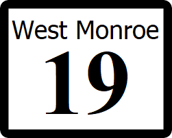
West Monroe State Highway 19: Difference between revisions
(Created page with "right|300px {{Infobox road |length_mi=62 |length_ref= |formed=1954 |direction_a=East |terminus_a= 25px|link=Ibican Route 2 in Hudson, We...") |
No edit summary |
||
| (4 intermediate revisions by the same user not shown) | |||
| Line 1: | Line 1: | ||
[[File:WM- | [[File:WM-19.png|right|300px]] | ||
{{Infobox road | {{Infobox road | ||
|length_mi= | |length_mi=206 | ||
|length_ref= | |length_ref= | ||
|formed= | |formed=1932 | ||
|direction_a= | |direction_a=South | ||
|terminus_a= [[File:IR-2.png|25px|link=Ibican Route 2]] in [[Hudson, West Monroe|Hudson]] | |terminus_a= [[File:IR-2.png|25px|link=Ibican Route 2]] in [[Hudson, West Monroe|Hudson]] | ||
|junction={{plainlist| | |junction={{plainlist| | ||
*[[File:WM- | *[[File:WM-57.png|25px|link=West Monroe State Highway 57]] | ||
*[[File:WM- | *[[File:I-10.svg|25px|link=Interstate 10]] | ||
*[[File:WM-51.png|25px|link=West Monroe State Highway 51]] | |||
*[[File:WM-60.png|25px|link=West Monroe State Highway 60]] | |||
*[[File:I-50.svg|25px|link=Interstate 50]] | |||
}} | }} | ||
|direction_b=West | |direction_b=West | ||
|terminus_b=[[File: | |terminus_b=[[File:WM-3.png|25px|link=West Monroe State Highway 3]] in [[Rodgers, West Monroe|Rodgers]] | ||
}} | }} | ||
'''State Highway | '''State Highway 19''' ('''SH 19''') is a highway that runs from [[Ibican Route 2]] in [[Hudson, West Monroe|Hudson]] to [[West Monroe State Highway 3]] near the [[Panamor]] state line. | ||
==Route description== | ==Route description== | ||
SH | SH 19 begins at a surface intersection with IR 2, then runs north through Hudson as a 4 lane surface street, Kent Highway. At an interchange with [[West Monroe State Highway 57|SH 57]], the route becomes a four lane divided highway. In [[Kent, West Monroe|Kent]], the highway intersects [[Interstate 10]] and crosses the [[Panamor River]]. From here, the highway becomes a much more rural two lane roadway continuing northwest through [[Ezel, West Monroe|Ezel]], and [[Willard, West Monroe|Willard]]. After crossing the [[Bailey River]], SH 19 takes a more northerly turn towards [[Stanton, West Monroe|Stanton]]. In Stanton, the highway intersects with [[Interstate 50]], and takes a turn back to the west. SH 19 ends at the Panamor state line in [[Rodgers, West Monroe|Rodgers]], with [[Panamor State Route 19]] continuing on. | ||
==Major intersections== | ==Major intersections== | ||
| Line 25: | Line 28: | ||
! style="text-align:center; vertical-align:bottom;"| '''Destination''' | ! style="text-align:center; vertical-align:bottom;"| '''Destination''' | ||
|- | |- | ||
| rowspan=" | | rowspan="4" | [[Albion County, West Monroe|Albion County]] | ||
| rowspan="2" | [[Hudson, West Monroe|Hudson]] | | rowspan="2" | [[Hudson, West Monroe|Hudson]] | ||
| [[File:IR-2.png|25px|link=Ibican Route 2]] - [[Covington, West Monroe|Covington]], [[Barton]] | | [[File:IR-2.png|25px|link=Ibican Route 2]] - [[Covington, West Monroe|Covington]], [[Barton]] | ||
|- | |- | ||
| [[File:WM- | | [[File:WM-57.png|25px|link=West Monroe State Highway 57]] - [[Stowell, West Monroe|Stowell]] | ||
|- | |- | ||
| [[Kent, West Monroe|Kent]] | |||
| [[ | | [[File:I-10.svg|25px|link=Interstate 10]] - [[Fairfield, West Monroe|Fairfield]], [[Barton]] | ||
| [[File: | |||
|- | |- | ||
| | | [[Ezel, West Monroe|Ezel]] | ||
| [[File: | | [[File:WM-57.png|25px|link=West Monroe State Highway 57]] - [[Robertson, West Monroe|Robertson]], [[Johnsonville, West Monroe|Johnsonville]] | ||
|- | |||
| rowspan="3" | [[Garden County, West Monroe|Garden County]] | |||
| [[Willard, West Monroe|Willard]] | |||
| [[File:WM-73.png|25px|link=West Monroe State Highway 73]] - [[Robertson, West Monroe|Robertson]], [[Garden City, West Monroe|Garden City]] | |||
|- | |||
| | |||
| [[File:WM-60.png|25px|link=West Monroe State Highway 60]] - [[Sunrise, West Monroe|Sunrise]] | |||
|- | |||
| [[Stanton, West Monroe|Stanton]] | |||
| [[File:I-50.svg|25px|link=Interstate 50]] - [[Fairfield, West Monroe|Fairfield]], [[Barton]] | |||
|- | |||
| rowspan="2" | [[Oldham County, West Monroe|Oldham County]] | |||
| rowspan="2" | [[Rodgers, West Monroe|Rodgers]] | |||
| [[File:WM-3.png|25px|link=West Monroe State Highway 3]] - [[Huntsville, West Monroe|Huntsville]], [[Bronson, West Monroe|Bronson]] | |||
|- | |||
| [[File:PA-19.png|25px|link=Panamor State Route 19]] - [[Gold Canyon, Panamor]] | |||
|} | |} | ||
| Line 42: | Line 60: | ||
* [[List of state highways in West Monroe]] | * [[List of state highways in West Monroe]] | ||
[[Category:State highways in West Mornoe| | [[Category:State highways in West Mornoe|019]] | ||
Latest revision as of 00:38, 7 February 2022
| Route information | |
|---|---|
| Length | 206 mi (332 km) |
| Existed | 1932–present |
| Major junctions | |
| South end | |
| West end | |
State Highway 19 (SH 19) is a highway that runs from Ibican Route 2 in Hudson to West Monroe State Highway 3 near the Panamor state line.
Route description
SH 19 begins at a surface intersection with IR 2, then runs north through Hudson as a 4 lane surface street, Kent Highway. At an interchange with SH 57, the route becomes a four lane divided highway. In Kent, the highway intersects Interstate 10 and crosses the Panamor River. From here, the highway becomes a much more rural two lane roadway continuing northwest through Ezel, and Willard. After crossing the Bailey River, SH 19 takes a more northerly turn towards Stanton. In Stanton, the highway intersects with Interstate 50, and takes a turn back to the west. SH 19 ends at the Panamor state line in Rodgers, with Panamor State Route 19 continuing on.
Major intersections
| County | Location | Destination |
|---|---|---|
| Albion County | Hudson | |
| Kent | ||
| Ezel | ||
| Garden County | Willard | |
| Stanton | ||
| Oldham County | Rodgers | |
