User:Peterpalaiologos: Difference between revisions
No edit summary |
|||
| Line 28: | Line 28: | ||
|- | |- | ||
|'''4''' | |'''4''' | ||
|[[File:Larry_Strickland_NC.jpg|100px]] <br> [[wikipedia:q|Larry Coons]] <br> <small> ''since | |[[File:Larry_Strickland_NC.jpg|100px]] <br> [[wikipedia:q|Larry Coons]] <br> <small> ''since 2017'' </small> | ||
|Intergovernmental Cooperation <br> Planning and Development | |Intergovernmental Cooperation <br> Planning and Development | ||
|style="background-color:#FF0000" | | |style="background-color:#FF0000" | | ||
Revision as of 20:58, 14 March 2022
Richland County Council
| District | Incumbent | Committee Assignments | Party | |
|---|---|---|---|---|
| 1 | 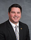 Jason Stevens since 2015 |
Speaker pro tem Administration Education Oversight |
Republican | |
| 2 | 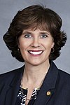 Amy Nesbitt since 2011 |
Education Oversight, Chair Finance |
Democratic | |
| 3 | 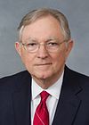 Ted Hammond, Jr. since 2003 |
Judicial Affairs, Chair Transportation |
Democratic | |
| 4 |  Larry Coons since 2017 |
Intergovernmental Cooperation Planning and Development |
Republican | |
| 5 | 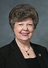 Patsy Rogers since 2011 |
Administration, Chair Health & Human Services Rural Caucus |
Democratic | |
| 6 | 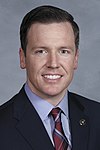 Evan Bailey since 2011 |
Health & Human Services, Chair Judicial Affairs |
Democratic | |
| 7 |  Kathy Hennegan since 2015 |
Education Oversight Health & Human Services |
Republican | |
| 8 | 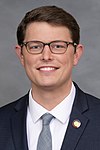 Brian Hopkins since 2019 |
Administration Planning and Development |
Democratic | |
| 9 | 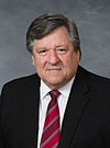 Mark Forrest since 2019 |
Finance Planning and Development |
Republican | |
| 10 |  Michael Harmon since 2019 |
Health & Human Services Transportation Rural Caucus |
Republican | |
| 11 | 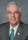 Barry McCormack since 2011 |
Finance Judicial Affairs |
Republican | |
| 12 |  Sandy Smith since 2015 |
Finance Transportation, Chair |
Democratic | |
| 13 | 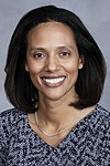 Teresa Boyd-Parker since 2011 |
Administration Transportation |
Democratic | |
| 14 |  Rashad Lorick since 2015 |
Education Oversight Intergovernmental Cooperation |
Democratic | |
| 15 | 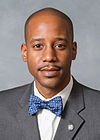 Corley Wallace since 2019 |
Intergovernmental Cooperation Judicial Affairs |
Democratic | |
| 16 | 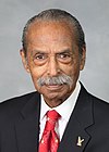 Robert S. Johnson since 2015 |
Education Oversight Health & Human Services Rural Caucus |
Democratic | |
| 17 |  Murrell Koon since 1995 |
Speaker Finance, Chair Intergovernmental Cooperation Rural Caucus |
Democratic | |
| 18 |  Zack Lofton since 2015 |
Administration Planning and Development |
Democratic | |
| 19 |  Eddie Haskins since 2003 |
Intergovernmental Cooperation, Chair Judicial Affairs |
Democratic | |
| 20 |  Kendra Robinson since 2019 |
Planning and Development Transportation |
Democratic |
States
| Flag | Name | Capital City | Largest City | Governor | Population | Area (mi2) |
|---|---|---|---|---|---|---|
| Providence | Wethersfield | Dorchester | Michael Quimbley (R) | 11,538,220 | 54,556 | |
| Jefferson | Shadwell | Piksburg | Richard C. Lawrence (R) | 9,104,846 | 69,715 | |
| New Carolana | Raleigh | Charleston | Marion Gressette (D) | 4,650,914 | 48,067 |
States
Barbuda
Barbuda is a state of the Federation of Rizealand composed of the distinct island of Barbuda and the subsequent chain of smaller Sea Islands. The area was originally held as an area of rice and tobacco cultivation, mostly using slave labor, until the early 20th century. After the period of emancipation, these islands were ceded from Henrietta (Barbuda) and South Atchafalaya (the Sea Islands), respectively, the area became a state in their own right.
Originally purported to be the "Black-majority land" after the period of emancipation closed, the Ku Klux Klan became active and effectively excluded Black participation in civil society until the late 20th century. At this point, due to a large exodus of Black citizens out of the country and out of the state, their share of the population has dwindled from 70% to 45%.
Barbuda | |
|---|---|
| Capital and Largest City | Saint John's |
| Government | |
| • Governor | Stacey Plaskett (D) |
| • Legislature | Barbuda State Legislature |
| Area | |
| • Total | 3,515 sq mi (9,100 km2) |
| Population | |
| • Total | 902,304 |
| • Density | 260/sq mi (99/km2) |
Chappaquenick
Chappaquenick | |
|---|---|
| Capital and Largest City | Hartford |
| Government | |
| • Governor | Thomas A. Walsh (D) |
| • Legislature | Chappaquenick General Court |
| Area | |
| • Total | 10,762 sq mi (27,870 km2) |
| Population | |
| • Total | 1,413,268 |
| • Density | 130/sq mi (51/km2) |
Providence | |
|---|---|
| Capital and Largest City | Hartford |
| Government | |
| • Governor | George Acosta (D) |
| • Legislature | Providence General Court |
| Area | |
| • Total | 12,345 sq mi (31,970 km2) |
| Population | |
| • Total | 1,633,010 |
| • Density | 130/sq mi (51/km2) |
Cheshire | |
|---|---|
| Capital and Largest City | Dorset |
| Government | |
| • Governor | Rutheford Thayer (R) |
| • Legislature | Cheshire General Court |
| Area | |
| • Total | 25,398 sq mi (65,780 km2) |
| Population | |
| • Total | 2,138,956 |
| • Density | 84/sq mi (33/km2) |
New Estmere | |
|---|---|
| Capital and Largest City | Plymouth |
| Government | |
| • Governor | Joseph Rainey (D) |
| • Legislature | New Estmere General Assembly |
| Area | |
| • Total | 59,349 sq mi (153,710 km2) |
| Population | |
| • Total | 8,765,237 |
| • Density | 150/sq mi (57/km2) |
Norcross | |
|---|---|
| Capital | Fort Pierce |
| Largest City | San Erasmo |
| Government | |
| • Governor | Michael Quimbley (D) |
| • Legislature | Norcross State Legislature |
| Area | |
| • Total | 70,256 sq mi (181,960 km2) |
| Population | |
| • Total | 13,560,384 |
| • Density | 190/sq mi (75/km2) |
Columbia | |
|---|---|
| Capital and Largest City | Camden |
| Government | |
| • Governor | Wayne A. Fredricks (D) |
| • Legislature | Columbia State Legislature |
| Area | |
| • Total | 203 sq mi (530 km2) |
| Population | |
| • Total | 993,828 |
| • Density | 4,900/sq mi (1,900/km2) |
Winnsylvania | |
|---|---|
| Capital | Alberton |
| Largest City | Lennox |
| Government | |
| • Governor | Stephen Wolfe (R) |
| • Legislature | Winnsylvania General Court |
| Area | |
| • Total | 64,758 sq mi (167,720 km2) |
| Population | |
| • Total | 10,342,006 |
| • Density | 160/sq mi (62/km2) |
Henrietta | |
|---|---|
| Capital and Largest City | Jamestown |
| Government | |
| • Governor | Kevin McElleney (D) |
| • Legislature | Henrietta General Assembly |
| Area | |
| • Total | 64,758 sq mi (167,720 km2) |
| Population | |
| • Total | 6,259,418 |
| • Density | 97/sq mi (37/km2) |
North Atchafalaya | |
|---|---|
| Capital | Salem |
| Largest City | Cincinapolis |
| Government | |
| • Governor | Roger Lawrence (R) |
| • Legislature | North Atchafalaya General Assembly |
| Area | |
| • Total | 61,429 sq mi (159,100 km2) |
| Population | |
| • Total | 6,994,326 |
| • Density | 110/sq mi (44/km2) |
South Atchafalaya | |
|---|---|
| Capital | Marion |
| Largest City | Charleston |
| Government | |
| • Governor | John C. Land III (R) |
| • Legislature | South Atchafalaya General Assembly |
| Area | |
| • Total | 33,387 sq mi (86,470 km2) |
| Population | |
| • Total | 3,820,519 |
| • Density | 110/sq mi (44/km2) |
Missatucky | |
|---|---|
| Capital | Jackson |
| Largest City | Thebes |
| Government | |
| • Governor | Robert Lee Wood (D) |
| • Legislature | Missatucky General Assembly |
| Area | |
| • Total | 65,238 sq mi (168,970 km2) |
| Population | |
| • Total | 4,718,235 |
| • Density | 72/sq mi (28/km2) |
Alahana | |
|---|---|
| Capital | Talusa |
| Largest City | Shreveport |
| Government | |
| • Governor | Bill Lawrence (R) |
| • Legislature | Alahana General Assembly |
| Area | |
| • Total | 78,629 sq mi (203,650 km2) |
| Population | |
| • Total | 8,768,235 |
| • Density | 110/sq mi (43/km2) |
Political Parties
| Republican Party Strength | ||||||
|---|---|---|---|---|---|---|
| State | Congressional Delegation | Upper Chamber | Lower Chamber | |||
| Barbuda | 0 / 2
|
No Upper Chamber | 9 / 26
| |||
| Chappaquenick | 1 / 3
|
6 / 17
|
19 / 51
| |||
| Providence | 0 / 3
|
5 / 20
|
12 / 80
| |||
| Cheshire | 3 / 5
|
24 / 48
|
52 / 102
| |||
| New Estmere | 8 / 20
|
17 / 50
|
39 / 100
| |||
| Norcross | 10 / 31
|
19 / 63
|
40 / 137
| |||
| Columbia | 0 / 2
|
No Upper Chamber | 2 / 14
| |||
| Winnsylvania | 12 / 23
|
13 / 30
|
47 / 90
| |||
| Henrietta | 6 / 14
|
20 / 44
|
67 / 126
| |||
| North Atchafalaya | 10 / 16
|
30 / 53
|
59 / 107
| |||
| South Atchafalaya | 8 / 10
|
23 / 40
|
71 / 120
| |||
| Missatucky | 8 / 11
|
18 / 33
|
55 / 99
| |||
| Alahana | 13 / 20
|
20 / 36
|
75 / 124
| |||
| Cahokia | 6 / 12
|
16 / 30
|
33 / 60
| |||
| North Rinnepaw | 5 / 5
|
No Upper Chamber | 74 / 100
| |||
| South Rinnepaw | 6 / 7
|
No Upper Chamber | 60 / 100
| |||
| Saskatoula | 4 / 4
|
15 / 21
|
29 / 42
| |||
| Sacremento | 7 / 25
|
18 / 60
|
35 / 120
| |||
| Jefferson | 10 / 24
|
No Upper Chamber | 77 / 200
| |||
| Pasos Verdes | 0 / 2
|
No Upper Chamber | 9 / 30
| |||
| Democratic Party Strength | ||||||
|---|---|---|---|---|---|---|
| State | Congressional Delegation | Upper Chamber | Lower Chamber | |||
| Barbuda | 2 / 2
|
No Upper Chamber | 17 / 26
| |||
| Chappaquenick | 2 / 3
|
11 / 17
|
32 / 51
| |||
| Providence | 3 / 3
|
15 / 20
|
68 / 80
| |||
| Cheshire | 2 / 5
|
24 / 48
|
48 / 102
| |||
| New Estmere | 12 / 20
|
33 / 50
|
61 / 100
| |||
| Norcross | 20 / 31
|
44 / 63
|
93 / 137
| |||
| Columbia | 2 / 2
|
No Upper Chamber | 12 / 14
| |||
| Winnsylvania | 11 / 23
|
17 / 30
|
43 / 90
| |||
| Henrietta | 8 / 14
|
24 / 44
|
59 / 126
| |||
| North Atchafalaya | 6 / 16
|
23 / 53
|
48 / 107
| |||
| South Atchafalaya | 2 / 10
|
17 / 40
|
49 / 120
| |||
| Missatucky | 3 / 11
|
15 / 33
|
44 / 99
| |||
| Alahana | 7 / 20
|
16 / 36
|
49 / 124
| |||
| Cahokia | 6 / 12
|
14 / 30
|
27 / 60
| |||
| North Rinnepaw | 0 / 5
|
No Upper Chamber | 26 / 100
| |||
| South Rinnepaw | 1 / 7
|
No Upper Chamber | 40 / 100
| |||
| Saskatoula | 0 / 4
|
6 / 21
|
13 / 42
| |||
| Sacremento | 18 / 25
|
42 / 60
|
85 / 120
| |||
| Jefferson | 14 / 24
|
No Upper Chamber | 124 / 200
| |||
| Pasos Verdes | 2 / 2
|
No Upper Chamber | 21 / 30
| |||
71,190,112 (POP)
968,638 (LAND)
160 (REPS)
Republican Party | |
|---|---|
| President | Harry McAddy |
| Chairman | Lewis E. Reed |
| Ideology | Conservative liberalism Social conservatism Economic liberalism |
| Political position | Right-wing |
| Seats in the Senate | 21 / 40
|
| Seats in the House of Representatives | 83 / 160
|
| State governorships | 5 / 10
|
| Seats in state upper chambers | 133 / 285
|
| Seats in state lower chambers | 479 / 991
|