West Monroe State Highway 71: Difference between revisions
Jump to navigation
Jump to search
No edit summary |
|||
| Line 6: | Line 6: | ||
|direction_a=South | |direction_a=South | ||
|terminus_a= [[File:US 64.svg|25px|link=Ibican Route 64]] in [[Tustin, West Monroe|Tustin]] | |terminus_a= [[File:US 64.svg|25px|link=Ibican Route 64]] in [[Tustin, West Monroe|Tustin]] | ||
|direction_b=North | |direction_b=North | ||
|terminus_b=[[File:WM-50.png|25px|link=West Monroe State Highway 50]] in [[Frankfort, West Monroe|Frankfort]] | |terminus_b=[[File:WM-50.png|25px|link=West Monroe State Highway 50]] in [[Frankfort, West Monroe|Frankfort]] | ||
Revision as of 15:44, 12 May 2022

| Route information | |
|---|---|
| Length | 274 mi (441 km) |
| Existed | 1974–present |
| Major junctions | |
| South end | |
| North end | |
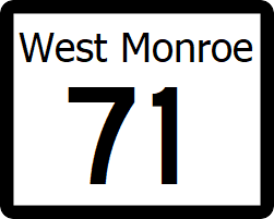
State Highway 71 (SH 71) is a major north-south highway that runs from Ibican Route 64 near Louisville to SH 50 in Frankfort. With SH 54 and IR 64, SH 71 forms the main corridor between Willmington and Charlotte, East Monroe
Major intersections
| County | Location | Destination |
|---|---|---|
| Willis | Tustin | |
| South | ||
| Sterling City | West | |
| Knox | Avery | |
| Madison | Atlanta | |
| Carson | Liberty Springs | North |
| Cadence | North | |
| Frankfort | ||
| North | ||