Kiljan: Difference between revisions
Jump to navigation
Jump to search
(Created page with "{{Infobox settlement | name = Kiljan | official_name = Kílján | settlement_type = Town | image_skyline = |...") |
No edit summary |
||
| (5 intermediate revisions by the same user not shown) | |||
| Line 1: | Line 1: | ||
{{Infobox settlement | {{Infobox settlement | ||
| name | | name = Kiljan | ||
| official_name | | official_name = Town of Kílján | ||
| settlement_type = Town | | settlement_type = {{wpl|Town}} | ||
| image_skyline = | | image_skyline = File:Kiljan .jpg | ||
| image_size = 300px | | image_size = 300px | ||
| image_alt = | | image_alt = | ||
| Line 20: | Line 20: | ||
| coordinates = | | coordinates = | ||
| subdivision_type = [[List of sovereign states|Country]] | | subdivision_type = [[List of sovereign states|Country]] | ||
| subdivision_name = {{Flagcountry| | | subdivision_name = {{Flagcountry|Gotneska}} | ||
| subdivision_type1 = [[States and Territories of Ibica|State]] | | subdivision_type1 = [[States and Territories of Ibica|State]] | ||
| subdivision_name1 = | | subdivision_name1 = | ||
| Line 30: | Line 30: | ||
| established_date2 = 29 March 1555 | | established_date2 = 29 March 1555 | ||
| named_for = | | named_for = | ||
| government_type = | | government_type = {{wpl|Mayor–council government|Mayor–council}} | ||
| leader_party = [[Blechingian Christian Party|BCP]] | | leader_party = [[Blechingian Christian Party|BCP]] | ||
| leader_title = Mayor | | leader_title = Mayor | ||
| Line 58: | Line 58: | ||
|population_blank1 = | |population_blank1 = | ||
| population_demonyms = Kíljáns | | population_demonyms = Kíljáns | ||
| timezone1 = | | timezone1 = | ||
|utc_offset1 = | |utc_offset1 = | ||
| timezone1_DST = | | timezone1_DST = | ||
|utc_offset1_DST = | |utc_offset1_DST = | ||
| postal_code_type = | | postal_code_type = | ||
| Line 85: | Line 85: | ||
|area_land_km2 = | |area_land_km2 = | ||
|area_water_km2 = | |area_water_km2 = | ||
|population_density_km2 = | |population_density_km2 = 1133.7 | ||
}} | }} | ||
'''Kiljan''' or Kílján its Götaish name, is a mid-high end town located along the [[River Ana]]. It is also the closet town and or city to [[Aibhneacha Móra National Park]]. The town is home to 66,890 citizens. The town is located about 5km south of the Argic Circle. | |||
Latest revision as of 04:53, 6 July 2022
Kiljan | |
|---|---|
| Town of Kílján | |
 | |
| Country | |
| Settled | 1120 AD |
| Incorporated | 29 March 1555 |
| Government | |
| • Type | Mayor–council |
| • Mayor | Medb Pedersdottír (BCP) |
| • City Manager | Anders Johansson, PhD |
| Area | |
| • Total | 59 km2 (22.9 sq mi) |
| Elevation | 910 m (2,980 ft) |
| Highest elevation | 1,338 m (4,389 ft) |
| Lowest elevation | 877 m (2,878 ft) |
| Population (2020) | |
| • Total | 66,890 |
| • Density | 1,133.7/km2 (2,936/sq mi) |
| Demonyms | Kíljáns |
| Primary Airport | Kílján Regional Airport |
| Website | www.Kiljan.gov |
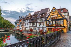
Kiljan or Kílján its Götaish name, is a mid-high end town located along the River Ana. It is also the closet town and or city to Aibhneacha Móra National Park. The town is home to 66,890 citizens. The town is located about 5km south of the Argic Circle.