File:Topographic Map Kapulaka.png: Difference between revisions
Jump to navigation
Jump to search
No edit summary |
(Faeydoro uploaded a new version of File:Topographic Map Kapulaka.png) |
Latest revision as of 11:55, 2 December 2022
Topographic map of the Republic of Kapulaka showing the provincial borders and all major cities
File history
Click on a date/time to view the file as it appeared at that time.
| Date/Time | Thumbnail | Dimensions | User | Comment | |
|---|---|---|---|---|---|
| current | 11:55, 2 December 2022 | 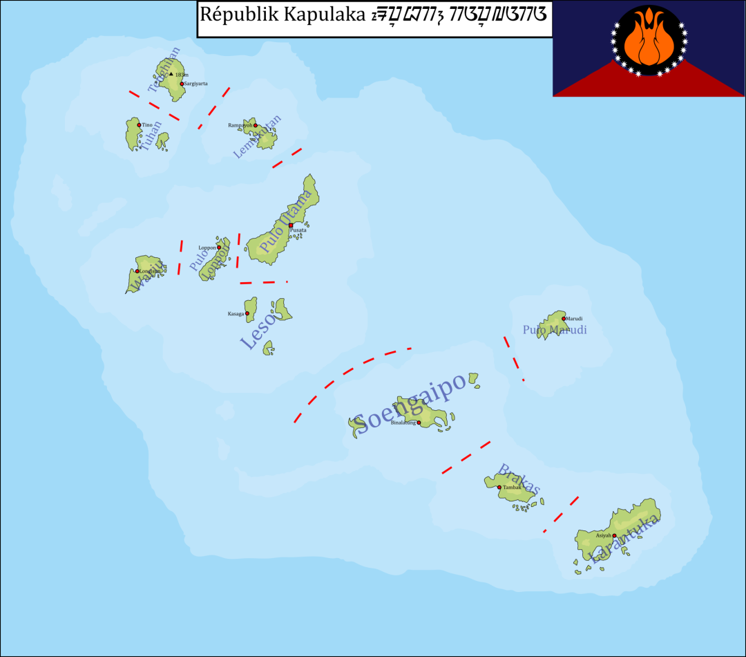 | 1,080 × 950 (207 KB) | Faeydoro (talk | contribs) | Smaller version to better fit Wiki pages |
| 11:43, 2 December 2022 | Error creating thumbnail: File with dimensions greater than 12.5 MP | 5,000 × 4,399 (1 MB) | Faeydoro (talk | contribs) |
You cannot overwrite this file.
File usage
There are no pages that use this file.