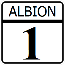
Albion State Route 1: Difference between revisions
Jump to navigation
Jump to search
No edit summary |
|||
| Line 125: | Line 125: | ||
| East [[File:IR 50 Alt.png|25px|link=Ibican Route 50 Alternate]] - [[Greenwood, Albion|Greenwood]]; Begin SR 3 Concurrency | | East [[File:IR 50 Alt.png|25px|link=Ibican Route 50 Alternate]] - [[Greenwood, Albion|Greenwood]]; Begin SR 3 Concurrency | ||
|- | |- | ||
| South [[File:I-75.svg|25px|link=Interstate 75]] West [[File:IR 50 | | South [[File:I-75.svg|25px|link=Interstate 75]] West [[File:IR-50-Alt.png|25px|link=Ibican Route 50 Alternate]] To [[File:AL-49.png|25px|link=Albion State Route 49]] - [[Kemah, Albion|Kemah]], [[Georgetown, Albion|Georgetown]]; End SR 3 Concurrency | ||
|- | |- | ||
| [[File:I-270.svg|25px|link=Interstate 270 (Albion)]] | | [[File:I-270.svg|25px|link=Interstate 270 (Albion)]] | ||
Revision as of 23:52, 2 January 2023
| Route information | |
|---|---|
| Length | 355 mi (571 km) |
| Existed | 1913–present |
| Major junctions | |
| South end | |
| North end | Fremont Street in Norwood |
Albion State Route 1 (SR 1) is a north-south major state highway crossing Albion. Its southern terminus is on the waterfront in Republic. Its northern terminus is on the waterfront in Norwood.
Route description
SH 1 spends most of its routing a rural four lane divided highway, being upgraded a 6 or more lane freeway through major cities. SH 1 is the primary connection between the state's two largest cities, and spends a considerable distance conjoined with other major highways.
