Gharmaaqtuq: Difference between revisions
Jump to navigation
Jump to search
No edit summary |
m (Added Category:Countries (Thegye)) |
||
| (13 intermediate revisions by one other user not shown) | |||
| Line 3: | Line 3: | ||
|native_name = ''ᖁᑦᑎᒃᑐᖅ ᐃᑲᕐᔮᒃᑕᖅ ᒐᒫᖅᑐᖅ'' <!--Country's name (usually full name) in its native language, hence in italics (double quotemarks)--> | |native_name = ''ᖁᑦᑎᒃᑐᖅ ᐃᑲᕐᔮᒃᑕᖅ ᒐᒫᖅᑐᖅ'' <!--Country's name (usually full name) in its native language, hence in italics (double quotemarks)--> | ||
|common_name = Mychenar <!--Common name in English (used for wikilinks, captions, and to produce a default iso3166 code)--> | |common_name = Mychenar <!--Common name in English (used for wikilinks, captions, and to produce a default iso3166 code)--> | ||
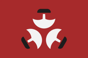
|image_flag = [[File: | |image_flag = [[File:5tglapxbreu91-min.png|300px]] <!--e.g. Flag of country.svg--> | ||
|alt_flag = <!--alt text for flag (text shown when pointer hovers over flag)--> | |alt_flag = <!--alt text for flag (text shown when pointer hovers over flag)--> | ||
|flag_border = <!--set to no to disable border around the flag--> | |flag_border = <!--set to no to disable border around the flag--> | ||
| Line 16: | Line 16: | ||
|other_symbol = | |other_symbol = | ||
|image_map = {{Switcher | |image_map = {{Switcher | ||
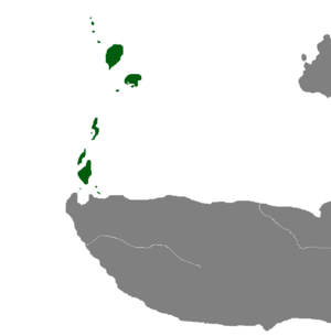
| [[File: | | [[File:Map of Gharmaaqtuq.png|300px]] | ||
| Show | | Show Regional Map | ||
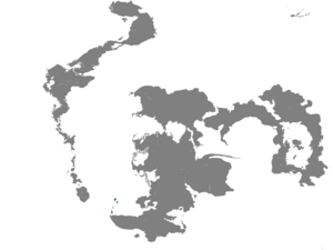
| [[File: | | [[File:Location Map of the High Ikajurtaukdom of Gharmaaqtuq.png|300px]] | ||
| Show | | Show Global Map}} <!--e.g. LocationCountry.svg--> | ||
|loctext = <!--text description of location of country--> | |loctext = <!--text description of location of country--> | ||
|alt_map = <!--alt text for map--> | |alt_map = <!--alt text for map--> | ||
| Line 28: | Line 28: | ||
|capital = [[Nunalipaujaqtalluit]] <!--Name of country/territory's capital, wikilinked if link exists--> | |capital = [[Nunalipaujaqtalluit]] <!--Name of country/territory's capital, wikilinked if link exists--> | ||
|largest_city = Nunalipaujaqtalluit <!--Name of country/territory's largest city. Use "capital" (without quotation marks) if it's the capital.--> | |largest_city = Nunalipaujaqtalluit <!--Name of country/territory's largest city. Use "capital" (without quotation marks) if it's the capital.--> | ||
|official_languages = Ɣarmaaq Uqausinga<!--Languages recognised in legislation, constitution, etc--> | |official_languages = [[Ɣarmaaq Uqausinga]]<!--Languages recognised in legislation, constitution, etc--> | ||
|national_languages = Maaq, | |national_languages = [[Maaq]], [[Dziŋeeh Kuolas]]<!--Country/territory-wide languages recognised but not necessarily in country/territory-wide law, etc--> | ||
|regional_languages = Nunilamaaq<!--Languages recognised or associated with particular regions within the country/territory--> | |regional_languages = [[Nunilamaaq]], [[Vasalpinian]], [[Böyawetlan]]<!--Languages recognised or associated with particular regions within the country/territory--> | ||
|languages_type = <!--Use to specify a further type of language, if not official, national or regional--> | |languages_type = <!--Use to specify a further type of language, if not official, national or regional--> | ||
|languages = <!--Languages of the further type--> | |languages = <!--Languages of the further type--> | ||
| Line 37: | Line 37: | ||
| 82% [[Maaq]] | | 82% [[Maaq]] | ||
| 17% [[Uluu Dzon]] | | 17% [[Uluu Dzon]] | ||
| 0. | | 0.6% [[Böyawetlat]] | ||
| 0. | | 0.1% [[Vasalpin]] | ||
| 0.3% Other | |||
| }} <!--List/breakdown of ethnic groups within the country/territory--> | | }} <!--List/breakdown of ethnic groups within the country/territory--> | ||
|religion = {{unbulleted list | |religion = {{unbulleted list | ||
| 87. | | 87.3% [[Tulugaqaitism]] | ||
| 12. | | 12.1% [[Dzyŋ Yteɣel]] | ||
| 0.6% [[I'nyéchöluk]] | |||
| }} | | }} | ||
|demonym = Gharmaaq <!--Term/s describing those associated with the country/territory (e.g. "Belgian" for the country Belgium)--> | |demonym = Gharmaaq <!--Term/s describing those associated with the country/territory (e.g. "Belgian" for the country Belgium)--> | ||
| Line 59: | Line 61: | ||
|lower_house = <!--Name of governing body's lower house, if given (e.g. "Chamber of Deputies")--> | |lower_house = <!--Name of governing body's lower house, if given (e.g. "Chamber of Deputies")--> | ||
|sovereignty_type = <!--Brief description of country/territory's status ("Independence [from...]", "Autonomous province [of...]", etc)--> | |sovereignty_type = <!--Brief description of country/territory's status ("Independence [from...]", "Autonomous province [of...]", etc)--> | ||
|sovereignty_note = | |sovereignty_note = | ||
|established_event1 = | |established_event1 = Böyawetlat State | ||
| | |established_date1 = ???AE - 740 IE | ||
| | |established_event2 = Dzon Domination<!--First key event in history of country/territory's status or formation--> | ||
| | |established_date2 = 742 IE - 1001 IE<!--Date of first key event--> | ||
| | |established_event3 = Great Migration<!--Second key event--> | ||
| | |established_date3 = 990 IE - 1001 IE<!--Date of second key event--> | ||
| | |established_event4 = Maaq-Dzon Wars | ||
| | |established_date4 = 1001 IE - 1016 IE | ||
| | |established_event5 = Settlement of Gharmaaqtuq | ||
| | |established_date5 = 1011 IE - 1093 IE | ||
|established_event6 = Maaq Domination | |||
|established_date6 = 1093 IE - 1336 IE | |||
|established_event7 = Troubled Times | |||
|established_date7 = 1336 IE - 1369 IE | |||
|established_event8 = Reign of Pâkuk | |||
|established_date8= 1370 IE - Current Day | |||
<!--......--> | <!--......--> | ||
|established_event13 = <!--(up to 13 distinct events may be included)--> | |established_event13 = <!--(up to 13 distinct events may be included)--> | ||
| Line 80: | Line 88: | ||
|percent_water = | |percent_water = | ||
|area_label = Total <!--Label under "Area" (default is "Total")--> | |area_label = Total <!--Label under "Area" (default is "Total")--> | ||
|population_estimate = | |population_estimate = ≈750,000 | ||
|population_estimate_year = 1380 | |population_estimate_year = 1380 | ||
|population_census = | |population_census = | ||
|population_census_year = | |population_census_year = | ||
|population_density_km2 = 18 | |population_density_km2 = 18.03 | ||
|population_density_sq_mi = 46.72 | |population_density_sq_mi = 46.72 | ||
|population_density_rank = | |population_density_rank = | ||
| Line 92: | Line 100: | ||
|patron_saint = <!--Use patron_saints for multiple--> | |patron_saint = <!--Use patron_saints for multiple--> | ||
}} | }} | ||
__TOC__ | __TOC__ | ||
==Etymology== | ==Etymology== | ||
The name Gharmaaqtuq is a combination of many different linguistic influences, including those of the [[Dziŋeeh Kuolas]], [[Böyawetlan]] and [[Maaq]] languages. The most commonly agreed upon origin story is that when the [[Maaq]] people migrated from the Far South of Deteros, they came upon the archipelago which is now called Gharmaaqtuq, labelling it Gaulamaaqmuuqtuq, which means "Lands With The Moving Mountain People". Overtime, the traditional [[Maaq]] language evolved into contemporary [[Gharmaaq]] due to heavy influences from external peoples such as the [[Uluu Dzon]], [[Böyawetlat]] and [[Vasalpin]]. The name was simplified and the "Gh" sound from the [[Dziŋeeh Kuolas]] language of the [[Uluu Dzon]] was added at the start of the name, creating the name Gharmaaqtuq. | |||
==History== | ==History== | ||
| Line 118: | Line 128: | ||
==Notes== | ==Notes== | ||
[[Category:Countries (Thegye)]] | |||
Latest revision as of 02:54, 30 September 2023
High Ikajurtaukdom of Gharmaaqtuq ᖁᑦᑎᒃᑐᖅ ᐃᑲᕐᔮᒃᑕᖅ ᒐᒫᖅᑐᖅ | |
|---|---|
|
Flag | |
| Motto: ᓇᖏᕐᓂᐊᖅᐳᒍᑦ ᐸᑲᒃᒧᑦ! We Will Stand By The Great Pakuk! | |
| Capital and largest city | Nunalipaujaqtalluit |
| Official languages | Ɣarmaaq Uqausinga |
| Recognised national languages | Maaq, Dziŋeeh Kuolas |
| Recognised regional languages | Nunilamaaq, Vasalpinian, Böyawetlan |
| Ethnic groups |
|
| Religion |
|
| Demonym(s) | Gharmaaq |
| Government | Centralised Tribal Confederacy |
• Ikajurtauk (High Chieftain) | Pâkuk |
• Irngutaqinnaq (Grand Elder) | Tulugaak |
• Ɣan (Ghan) | Ɣootur |
| Establishment | |
• Böyawetlat State | ???AE - 740 IE |
• Dzon Domination | 742 IE - 1001 IE |
• Great Migration | 990 IE - 1001 IE |
• Maaq-Dzon Wars | 1001 IE - 1016 IE |
• Settlement of Gharmaaqtuq | 1011 IE - 1093 IE |
• Maaq Domination | 1093 IE - 1336 IE |
• Troubled Times | 1336 IE - 1369 IE |
• Reign of Pâkuk | 1370 IE - Current Day |
| Area | |
• Total | 36,040 km2 (13,920 sq mi) |
| Population | |
• 1380 estimate | ≈750,000 |
• Density | 18.03/km2 (46.7/sq mi) |
| Currency | Kakkiuraq (ᖃ) |
Etymology
The name Gharmaaqtuq is a combination of many different linguistic influences, including those of the Dziŋeeh Kuolas, Böyawetlan and Maaq languages. The most commonly agreed upon origin story is that when the Maaq people migrated from the Far South of Deteros, they came upon the archipelago which is now called Gharmaaqtuq, labelling it Gaulamaaqmuuqtuq, which means "Lands With The Moving Mountain People". Overtime, the traditional Maaq language evolved into contemporary Gharmaaq due to heavy influences from external peoples such as the Uluu Dzon, Böyawetlat and Vasalpin. The name was simplified and the "Gh" sound from the Dziŋeeh Kuolas language of the Uluu Dzon was added at the start of the name, creating the name Gharmaaqtuq.


