Terfanmar: Difference between revisions
Jump to navigation
Jump to search
(Created page with "{{WIP}} {{Infobox settlement | name = Terfanmar | native_name = Τερφανμαρ | settlement_type = Capital City | image_skyline = File:The s...") |
No edit summary |
||
| Line 18: | Line 18: | ||
| founder = Unknown | | founder = Unknown | ||
| seat_type = Capital | | seat_type = Capital | ||
| seat | | seat = Dazkyirì | ||
| government_footnotes = | | government_footnotes = | ||
| government_type = | | government_type = | ||
| Line 47: | Line 47: | ||
| area_blank2_title = | | area_blank2_title = | ||
<!-- square kilometers --> | <!-- square kilometers --> | ||
| area_total_km2 = | | area_total_km2 = 2,381 | ||
| area_urban_km2 = | | area_urban_km2 = | ||
| area_rural_km2 = | | area_rural_km2 = | ||
| area_metro_km2 = | | area_metro_km2 = | ||
| elevation_m = 9 | | elevation_m = 9 | ||
| population_as_of = 2022 | | population_as_of = 2022 | ||
| population_total = | | population_total = 17,282,992 | ||
| population_density_km2 = auto | | population_density_km2 = auto | ||
| population_demonym = Terian | | population_demonym = Terian | ||
Revision as of 16:56, 17 October 2023
This article is incomplete because it is pending further input from participants, or it is a work-in-progress by one author. Please comment on this article's talk page to share your input, comments and questions. Note: To contribute to this article, you may need to seek help from the author(s) of this page. |
Terfanmar
Τερφανμαρ | |
|---|---|
Capital City | |
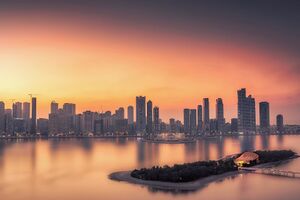
Image of downtown Terfanmar | |
| Nickname: T-Mar | |
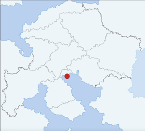
Terfanmar, marked on a map of The Cape Bay | |
| Country | The Cape Bay |
| Territory | Terfanmar Metro |
| First Established | ~3,000BCE |
| Founded by | Unknown |
| Capital | Dazkyirì |
| Government | |
| • Body | Council of Terfanmar |
| • Mayor | Medina Kaffikha (Green - Urban) |
| Area | |
| • Total | 2,381 km2 (919 sq mi) |
| Elevation | 9 m (30 ft) |
| Population (2022) | |
| • Total | 17,282,992 |
| • Density | 7,300/km2 (19,000/sq mi) |
| Demonym | Terian |
| Time zone | -2 |
| City Code | 1L-1H-1L |
| Website | www |


