Vasroderno: Difference between revisions
Slovertia12 (talk | contribs) No edit summary |
Slovertia12 (talk | contribs) |
||
| Line 174: | Line 174: | ||
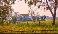
|A village church in southern Vasroderno | |A village church in southern Vasroderno | ||
}} | }} | ||
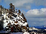
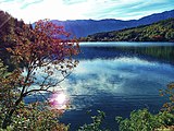
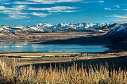
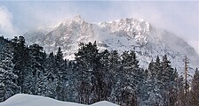
Vasroderno can be split into several different geographic regions. In the south east lies the warm coast of the Sea of Buroz in which lies a coastal plain traversed by wide rivers and further inland gives way to rolling hills covered in dense {{wp|Mediterranean forests, woodlands, and scrub|forests, woodlands, and scrub}} as well as valleys and wide rivers. This rises to form the Dromorian mountain range which runs from the north east to the centre of the country like a spine sheltering the vast Urodia plain in the centre of the country. The centre of the country contains dense forest and a variety of warm dry forests and the lush plains of the Uro river and its tributaries. Further west the largest and highest mountain range the Aradascal mountains stretch in a bowl towards the Ovardic Ocean with large wide slopes and peaks and beautiful varied and spectacular scenery to the south of this lies a semi arid steppe which stretches towards the empire’s south western border. | |||
===Climate=== | ===Climate=== | ||
===Subdivisions=== | ===Subdivisions=== | ||
==Politics and government== | ==Politics and government== | ||
===Foreign relations=== | ===Foreign relations=== | ||
Revision as of 22:41, 20 November 2023
This article is incomplete because it is pending further input from participants, or it is a work-in-progress by one author. Please comment on this article's talk page to share your input, comments and questions. Note: To contribute to this article, you may need to seek help from the author(s) of this page. |
The Empire of Vasroderno Imperus Vasrodernica | |
|---|---|
|
Flag | |
| Motto: "Arus Vorde Fortas" "Work Garners Strength" | |
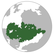 Vasroderno (Green) spanning the continents of Ealios and Gerania | |
| Capital and largest city | Vasroderno |
| Recognised national languages | Vasrodernic |
| Recognised regional languages | Various |
| Demonym(s) | Vasrodernic |
| Government | Unitary parliamentary Constitutional monarchy |
• Emperor | Voldarna III |
| Aleksander Moras | |
| Legislature | Senate |
| Noble Council | |
| Representative Council | |
| Establishment | |
• Foundation of Kingdom of Vasroderno | 1012 |
• Expansion Period | 1240-1410 |
• Republic | 1560 |
• Civil War | 1632 |
• Empire & Northward Conquest | 1632-1701 |
• Great Schism | 1819 |
• Unification | 1863 |
| Population | |
• 2023 estimate | 88,990,734 |
| GDP (nominal) | 2023 estimate |
• Total | $22 trillion |
• Per capita | $78,000 |
| HDI (2023) | 0.92 very high |
| Currency | Vasrodernic Dolnur (VAD) |
| Driving side | right |
| ISO 3166 code | VAS |
| Internet TLD | .va |
Vasroderno is a country and unitary parliamentary Constitutional monarchy. It reaches from the Dromorian Mountains in the north to the Jurdos Steppe in the south, the Sea of Buroz in the south west and the Ovardic Ocean in the north east. The city of Vasroderno is the largest city and capital it is also known as the imperial city owing to its position as the seat of government and the monarchy. Other major cities include Provarica in the south west, Bovorico in the south, Eapondora, Dalkosa and Gadarinivo. The empire is split into three levels of subdivison. The first level consists of 20 Pramori which have councils and manage certain areas of local governance, 55 Daloci which the Pramori are split into and which are primarily for electoral purposes and 344 Terosi which were the old traditional Daloci subdivisions before they were significantly reformed.
The constitutional monarch of the empire is Voldarna III, the role of the Emperor of Vasroderno has been constitutional since 1863 after the unification of the empire under Urus the Great following the Great Schism of 1819. The Emperor serves as Head of state. The Head of government of the nation is the Prime Minister who is the leader of the largest party in the lower house of the Senate of Vasroderno to which elections are held every four years.
Vasroderno is a highly developed country renowned for its beautiful geography, its rich cultural legacy and history as well as its art, architecture and imprint on the history of the world and its presence on the global stage. It is one of the world’s largest political and military powers and has a considerable GDP as well as we’ll developed state welfare services and programs.
History
Geography
The Ancient walls of the imperial city of Vasroderno
Vasroderno can be split into several different geographic regions. In the south east lies the warm coast of the Sea of Buroz in which lies a coastal plain traversed by wide rivers and further inland gives way to rolling hills covered in dense forests, woodlands, and scrub as well as valleys and wide rivers. This rises to form the Dromorian mountain range which runs from the north east to the centre of the country like a spine sheltering the vast Urodia plain in the centre of the country. The centre of the country contains dense forest and a variety of warm dry forests and the lush plains of the Uro river and its tributaries. Further west the largest and highest mountain range the Aradascal mountains stretch in a bowl towards the Ovardic Ocean with large wide slopes and peaks and beautiful varied and spectacular scenery to the south of this lies a semi arid steppe which stretches towards the empire’s south western border.

