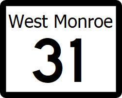
West Monroe State Highway 31: Difference between revisions
Jump to navigation
Jump to search
No edit summary |
No edit summary |
||
| Line 43: | Line 43: | ||
| [[File:US 1.svg|25px|link=Ibican Route 1]] - [[Amity, West Monroe|Amity]], [[Lynwood, West Monroe|Lynwood]] | | [[File:US 1.svg|25px|link=Ibican Route 1]] - [[Amity, West Monroe|Amity]], [[Lynwood, West Monroe|Lynwood]] | ||
|- | |- | ||
| rowspan=" | | rowspan="4" | [[Wilkinson County, West Monroe|Wilkinson]] | ||
| | |||
| [[File:Wilkinson Toll Road.png|25px|link=Wilkinson Toll Road]] - [[Rhone, West Monroe|Rhone]] | |||
|- | |||
| rowspan="3" | [[Cleveland, West Monroe|Cleveland]] | | rowspan="3" | [[Cleveland, West Monroe|Cleveland]] | ||
| [[File:WM-55.png|25px|link=West Monroe State Highway 55]] - [[Arizona, West Monroe|Arizona]] | | [[File:WM-55.png|25px|link=West Monroe State Highway 55]] - [[Arizona, West Monroe|Arizona]] | ||
| Line 51: | Line 54: | ||
| [[File:WM-11.png|25px|link=West Monroe State Highway 11]] - [[May, West Monroe|May]], [[Parma, West Monroe|Parma]] | | [[File:WM-11.png|25px|link=West Monroe State Highway 11]] - [[May, West Monroe|May]], [[Parma, West Monroe|Parma]] | ||
|- | |- | ||
| rowspan=" | | rowspan="8" | [[Denton County, West Monroe|Denton]] | ||
| rowspan=" | | rowspan="4" | [[Denton, West Monroe|Denton]] | ||
| North [[File:WM-28.png|25px|link=West Monroe State Highway 28]] - [[Parma, West Monroe|Parma]]; End SH 28 Concurrency | | North [[File:WM-28.png|25px|link=West Monroe State Highway 28]] - [[Parma, West Monroe|Parma]]; End SH 28 Concurrency | ||
|- | |||
| [[File:WM-49.png|25px|link=West Monroe State Highway 49]] - [[Holgate, West Monroe|Holgate]], [[Glass, West Monroe|Glass]] | |||
|- | |- | ||
| [[File:I-30.svg|25px|link=Interstate 30]] - [[Rhone]], [[Toledo, West Monroe|Toledo]] | | [[File:I-30.svg|25px|link=Interstate 30]] - [[Rhone]], [[Toledo, West Monroe|Toledo]] | ||
| Line 60: | Line 65: | ||
|- | |- | ||
| | | | ||
| South [[File:WM-28.png|25px|link=West Monroe State Highway 28]] - [[St. Lawrence, West Monroe|St. Lawrence]] | | South [[File:WM-28.png|25px|link=West Monroe State Highway 28]][[File:RR-28.png|25px|link=West Monroe Rural Road 28]] - [[St. Lawrence, West Monroe|St. Lawrence]], [[Renner Village, West Monroe|Renner Village]] | ||
|- | |||
| [[Brookesmith, West Monroe|Brookesmith]] | |||
| [[File:RR-15.png|25px|link=West Monroe Rural Road 15]] - [[Mercury, West Monroe|Mercury]], [[Fayetteville, West Monroe|Fayetteville]] | |||
|- | |- | ||
| rowspan="2" | [[Big Spring State Park]] | | rowspan="2" | [[Big Spring State Park]] | ||
Revision as of 21:16, 28 June 2024
| Route information | |
|---|---|
| Length | 195 mi (314 km) |
| Existed | 1927–present |
| Major junctions | |
| West end | |
| North end | |
State Highway 31 (SH 31) is a highway that runs from Ibican Route 2 in Lexington, outside of Rhone to Ibican Route 64 near Leesville, on the shore of Lake Mercury.
Major intersections
| County | Location | Destination |
|---|---|---|
| Archer | Addison | |
| Kennedy | ||
| Amity River | ||
| Addison | ||
| Wilkinson | ||
| Cleveland | ||
| Wilkinson Bayou | ||
| Denton | Denton | North |
| South | ||
| Brookesmith | ||
| Big Spring State Park | ||
