West Monroe State Highway 55: Difference between revisions
Jump to navigation
Jump to search
(Created page with "right|300px {{Infobox road |length_mi=195 |length_ref= |formed=1942 |direction_a=South |terminus_a= [[File:WM-31.png|25px|link=West Monroe State Highway 31]...") |
No edit summary |
||
| (3 intermediate revisions by the same user not shown) | |||
| Line 22: | Line 22: | ||
! style="text-align:center; vertical-align:bottom;"| '''Destination''' | ! style="text-align:center; vertical-align:bottom;"| '''Destination''' | ||
|- | |- | ||
| [[Wilkinson County, West Monroe|Wilkinson]] | | rowspan="7" | [[Wilkinson County, West Monroe|Wilkinson]] | ||
| [[ | | [[Glass, West Monroe|Glass]] | ||
| [[File:WM- | | [[File:WM-49.png|25px|link=West Monroe State Highway 49]] to [[File:WM-6.png|25px|link=West Monroe State Highway 6]] - [[Denton, West Monroe|Denton]], [[Talpa, West Monroe|Talpa]] | ||
|- | |||
| [[Brownwood, West Monroe|Brownwood]] | |||
| [[File:I-30.svg|25px|link=Interstate 30]] - [[Rhone, West Monroe|Rhone]], [[Toledo, West Monroe|Toledo]] | |||
|- | |||
| | |||
| [[File:RR-28.png|25px|link=West Monroe Rural Road 28]] - [[Brookesmith, West Monroe|Brookesmith]], [[Lake Kennedy]] | |||
|- | |||
| rowspan="4" | [[Cleveland, West Monroe|Cleveland]] | |||
| South [[File:WM-11.png|25px|link=West Monroe State Highway 11]] - [[Rhone]], [[May, West Monroe|May]] | |||
|- | |||
| North [[File:WM-11.png|25px|link=West Monroe State Highway 11]] East [[File:WM-31.png|25px|link=West Monroe State Highway 31]] - [[Parma, West Monroe|Parma]], [[Denton, West Monroe|Denton]] | |||
|- | |||
| [[Wilkinson Bayou]] | |||
|- | |||
| West [[File:WM-31.png|25px|link=West Monroe State Highway 31]] - [[Addison, West Monroe|Addison]] | |||
|- | |- | ||
| rowspan="2" | [[Midland County, West Monroe|Midland]] | | rowspan="2" | [[Midland County, West Monroe|Midland]] | ||
| Line 33: | Line 48: | ||
| [[File:WM-28.png|25px|link=West Monroe State Highway 28]] - [[Blanchester, West Monroe|Blanchester]], [[Marion, West Monroe|Marion]] | | [[File:WM-28.png|25px|link=West Monroe State Highway 28]] - [[Blanchester, West Monroe|Blanchester]], [[Marion, West Monroe|Marion]] | ||
|- | |- | ||
| rowspan=" | | rowspan="7" | [[Montgomery County, West Monroe|Montgomery]] | ||
| colspan="2" | [[Amity River]] | | colspan="2" | [[Amity River]] | ||
|- | |||
| rowspan="2" | [[Woodway, West Monroe|Woodway]] | |||
| [[File:RR-52.png|25px|link=West Monroe Rural Road 52]] - [[Amity, West Monroe|Amity]] | |||
|- | |||
| [[File:RR-48.png|25px|link=West Monroe Rural Road 48]] - [[Ricetown, West Monroe|Ricetown]], [[Carthage, West Monroe|Carthage]] | |||
|- | |||
| | |||
| [[File:RR-86.png|25px|link=West Monroe Rural Road 86]] - [[Brenham, West Monroe|Brenham]] | |||
|- | |- | ||
| [[Ames, West Monroe|Denton]] | | [[Ames, West Monroe|Denton]] | ||
| Line 42: | Line 65: | ||
|[[File:WM-4.png|25px|link=West Monroe State Highway 4]] - [[Deer Park, West Monroe|Deer Park]], [[Dover, West Monroe|Dover]] | |[[File:WM-4.png|25px|link=West Monroe State Highway 4]] - [[Deer Park, West Monroe|Deer Park]], [[Dover, West Monroe|Dover]] | ||
|- | |- | ||
| rowspan=" | | | ||
| [[File:RR-71.png|25px|link=West Monroe Rural Road 71]] - [[Dundee, West Monroe|Dundee]] | |||
|- | |||
| rowspan="7" | [[Wheeling County, West Monroe|Wheeling]] | |||
| | |||
| [[File:RR-57.png|25px|link=West Monroe Rural Road 71]] - [[Dundee, West Monroe|Dundee]], [[Bailey, West Monroe|Bailey]] | |||
|- | |||
| colspan="2" | [[Bailey River]] | | colspan="2" | [[Bailey River]] | ||
|- | |- | ||
| [[Crossroads, West Monroe|Crossroads]] | | rowspan="2" | [[Crossroads, West Monroe|Crossroads]] | ||
| [[File:RR-44.png|25px|link=West Monroe Rural Road 44]] - [[Prattsville, West Monroe|Prattsville]], [[Bailey, West Monroe|Bailey]] | |||
|- | |||
| South [[File:WM-30.png|25px|link=West Monroe State Highway 30]] - [[Bethany, West Monroe|Bethany]], [[Dundee, West Monroe|Dundee]] | | South [[File:WM-30.png|25px|link=West Monroe State Highway 30]] - [[Bethany, West Monroe|Bethany]], [[Dundee, West Monroe|Dundee]] | ||
|- | |- | ||
Latest revision as of 17:19, 30 June 2024
| Route information | |
|---|---|
| Length | 195 mi (314 km) |
| Existed | 1942–present |
| Major junctions | |
| South end | |
| North end | |
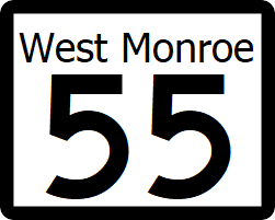
State Highway 55 (SH 55) is a highway that runs north-south from Cleveland, outside of Rhone to Cowcreek, on the Calahan state line.
Major intersections
| County | Location | Destination |
|---|---|---|
| Wilkinson | Glass | |
| Brownwood | ||
| Cleveland | South | |
| North | ||
| Wilkinson Bayou | ||
| West | ||
| Midland | Arizona | |
| Denton | ||
| Montgomery | Amity River | |
| Woodway | ||
| Denton | South | |
| Montgomery | ||
| Wheeling | ||
| Bailey River | ||
| Crossroads | ||
| South | ||
| Sturgeon | ||
| Cow Creek | ||
| Cowcreek | ||
