West Monroe State Highway 8: Difference between revisions
Jump to navigation
Jump to search
(Created page with "right|300px {{Infobox road |length_mi=2150 |length_ref= |formed=1960 |direction_a=South |terminus_a= 25px|link=Interstate 10 in Clarksvil...") |
No edit summary |
||
| (7 intermediate revisions by the same user not shown) | |||
| Line 1: | Line 1: | ||
[[File:WM- | [[File:WM-8.png|right|300px]] | ||
{{Infobox road | {{Infobox road | ||
|length_mi= | |length_mi=68 | ||
|length_ref= | |length_ref= | ||
|formed= | |formed=1952 | ||
|direction_a= | |direction_a=West | ||
|terminus_a= [[File: | |terminus_a= [[File:WM-1.png|25px|link=West Monroe State Highway 1]] in [[Seabrook, West Monroe|Seabrook]] | ||
|junction= | |junction= | ||
*[[File:WM-21.png|25px|link=West Monroe State Highway 21]] | *[[File:WM-21.png|25px|link=West Monroe State Highway 21]] | ||
*[[File:WM-11.png|25px|link=West Monroe State Highway 11]] | *[[File:WM-11.png|25px|link=West Monroe State Highway 11]] | ||
|direction_b=East | |||
|terminus_b=[[File:WM-6.png|25px|link=West Monroe State Highway 6]] in [[Millhome, West Monroe|Millhome]] | |||
}} | }} | ||
'''State Highway 8''' ('''SH 8''') is a major east-west highway serving the southern suburbs of [[Rhone]], running mostly through Mason County. For nearly the entire route, SH 8 is a six lane roadway, alternating between a center turn lane and landscaped median depending on the city its currently passing through. | |||
'''State Highway | |||
==Major intersections== | ==Major intersections== | ||
| Line 26: | Line 21: | ||
! style="text-align:center; vertical-align:bottom;"| '''Destination''' | ! style="text-align:center; vertical-align:bottom;"| '''Destination''' | ||
|- | |- | ||
| rowspan=" | | rowspan="8" | [[Mason County, West Monroe|Mason]] | ||
| rowspan=" | | rowspan="4" | [[Seabrook, West Monroe|Seabrook]] | ||
| [[File:WM-1.png|25px|link=West Monroe State Highway 1]] - [[Port Wells, West Monroe|Port Wells]], [[Gatlinburg, West Monroe|Gatlinburg]] | | [[File:WM-1.png|25px|link=West Monroe State Highway 1]] - [[Port Wells, West Monroe|Port Wells]], [[Gatlinburg, West Monroe|Gatlinburg]] | ||
|- | |||
| [[File:UR-73.png|25px|link=West Monroe Urban Road 73]] - [[Port Wells, West Monroe|Port Wells]] | |||
|- | |- | ||
| [[File:WM-21.png|25px|link=West Monroe State Highway 21]] - [[Anderson, West Monroe|Anderson]] | | [[File:WM-21.png|25px|link=West Monroe State Highway 21]] - [[Anderson, West Monroe|Anderson]] | ||
|- | |||
| [[File:UR-29.png|25px|link=West Monroe Urban Road 29]] - [[Anderson, West Monroe|Anderson]] | |||
|- | |||
| [[Marlow, West Monroe|Marlow]] | |||
| [[File:WM-11.png|25px|link=West Monroe State Highway 11]] - [[Gatlinburg, West Monroe|Gatlinburg]], [[Rhone]] | |||
|- | |- | ||
| rowspan="2" | [[Gatlinburg, West Monroe|Gatlinburg]] | | rowspan="2" | [[Gatlinburg, West Monroe|Gatlinburg]] | ||
| [[File: | | [[File:UR-89.png|25px|link=West Monroe Urban Road 89]] - [[Marlow, West Monroe|Marlow]] | ||
|- | |||
| [[File:UR-16.png|25px|link=West Monroe Urban Road 16]] - [[Marlow, West Monroe|Marlow]] | |||
|- | |- | ||
| [[File:WM-47.png|25px|link=West Monroe State Highway 47]] - [[ | | [[Champion, West Monroe|Champion]] | ||
| [[File:WM-47.png|25px|link=West Monroe State Highway 47]] - [[Cambridge, West Monroe|Cambrdge]], [[Gatlinburg, West Monroe|Gatlinburg]] | |||
|- | |- | ||
| rowspan="2" | [[Travis County, West Monroe|Travis]] | | rowspan="2" | [[Travis County, West Monroe|Travis]] | ||
Latest revision as of 17:34, 1 August 2024
| Route information | |
|---|---|
| Length | 68 mi (109 km) |
| Existed | 1952–present |
| Major junctions | |
| West end | |
| East end | |
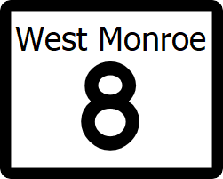
State Highway 8 (SH 8) is a major east-west highway serving the southern suburbs of Rhone, running mostly through Mason County. For nearly the entire route, SH 8 is a six lane roadway, alternating between a center turn lane and landscaped median depending on the city its currently passing through.
Major intersections
| County | Location | Destination |
|---|---|---|
| Mason | Seabrook | |
| Marlow | ||
| Gatlinburg | ||
| Champion | ||
| Travis | Millhome | Travis Bayou |
