Outline of Romaia: Difference between revisions
Jump to navigation
Jump to search
No edit summary |
|||
| (2 intermediate revisions by the same user not shown) | |||
| Line 6: | Line 6: | ||
| alt1 = | | alt1 = | ||
| caption1 = The [[Flag of Romaia]] | | caption1 = The [[Flag of Romaia]] | ||
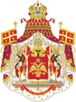
| image2 = | | image2 = coa_romaia.png | ||
| width2 = 109 | | width2 = 109 | ||
| alt2 = | | alt2 = | ||
| Line 56: | Line 56: | ||
** Land boundaries: 3755,5 km | ** Land boundaries: 3755,5 km | ||
::{{Flag|Haramoun}} ([[Outline of Haramoun|outline]]) 252 km | ::{{Flag|Haramoun}} ([[Outline of Haramoun|outline]]) 252 km | ||
::{{Flag| | ::{{Flag|Sanetia}} ([[Outline of Sanetia|outline]]) 651 km | ||
::{{Flag|Isfahan}} ([[Outline of Isfahan|outline]]) 2852,5 km | ::{{Flag|Isfahan}} ([[Outline of Isfahan|outline]]) 2852,5 km | ||
:* Coastline: 2547,85 km | :* Coastline: 2547,85 km | ||
| Line 126: | Line 126: | ||
[[Demographics of Romaia]] | [[Demographics of Romaia]] | ||
=== | === Neighbours of Romaia === | ||
[[Romaia]] shares its north border with: | [[Romaia]] shares its north border with: | ||
* [[Haramoun]] | * [[Haramoun]] | ||
* [[Isfahan]] | * [[Isfahan]] | ||
* [[ | * [[Sanetia]] | ||
Latest revision as of 19:13, 7 August 2024
This article is incomplete because it is pending further input from participants, or it is a work-in-progress by one author. Please comment on this article's talk page to share your input, comments and questions. Note: To contribute to this article, you may need to seek help from the author(s) of this page. |
The following outline is provided as an overview of and topical guide to Romaia:
Romaia is a democracy organized in the form of a parliamentary government under a constitutional monarchy in Southeastern Eulabia, located primarily upon the TBD.
General reference
- Name of Romaia
- Pronunciation: TBD
- el
- Common English country name: Romaia
- Official English country name: Romaian Empire
- Common endonym(s): Ρωμανία (Romanìa), Ρωμάια (Romaia, Archaic)
- Official endonym(s): Ρωμαϊκή Αυτοκρατορία (Romaiki Aftokratoria)
- Adjectival(s): Romaian
- Demonym(s): Romaian
- Pronunciation: TBD
- Date and time notation in Romaia
- International rankings of Romaia
- ISO country codes: RA, ROA, 640
- ISO region codes: See ISO 3166-2:RA
- Internet country code top-level domain: .ra .ρω
Geography of Romaia
- Romaia is:
- a country
- Location:
- North: Paralia Agias Marias
- South: Perasma Olon ton Agion
- East: Korifi Agiou Efstratiou
- West: Paralia ton Iaonion
- High: Chios 3,710 m (12,172 ft)
- Low: Kato Livadia Apollonias −3.2 m (−10 ft)
- Land boundaries: 3755,5 km
-
- Coastline: 2547,85 km
- Sharing Ilian Sea with Haramoun
- Population of Romaia: 59,576,148 people (2022 estimate) - TBD most populous country
- Area of Romaia: 576,035 km2 (222,408 sq mi)
Environment of Romaia
- Climate of Romaia
- Conservation in Romaia
- Geology of Romaia
- National parks of Romaia
- Wildlife of Romaia
Geographic features of Romaia
- Glaciers of Romaia
- Islands of Romaia
- Lakes of Romaia
- Mountains of Romaia
- Rivers of Romaia
- Valleys of Romaia
Regions of Romaia
Administrative divisions types
Statistical divisions of Romaia
Regions, and departments of Romaia
Comunes of Romaia
- Cities of Romaia
- Capital of Romaia: Constantinoupoli
- Cities in Romaia over 100,000 population
Demography of Romaia
Neighbours of Romaia
Romaia shares its north border with:

