Tlord: Difference between revisions
No edit summary |
No edit summary |
||
| (26 intermediate revisions by the same user not shown) | |||
| Line 1: | Line 1: | ||
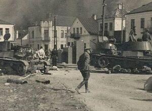
[[File:Revolt.jpg|thumb]] | |||
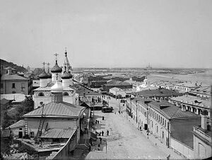
[[File:Barzar.jpg|thumb]] | |||
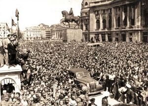
[[File:8-noiembrie-1945.jpg|thumb]] | |||
[[File:Africa war.png|thumb]] | |||
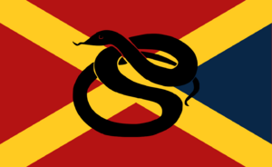
[[File:Destronka fascist party flag.png|thumb]] | |||
[[File:Belarus.png|thumb]] | |||
[[File:Untitled um.png|thumb]] | |||
[[File:5eb4508d15e9f95f147d4e91 work.jpg|thumb]] | |||
https://www.nationstates.net/images/flags/uploads/tlord__836555.png | |||
[[File:Argentinad.png|thumb]] | |||
[[File:Tlordian.png|thumb]] | |||
[[File:Rusland.png|thumb]] | |||
[[File:Tlordian tunisia.png|thumb]] | |||
[[File:Stars n' Bars.png|thumb]] | |||
[[ | |||
[[File:Armenian Revolutionary Federation.png|thumb]] | |||
]] | |||
[[File:Granatan War.png|thumb]] | |||
[[File:RESTANIAN BUSHWAR.png|thumb]] | |||
[[File:Cheskian Revolt.png|thumb]] | |||
[[File:CHESKIAN REVOLT.png|thumb]] | |||
Work In Progress "Need some help on the info-box" | |||
== Overview of Tlord == | |||
[[File:Nasjonalist Russlanddqwdq.png|thumb]] | |||
{{Infobox country | |||
|micronation = No | |||
|conventional_long_name = <!--Formal or official full name of the country in English--> | |||
|native_name = <!--Country's name (usually full name) in its official/defacto language(s), hence in italics (double quotemarks)--> | |||
|common_name = <!--Common name in English (used for wikilinks, captions, and to produce a default iso3166 code)--> | |||
|status = <!--Status of country, especially useful for micronations--> | |||
|image_flag = <!--e.g. Flag of country.svg--> | |||
|alt_flag = <!--alt text for flag (text shown when pointer hovers over flag)--> | |||
|flag_border = <!--set to no to disable border around the flag--> | |||
|image_flag2 = <!--e.g. Second-flag of country.svg--> | |||
|alt_flag2 = <!--alt text for second flag--> | |||
|flag2_border = <!--set to no to disable border around the flag--> | |||
|image_coat = <!--e.g. Coat of arms of country.svg--> | |||
|alt_coat = <!--alt text for coat of arms--> | |||
|symbol_type = <!--emblem, seal, etc (if not a coat of arms)--> | |||
|national_motto = <!--in inverted commas and wikilinked if link exists--> | |||
|englishmotto = <!--English language version of motto--> | |||
|national_anthem = <!--in inverted commas and wikilinked if link exists--> | |||
|royal_anthem = <!--in inverted commas and wikilinked if link exists--> | |||
|other_symbol_type = <!--Use if a further symbol exists, e.g. hymn--> | |||
|other_symbol = | |||
|image_map = <!--e.g. LocationCountry.svg--> | |||
|loctext = <!--text description of location of country--> | |||
|alt_map = <!--alt text for map--> | |||
|map_caption = <!--Caption to place below map--> | |||
|image_map_size = <!--Map size in number of pixels--> | |||
|image_map2 = <!--Another map, if required--> | |||
|alt_map2 = <!--alt text for second map--> | |||
|map_caption2 = <!--Caption to place below second map--> | |||
|image_map2_size = <!--Map size in number of pixels--> | |||
|capital = <!--Name of country/territory's capital, wikilinked if link exists--> | |||
|coordinates = <!-- Coordinates for capital, using {{tl|coord}} --> | |||
|largest_city = <!--Name of country/territory's largest city. Use "capital" (without quotation marks) if it's the capital.--> | |||
|largest_settlement_type = <!--Type of settlement if largest settlement not a city--> | |||
|largest_settlement = <!--Name of largest settlement--> | |||
|official_languages = <!--Languages recognised in legislation, constitution, etc--> | |||
|national_languages = <!--Country/territory-wide languages recognised but not necessarily in country/territory-wide law, etc--> | |||
|regional_languages = <!--Languages recognised or associated with particular regions within the country/territory--> | |||
|languages_type = <!--Use to specify a further type of language, if not official, national or regional--> | |||
|languages = <!--Languages of the further type--> | |||
|languages_sub = <!--Is this further type of language a sub-item of the previous non-sub type? ("yes" or "no")--> | |||
|languages2_type = <!--Another further type of language--> | |||
|languages2 = <!--Languages of this second further type--> | |||
|languages2_sub = <!--Is the second alternative type of languages a sub-item of the previous non-sub type? ("yes" or "no")--> | |||
|ethnic_groups = <!--List/breakdown of ethnic groups within the country/territory--> | |||
|ethnic_groups_year = <!--Year of ethnic groups data (if provided)--> | |||
|ethnic_groups_ref = <!--(for any ref/s to associate with ethnic groups data)--> | |||
|religion = <!--Religion--> | |||
|religion_year = <!--Year of religion data (if provided)--> | |||
|religion_ref = <!--(for any ref/s to associate with religion data)--> | |||
|demonym = <!--Term/s describing those associated with the country/territory (e.g. "Belgian" for the country Belgium)--> | |||
|government_type = <!--(often a compound multi-wikilinked term, e.g. "Federal semi-presidential constitutional republic", etc)--> | |||
|leader_title1 = <!--(for a country, usually the head of state's (wikilinked) title, e.g. "President", "Monarch")--> | |||
|leader_name1 = | |||
|leader_title2 = <!--(could be "Vice President", otherwise "Prime Minster", etc, etc)--> | |||
|leader_name2 = | |||
|leader_title14 = <!--(up to 14 distinct leaders may be included)--> | |||
|leader_name14 = | |||
|legislature = <!--Name of the country/territory's governing body, e.g. "Parliament", "Congress", etc--> | |||
|upper_house = <!--Name of governing body's upper house, if given (e.g. "Senate")--> | |||
|lower_house = <!--Name of governing body's lower house, if given (e.g. "Chamber of Deputies")--> | |||
|sovereignty_type = <!--Brief description of country/territory's status ("Independence [from...]", "Autonomous province [of...]", etc)--> | |||
|sovereignty_note = | |||
|established_event1 = <!--First key event in history of country/territory's status or formation--> | |||
|established_date1 = <!--Date of first key event--> | |||
|established_event2 = <!--Second key event--> | |||
|established_date2 = <!--Date of second key event--> | |||
|established_event13 = <!--(up to 13 distinct events may be included)--> | |||
|established_date13 = | |||
|area_rank = | |||
|area = <!--Major area size (in [[Template:convert]] either km2 or sqmi first)--> | |||
|area_km2 = <!--Major area size (in square km)--> | |||
|area_sq_mi = <!--Area in square mi (requires area_km2)--> | |||
|area_footnote = <!--Optional footnote for area--> | |||
|percent_water = | |||
|area_label = <!--Label under "Area" (default is "Total")--> | |||
|area_label2 = <!--Label below area_label (optional)--> | |||
|area_data2 = <!--Text after area_label2 (optional)--> | |||
|population_estimate = | |||
|population_estimate_rank = | |||
|population_estimate_year = | |||
|population_census = | |||
|population_census_year = | |||
|population_density_km2 = | |||
|population_density_sq_mi = | |||
|population_density_rank = | |||
|nummembers = <!--An alternative to population for micronation--> | |||
|GDP_PPP = <!--(Gross Domestic Product from Purchasing Power Parity)--> | |||
|GDP_PPP_rank = | |||
|GDP_PPP_year = | |||
|GDP_PPP_per_capita = | |||
|GDP_PPP_per_capita_rank = | |||
|GDP_nominal = | |||
|GDP_nominal_rank = | |||
|GDP_nominal_year = | |||
|GDP_nominal_per_capita = | |||
|GDP_nominal_per_capita_rank = | |||
|Gini = <!--(Gini measure of income inequality; input number only; valid values are between 0 and 100)--> | |||
|Gini_ref = <!--(for any ref/s to associate with Gini number)--> | |||
|Gini_rank = | |||
|Gini_year = | |||
|HDI_year = <!-- Please use the year to which the data refers, not the publication year--> | |||
|HDI = <!--(Human Development Index; input number only; valid values are between 0 and 1)--> | |||
|HDI_change = <!--increase/decrease/steady; rank change from previous year--> | |||
|HDI_rank = | |||
|HDI_ref = <!--(for any ref/s to associate with HDI number)--> | |||
|currency = <!--Name/s of currency/ies used in country/territory--> | |||
|currency_code = <!--ISO 4217 code/s for currency/ies (each usually three capital letters)--> | |||
|time_zone = <!--e.g. GMT, PST, AST, etc, etc (wikilinked if possible)--> | |||
|utc_offset = <!--in the form "+N", where N is number of hours offset--> | |||
|time_zone_DST = <!--Link to DST (Daylight Saving Time) used, otherwise leave empty--> | |||
|utc_offset_DST = <!--in the form "+N", where N is number of hours offset--> | |||
|DST_note = <!--Optional note regarding DST use--> | |||
|antipodes = <!--Place/s exactly on the opposite side of the world to country/territory--> | |||
|date_format = <!--all-numeric date format and era, such as [[Common Era|CE]], [[Anno Domini|AD]], [[Hijri year|AH]], etc.; e.g. {{abbr|yyyy|year}}-{{abbr|mm|month}}-{{abbr|dd|day}} ([[Anno Domini|AD]]) --> | |||
|drives_on = <!--"right" or "left" (side of road)--> | |||
|cctld = <!--Internet country code top-level domain identifier (e.g. [[.br]], [[.de]], etc)--> | |||
|iso3166code = <!--ISO code only; no extra text. Use to override default from common_name parameter above; omit using "omit".--> | |||
|calling_code = <!--e.g. [[+1]], [[+531]], [[+44]], etc--> | |||
|patron_saint = <!--Use patron_saints for multiple--> | |||
|image_map3 = <!--Optional third map position, e.g. for use with reference to footnotes below it--> | |||
|alt_map3 = <!--alt text for third map position--> | |||
|footnote_a = <!--For any footnote <sup>a</sup> used above--> | |||
|footnote_b = <!--For any footnote <sup>b</sup> used above--> | |||
|footnote_h = <!--For any footnote <sup>h</sup> used above--> | |||
|footnotes = <!--For any generic non-numbered footnotes--> | |||
}} | |||
=== History of Tlord=== | |||
== Duchy of Tlord == | == Duchy of Tlord == | ||
[[File:Tlordian Duchy Flag.png|thumb|The Tlordian Duchy]] | |||
| Line 12: | Line 173: | ||
=== Middle Ages === | === Middle Ages === | ||
[[File:DCRPB.png|thumb]] | |||
=== Early Modern Era === | === Early Modern Era === | ||
By about 1534 AD, most villages had been populated so much that the main cities began issuing heavy taxes on the amount of children in a household. In response, multiple towns split from Tlord and established their own Kingdom; "Kingdom of Chesk" ruled by the previous councilor of a city in the kingdom, Bratisrad. By 1602, the Tlordian hetmans grew increasingly mad at the small kingdom that they began to amass large armies at the borders in a show of force. Although the Cheskans were not happy with their only neighbor beginning to cut down on exports of grain and wine, they had to give in eventually as several Tlordian armies sieged their capital city of Bratisrad. Though the Tlordian army was defeated after the siege and the Kingdom of Chesk annexed a corridor of land to it's east giving access to the sea of Doell. Tlord was now famed for their coal and steel production to the north of the mines, which lead Tlord to gain a seat on the Eastern council. | By about 1534 AD, most villages had been populated so much that the main cities began issuing heavy taxes on the amount of children in a household. In response, multiple towns split from Tlord and established their own Kingdom; "Kingdom of Chesk" ruled by the previous councilor of a city in the kingdom, Bratisrad. By 1602, the Tlordian hetmans grew increasingly mad at the small kingdom that they began to amass large armies at the borders in a show of force. Although the Cheskans were not happy with their only neighbor beginning to cut down on exports of grain and wine, they had to give in eventually as several Tlordian armies sieged their capital city of Bratisrad. Though the Tlordian army was defeated after the siege and the Kingdom of Chesk annexed a corridor of land to it's east giving access to the sea of Doell. Tlord was now famed for their coal and steel production to the north of the mines, which lead Tlord to gain a seat on the Eastern council. Thus ending the Hetmanate of Tlord in 1802. | ||
==Democratic States of Tlord == | |||
==Geography== | |||
The geography of Tlord is very diverse with changes depending on the way on a compass you travel. [[File:World Map.png|thumb|World Map.]] | |||
[ | |||
===Climate=== | |||
===Environment=== | |||
==Politics and government== | |||
===Military=== | |||
Tlord possess a large army to attack whoever they please. | |||
===Foreign relations=== | |||
==Economy== | |||
===Energy=== | |||
Tlord is mainly powered by 3 large Nuclear Power plants located in the Petravel region of Northen Tlord. | |||
===Industry=== | |||
Tlordian industry is spearheaded by it's large Information Technology where in Aropopol, multiple foundries and industrial complexes manufacture products for export and home-use. Sometimes the under-used narrow gauge system of rail is closed for freight movement between major resource production areas, though that rarely happens. | |||
===Infrastructure== | |||
===Transport=== | |||
Tlord is commonly served by it's system of Trains. Normally intercity and local city trains are standard-gauge while the smaller villages and towns are served by narrow gauge. Typically Standard-Gauge services are hosted by ''ConnectMe'', ''Soyetas'' and ''Citynow''. Though Narrow-gauge service's are mainly ''VillageRail''. Though rail is connected throughout it's multiple servicers, airports are only served by one national servicer ''TlordFlight'', which lacks many smaller planes to shuttle from city-city. Buses are common but are not in a system but instead is cut up into districts which function independently. | |||
==Demographics== | |||
[[thumb]] | |||
===Education=== | |||
===Religion=== | |||
==Culture== | |||
The Tlordian culture is a remarkably food focused one, with large kitchens and banquet halls in many big cities. | |||
====Music and art==== | |||
Art and Music are lead by notable painters and musicians; Anatolij Pylypovych, | |||
====Cuisine==== | |||
====Sports==== | |||
[[File:Ostria Flag.png|thumb]] | |||
Latest revision as of 22:25, 3 December 2024

[[
]]
Work In Progress "Need some help on the info-box"
Overview of Tlord
Tlord |
|---|
History of Tlord
Duchy of Tlord
The Hetmanate of Tlord
Middle Ages
Early Modern Era
By about 1534 AD, most villages had been populated so much that the main cities began issuing heavy taxes on the amount of children in a household. In response, multiple towns split from Tlord and established their own Kingdom; "Kingdom of Chesk" ruled by the previous councilor of a city in the kingdom, Bratisrad. By 1602, the Tlordian hetmans grew increasingly mad at the small kingdom that they began to amass large armies at the borders in a show of force. Although the Cheskans were not happy with their only neighbor beginning to cut down on exports of grain and wine, they had to give in eventually as several Tlordian armies sieged their capital city of Bratisrad. Though the Tlordian army was defeated after the siege and the Kingdom of Chesk annexed a corridor of land to it's east giving access to the sea of Doell. Tlord was now famed for their coal and steel production to the north of the mines, which lead Tlord to gain a seat on the Eastern council. Thus ending the Hetmanate of Tlord in 1802.
Democratic States of Tlord
Geography
The geography of Tlord is very diverse with changes depending on the way on a compass you travel.
[
Climate
Environment
Politics and government
Military
Tlord possess a large army to attack whoever they please.
Foreign relations
Economy
Energy
Tlord is mainly powered by 3 large Nuclear Power plants located in the Petravel region of Northen Tlord.
Industry
Tlordian industry is spearheaded by it's large Information Technology where in Aropopol, multiple foundries and industrial complexes manufacture products for export and home-use. Sometimes the under-used narrow gauge system of rail is closed for freight movement between major resource production areas, though that rarely happens.
=Infrastructure
Transport
Tlord is commonly served by it's system of Trains. Normally intercity and local city trains are standard-gauge while the smaller villages and towns are served by narrow gauge. Typically Standard-Gauge services are hosted by ConnectMe, Soyetas and Citynow. Though Narrow-gauge service's are mainly VillageRail. Though rail is connected throughout it's multiple servicers, airports are only served by one national servicer TlordFlight, which lacks many smaller planes to shuttle from city-city. Buses are common but are not in a system but instead is cut up into districts which function independently.
Demographics
Education
Religion
Culture
The Tlordian culture is a remarkably food focused one, with large kitchens and banquet halls in many big cities.
Music and art
Art and Music are lead by notable painters and musicians; Anatolij Pylypovych,
