Carson County, West Monroe: Difference between revisions
(Created page with "{{Infobox Ibican county | county = Carson County | state = West Monroe | seal = | founded = 1840 | named for = | seat = Frankfort | largest city wl...") |
|||
| (3 intermediate revisions by the same user not shown) | |||
| Line 29: | Line 29: | ||
===Major highways=== | ===Major highways=== | ||
* [[File:I-30.svg|25px|link=Interstate 30]] | * [[File:I-30.svg|25px|link=Interstate 30]] | ||
* [[File:WM- | * [[File:WM-50.png|25px|link=West Monroe State Highway 15]] | ||
* [[File:WM-71.png|25px|link=West Monroe State Highway 71]] | * [[File:WM-71.png|25px|link=West Monroe State Highway 71]] | ||
* [[File:WM-190.png|25px|link=West Monroe State Highway 190]] | * [[File:WM-190.png|25px|link=West Monroe State Highway 190]] | ||
* [[File:Texas Loop 230. | * [[File:Texas Loop 230.svg|25px|link=West Monroe State Loop 230]] | ||
* [[File:Texas Spur 99. | * [[File:Texas Spur 99.svg|25px|link=West Monroe State Spur Highway 99]] | ||
* [[File:Texas Spur 201. | * [[File:Texas Spur 201.svg|25px|link=West Monroe State Spur Highway 201]] | ||
===Adjacent counties=== | ===Adjacent counties=== | ||
| Line 75: | Line 75: | ||
|-valign=top | |-valign=top | ||
| | | | ||
* [[Lewiston, West Monroe|Lewiston]] | |||
* [[Liberty Springs, West Monroe|Liberty Springs]] | * [[Liberty Springs, West Monroe|Liberty Springs]] | ||
* [[Spring Hill, West Monroe|Spring Hill]] | * [[Spring Hill, West Monroe|Spring Hill]] | ||
Latest revision as of 06:56, 2 June 2024
Carson County | |
|---|---|
 The Carson County Courthouse | |
 Location within the state of West Monroe | |
 West Monroe's location within Ibica | |
| Country | |
| State | |
| Founded | 1840 |
| County seat | Frankfort |
| Largest city | Frankfort |
| Area | |
| • Total | 923 sq mi (2,390 km2) |
| • Land | 885 sq mi (2,290 km2) |
| • Water | 38 sq mi (100 km2) 4.1% |
| Population ({{{2}}}) | |
| • Total | 244,409 |
| • Density | 256/sq mi (99/km2) |
}}
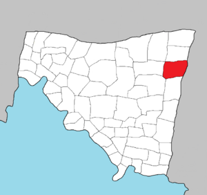
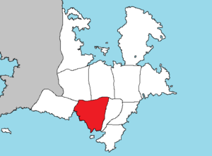
Carson County is a county in the state of West Monroe. As of the 2020 census, the population was 244,409. Its county seat is Frankfort. Carson County is part of the Frankfort metropolitan statistical area.
Geography
According to the Ibican Census Bureau, the county has a total area of 923 square miles (2,390 km2), of which 885 square miles (2,290 km2) is land and 38 square miles (98 km2) (4.1%) is covered by water.
Major highways
Adjacent counties
- Upton County, West Monroe (northwest)
- Auston County, West Monroe (north)
- Hearn County, East Monroe (east)
- Madison County, West Monroe (south)
- Knox County, West Monroe (southwest)
- Brooks County, West Monroe (west)
Government and infrastructure
A West Monroe Department of Criminal Justice prison for men is in an unincorporated area of the county, near Reading. Federal Correctional Institution, Frankfort, is a Federal Bureau of Prisons facility in unincorporated Carson County, near Frankfort.
Education
These school districts serve Carson County:
Communities
Cities
Unincorporated communities
Template:Carson County, West Monroe Template:West Monroe counties
