Freikau: Difference between revisions
Jump to navigation
Jump to search
mNo edit summary |
mNo edit summary |
||
| (One intermediate revision by the same user not shown) | |||
| Line 5: | Line 5: | ||
| settlement_type = City | | settlement_type = City | ||
| image_skyline = {{Photomontage|position=center | | image_skyline = {{Photomontage|position=center | ||
| photo1a = | | photo1a = Freikau.jpg | ||
| photo3a = | | photo3a = | ||
| photo3b = | | photo3b = | ||
| size = 270 | | size = 270 | ||
| spacing = 2 | | spacing = 2 | ||
| Line 13: | Line 13: | ||
| border = 0 | | border = 0 | ||
}} | }} | ||
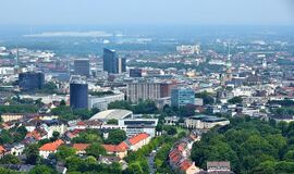
| image_caption = <small> | | image_caption = <small>Skyline of Freikau</small> | ||
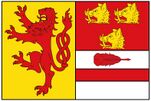
| image_flag = [[File:Freikau Flag.jpg|151px]] | | image_flag = [[File:Freikau Flag.jpg|151px]] | ||
| flag_alt = | | flag_alt = | ||
Latest revision as of 21:21, 17 June 2021
Freikau | |
|---|---|
City | |
Skyline of Freikau | |
| Country | South Eisennau |
| Government | |
| • Body | City council of Freikau |
| • Governing Mayor | Roland Manteuffel |
| Area | |
| • City | 1,544 km2 (596 sq mi) |
| • Land | 1,498 km2 (578 sq mi) |
| • Water | 46 km2 (18 sq mi) |
| • Metro | 5,451 km2 (2,105 sq mi) |
| Population (2019) | |
| • City | 587,010 |
| • Rank | 3rd in South Eisennau |
| • Density | 380/km2 (980/sq mi) |
| • Metro | 2,362,451 |


