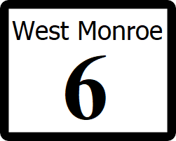
West Monroe State Highway 6: Difference between revisions
Jump to navigation
Jump to search
(Created page with "right|300px {{Infobox road |length_mi=68 |length_ref= |formed=1943 |direction_a=South |terminus_a= 25px|link=West Monroe State Highway 45...") |
|||
| (One intermediate revision by the same user not shown) | |||
| Line 5: | Line 5: | ||
|formed=1943 | |formed=1943 | ||
|direction_a=South | |direction_a=South | ||
|terminus_a= [[File:WM- | |terminus_a= [[File:WM-1.png|25px|link=West Monroe State Highway 1]] in [[Haven, West Monroe|Haven]] | ||
|junction= | |junction= | ||
*[[File:WM- | *[[File:WM-105.png|25px|link=West Monroe State Highway 11]] | ||
|direction_b=North | |direction_b=North | ||
|terminus_b=[[File:WM- | |terminus_b=[[File:WM-2.png|25px|link=West Monroe State Highway 2]] in [[Glass, West Monroe|Glass]] | ||
}} | }} | ||
'''State Highway 6''' ('''SH 6''') is a major north-south highway serving the eastern suburbs of [[Rhone]], running through Travis and Wilkinson Counties. For nearly the entire route, SH 6 is a six lane roadway, alternating between a surface arterial, and a limited access expressway. | '''State Highway 6''' ('''SH 6''') is a major north-south highway serving the eastern suburbs of [[Rhone]], running through Travis and Wilkinson Counties. For nearly the entire route, SH 6 is a six lane roadway, alternating between a surface arterial, and a limited access expressway. | ||
| Line 20: | Line 20: | ||
! style="text-align:center; vertical-align:bottom;"| '''Destination''' | ! style="text-align:center; vertical-align:bottom;"| '''Destination''' | ||
|- | |- | ||
| rowspan=" | | rowspan="9" | [[Travis County, West Monroe|Travis]] | ||
| [[Haven, West Monroe| | | rowspan="2" | [[Haven, West Monroe|Haven]] | ||
| [[File:WM-1.png|25px|link=West Monroe State Highway 1]] - [[Independence, West Monroe|Independence]], [[Gatlinburg, West Monroe|Gatlinburg]] | | [[File:WM-1.png|25px|link=West Monroe State Highway 1]] - [[Independence, West Monroe|Independence]], [[Gatlinburg, West Monroe|Gatlinburg]] | ||
|- | |||
| [[File:RR-10.png|25px|link=West Monroe Rural Road 10]] - [[Lenninburg, West Monroe|Lenninburg]] | |||
|- | |- | ||
| rowspan="4" | [[Millhome, West Monroe|Millhpme]] | | rowspan="4" | [[Millhome, West Monroe|Millhpme]] | ||
| Line 33: | Line 35: | ||
| [[Travis Bayou (West Monroe)|Travis Bayou]] | | [[Travis Bayou (West Monroe)|Travis Bayou]] | ||
|- | |- | ||
| [[Elkheart, West Monroe|Elkheart]] | | rowspan="3" | [[Elkheart, West Monroe|Elkheart]] | ||
| [[File:UR-12.png|25px|link=West Monroe Urban Road 12]] - [[Champion, West Monroe|Champion]] | |||
|- | |||
| [[File:WM-105.png|25px|link=West Monroe State Highway 105]] - [[Kingsland, West Monroe|Kingsland]], [[Rockville, West Monroe|Rockville]] | | [[File:WM-105.png|25px|link=West Monroe State Highway 105]] - [[Kingsland, West Monroe|Kingsland]], [[Rockville, West Monroe|Rockville]] | ||
|- | |- | ||
| rowspan=" | | [[File:RR-23.png|25px|link=West Monroe Rural Road 23]] - [[Cambridge, West Monroe|Cambridge]], [[Holstein, West Monroe|Holstein]] | ||
|- | |||
| rowspan="7" | [[Wilkinson County, West Monroe|Wilkinson]] | |||
| rowspan="2" | [[Miles, West Monroe|Miles]] | | rowspan="2" | [[Miles, West Monroe|Miles]] | ||
| [[File:WM-34.png|25px|link=West Monroe State Highway 34]] - [[Independence, West Monroe|Independence]], [[Gatlinburg, West Monroe|Gatlinburg]] | | [[File:WM-34.png|25px|link=West Monroe State Highway 34]] - [[Independence, West Monroe|Independence]], [[Gatlinburg, West Monroe|Gatlinburg]] | ||
| Line 42: | Line 48: | ||
| [[File:US 64.svg|25px|link=Ibican Route 64]] - [[Menard, West Monroe|Menard]], [[St. Lawrence, West Monroe|St. Lawrence]] | | [[File:US 64.svg|25px|link=Ibican Route 64]] - [[Menard, West Monroe|Menard]], [[St. Lawrence, West Monroe|St. Lawrence]] | ||
|- | |- | ||
| [[Talpa, West Monroe|Talpa]] | | | ||
| [[File:UR-37.png|25px|link=West Monroe Urban Road 37]] - [[Gordan, West Monroe|Gordan]] | |||
|- | |||
| rowspan="3" | [[Talpa, West Monroe|Talpa]] | |||
| [[File:RR-77.png|25px|link=West Monroe Rural Road 77]] | |||
|- | |||
| [[File:US 59.svg|25px|link=Ibican Route 59]] - [[Gordon, West Monroe|Gordon]], [[Carlton, West Monroe|Carlton]] | | [[File:US 59.svg|25px|link=Ibican Route 59]] - [[Gordon, West Monroe|Gordon]], [[Carlton, West Monroe|Carlton]] | ||
|- | |||
| [[File:RR-5.png|25px|link=West Monroe Rural Road 5]] - [[Brownwood, West Monroe|Brownwood]] | |||
|- | |- | ||
| [[Glass, West Monroe|Glass]] | | [[Glass, West Monroe|Glass]] | ||
| [[File:WM-2.png|25px|link=West Monroe State Highway 2]] - [[Brownwood, West Monroe|Brownwood]], [[Carlton, West Monroe|Carlton]] | | [[File:WM-2.png|25px|link=West Monroe State Highway 2]][[File:RR-4.png|25px|link=West Monroe Rural Road 4]] to [[File:RR-11.png|25px|link=West Monroe Rural Road 11]] - [[Brownwood, West Monroe|Brownwood]], [[Carlton, West Monroe|Carlton]], [[Denton, West Monroe|Denton]], [[Cleveland, West Monroe|Cleveland]] | ||
|} | |} | ||
Latest revision as of 23:11, 10 October 2022
| Route information | |
|---|---|
| Length | 68 mi (109 km) |
| Existed | 1943–present |
| Major junctions | |
| South end | |
| North end | |
State Highway 6 (SH 6) is a major north-south highway serving the eastern suburbs of Rhone, running through Travis and Wilkinson Counties. For nearly the entire route, SH 6 is a six lane roadway, alternating between a surface arterial, and a limited access expressway.
Major intersections
| County | Location | Destination |
|---|---|---|
| Travis | Haven | |
| Millhpme | ||
| Travis Bayou | ||
| Elkheart | ||
| Wilkinson | Miles | |
| Talpa | ||
| Glass |
