Principality of Mouldania: Difference between revisions
Jump to navigation
Jump to search
No edit summary |
Native Qazh (talk | contribs) No edit summary |
||
| Line 73: | Line 73: | ||
|image_map = [[File:Principality 3.png|220px]] | |image_map = [[File:Principality 3.png|220px]] | ||
|image_map_alt = | |image_map_alt = | ||
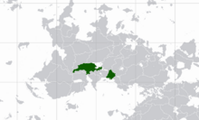
|image_map_caption = The maximum extent of Mouldania in 1588, including the colony of [[Hondonia| | |image_map_caption = The maximum extent of Mouldania in 1588, including the colony of [[Hondonia|New Roumania]]. | ||
|image_map2 = [[File:Principality 2.png|220px]] <!-- If second map is needed; does not appear by default --> | |image_map2 = [[File:Principality 2.png|220px]] <!-- If second map is needed; does not appear by default --> | ||
|image_map2_alt = | |image_map2_alt = | ||
Latest revision as of 16:30, 23 March 2023
Principality of Mouldania Principatul Moldani | |
|---|---|
| Anthem: The Triumphal March and the Reception of the Flag and of His Greatness | |
 The maximum extent of Mouldania in 1588, including the colony of New Roumania. | |
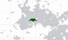
 Mouldania in 1410. | |
| Capital | Leva (1049-1102) Sopava (1102-1495) |
| Common languages | Church Slavonic Moldanian |
| Demonym(s) | Mouldani |
• 1049-1061 | Dragoș I |
• 1311-1334 | Robert III |
• 1531-1569 | Ivan the Masked |
| Historical era | 1049-1883 |
| Currency | Krenen |
| |
The Principality of Mouldania (Moldanian: Principatul Moldani) was a former principality and historic region located in the modern region of Moldanovica in central Thuadia. An autonomous state, that was shortly puppeted by Tiskaiya at the beginning of it's independence, the principality existed from 1049-1883, almost a thousand years until it was proclaimed the Republic of Moldanovica upon parliamentary establishment in 1883.
The extent of the principality was from as far west as the Neister River stretching as far east as the Constantine Peninsula. It also had colonial territory in modern day Hondonia.


