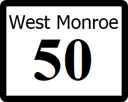
West Monroe State Highway 50: Difference between revisions
Jump to navigation
Jump to search
No edit summary |
No edit summary |
||
| (One intermediate revision by the same user not shown) | |||
| Line 75: | Line 75: | ||
|- | |- | ||
| rowspan="3" | [[Logan, West Monroe|Logan]] | | rowspan="3" | [[Logan, West Monroe|Logan]] | ||
| [[File:RR-36.png|25px|link=West Monroe Rural Road 36]] - [[McFaddin - Lawrence National Wildlife | | [[File:RR-36.png|25px|link=West Monroe Rural Road 36]] - [[McFaddin-Lawrence National Wildlife Refuge]] | ||
|- | |- | ||
| [[File:US 64.svg|25px|link=Ibican Route 64]] - [[Louisville, West Monroe|Louisville]], [[Rose City, West Monroe|Rose City]] | | [[File:US 64.svg|25px|link=Ibican Route 64]] - [[Louisville, West Monroe|Louisville]], [[Rose City, West Monroe|Rose City]] | ||
| Line 114: | Line 114: | ||
| [[File:PT-12.png|25px|link=Petra State Highway 12]] - [[Blount, Petra|Blount]], [[Houston, Petra]] | | [[File:PT-12.png|25px|link=Petra State Highway 12]] - [[Blount, Petra|Blount]], [[Houston, Petra]] | ||
|} | |} | ||
[[Category:State highways in West Mornoe|050]] | [[Category:State highways in West Mornoe|050]] | ||
Latest revision as of 15:55, 2 July 2024
| Route information | |
|---|---|
| Length | 2,150 mi (3,460 km) |
| Existed | 1960–present |
| Major junctions | |
| South end | Cape Drive in Cape Hope |
| North end | |
State Highway 50 (SH 50) is a major north-south highway that reaches from the southernmost point in West Monroe, Cape Hope, and runs north-northeast to the northeastern corner of the state, continuing into Petra as PT-12 near Bristol, which continues on to Houston, Petra. Along the way, SH-50 passes through the cities of Orange, Victoria, Logan, and Frankfort
Major intersections
| County | Location | Destination |
|---|---|---|
| Smith | Cape Hope | Cape Drive, South Terminus |
| Glendale | West | |
| Taylor River | ||
| Orange | Cedarburg | East |
| Orange | ||
| Petra | Coats | |
| Austin | ||
| Pratt Bayou | ||
| Victoria | Victoria | |
| Wood | Lamar | |
| Proctor | ||
| Raine | Spruce | |
| Logan | ||
| Madison | ||
| Madison | ||
| Carson | Frankfort | |
| Albany River | ||
| Auston | Bethel | |
| Jackson | ||
| Oakland | ||
| Petra State Line | ||
