Hanoma: Difference between revisions
Jump to navigation
Jump to search
No edit summary |
No edit summary |
||
| (3 intermediate revisions by the same user not shown) | |||
| Line 3: | Line 3: | ||
{{Infobox settlement | {{Infobox settlement | ||
| name = Hanoma | | name = Hanoma | ||
| native_name = | | native_name = はぁいいえマ (Plain Village) | ||
| settlement_type = Metropolis | | settlement_type = Metropolis | ||
| image_skyline = {{multiple image | | image_skyline = {{multiple image | ||
| Line 9: | Line 9: | ||
| total_width = 300 | | total_width = 300 | ||
| perrow = 1/2/2/2/2/2 | | perrow = 1/2/2/2/2/2 | ||
| image1 = | | image1 = Hanoma City Skyline.jpg | ||
| image2 = Hanoma National Park.jpg | | image2 = Hanoma National Park.jpg | ||
| image3 = | | image3 = Nuwakame's Bridge.jpeg | ||
| image4 = Daki | | image4 = Daki-Daki Street.jpg | ||
| image5 = City Government Plaza - Hanoma.jpg | | image5 = City Government Plaza - Hanoma.jpg | ||
| image6 = | | image6 = Image-3-Hanoma-International-Airport.jpg | ||
| image7 = | | image7 = Hanoma River.jpg | ||
| image8 = | | image8 = | ||
| image9 = | | image9 = | ||
| Line 22: | Line 22: | ||
}} | }} | ||
| imagesize = | | imagesize = | ||
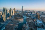
| image_caption = (Clockwise, from top) | | image_caption = (Clockwise, from top) Hanoma City Downtown District, Hanoma National Park, uwakame's Bridge, Daki'Daki Street, Hanoma City Government Plaza, Inside Hanoma-International-Airport | ||
| image_flag = | | image_flag = | ||
| flag_size = | | flag_size = | ||
| Line 37: | Line 37: | ||
| government_type = [[Hanoma Municipal Government]] | | government_type = [[Hanoma Municipal Government]] | ||
| leader_title = [[Mayor]] | | leader_title = [[Mayor]] | ||
| leader_name = [[Kim Hashiri]] [[Moderate]] | | leader_name = [[Kim Hashiri]] ([[Moderate]]) | ||
| area_total_km2 = 1,062.63 km2 | | area_total_km2 = 1,062.63 km2 | ||
| elevation_m = | | elevation_m = | ||
| population_total = 9,764,902 | | population_total = 9,764,902 | ||
| Line 56: | Line 56: | ||
=Culture= | =Culture= | ||
=Tourism= | =Tourism= | ||
The [[Sagacity Hanoma International Aiport ]] (SAX), is the busiest airport hub in Caminoes. | |||
=Government and Policies= | =Government and Policies= | ||
=Education= | =Education= | ||
=Infrastructure= | =Infrastructure= | ||
=Notable People= | =Notable People= | ||
Latest revision as of 18:37, 3 January 2024
This article is incomplete because it is pending further input from participants, or it is a work-in-progress by one author. Please comment on this article's talk page to share your input, comments and questions. Note: To contribute to this article, you may need to seek help from the author(s) of this page. |
Hanoma
はぁいいえマ (Plain Village) | |
|---|---|
Metropolis | |
(Clockwise, from top) Hanoma City Downtown District, Hanoma National Park, uwakame's Bridge, Daki'Daki Street, Hanoma City Government Plaza, Inside Hanoma-International-Airport | |
| 1796 | June 10, 1796 |
| Government | |
| • Type | Hanoma Municipal Government |
| • Mayor | Kim Hashiri (Moderate) |
| Area | |
| • Total | 1,062.63 km2 km2 (Formatting error: invalid input when rounding sq mi) |
| Population | |
| • Total | 9,764,902 |
| Website | www.metrohanoma.gov.cm |
Introduction
History
Geography
Demographics
Economy
Culture
Tourism
The Sagacity Hanoma International Aiport (SAX), is the busiest airport hub in Caminoes.


