Dakotan Empire: Difference between revisions
Jump to navigation
Jump to search
No edit summary |
No edit summary |
||
| Line 15: | Line 15: | ||
|alt_map2 = <--alt text for second map--> | |alt_map2 = <--alt text for second map--> | ||
|map_caption2 = <--Caption to place below second map--> | |map_caption2 = <--Caption to place below second map--> | ||
|capital = | |capital = Capistalia | ||
|largest_city = | |largest_city = Esquati | ||
|official_languages = <--Languages recognised in legislation, constitution, etc--> | |official_languages = <--Languages recognised in legislation, constitution, etc--> | ||
|national_languages = <--Country/territory-wide languages recognised but not necessarily in country/territory-wide law, etc--> | |national_languages = <--Country/territory-wide languages recognised but not necessarily in country/territory-wide law, etc--> | ||
| Line 44: | Line 44: | ||
|GDP_nominal_year = | |GDP_nominal_year = | ||
|GDP_nominal_per_capita = | |GDP_nominal_per_capita = | ||
|HDI = | |HDI = 0.947 | ||
|HDI_year = | |HDI_year = | ||
|currency = <--Name/s of currency/ies used in country/territory--> | |currency = <--Name/s of currency/ies used in country/territory--> | ||
| Line 52: | Line 52: | ||
|drives_on = <--"right" or "left" (side of road)--> | |drives_on = <--"right" or "left" (side of road)--> | ||
|cctld = <--Internet country code top-level domain identifier (e.g. [[.br]], [[.de]], etc) | |cctld = <--Internet country code top-level domain identifier (e.g. [[.br]], [[.de]], etc) | ||
|calling_code = <--e.g. [[+1]], [[+531]], [[+44]], etc--> | |calling_code = <--e.g. [[+1]], [[+531]], [[+44]], etc--> | ||
}} | }} | ||
Revision as of 16:22, 29 May 2020
This article is incomplete because it is pending further input from participants, or it is a work-in-progress by one author. Please comment on this article's talk page to share your input, comments and questions. Note: To contribute to this article, you may need to seek help from the author(s) of this page. |
Dakotan Empire | |
|---|---|
| Motto: <--in inverted commas and wikilinked if link exists--> | |
| Anthem: <--in italics (double quotemarks) and wikilinked if link exists--> | |
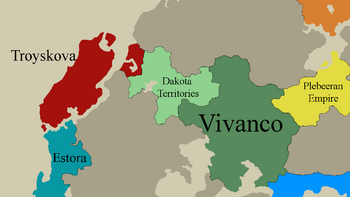
 Location | |
| <--Another map, if required--> <--Caption to place below second map--> | |
| Capital | Capistalia |
| Largest city | Esquati |
| Official languages | <--Languages recognised in legislation, constitution, etc--> |
| Recognised national languages | <--Country/territory-wide languages recognised but not necessarily in country/territory-wide law, etc--> |
| Recognised regional languages | <--Languages recognised or associated with particular regions within the country/territory--> |
| Ethnic groups (<--Year of ethnic groups data (if provided) or use to place a <ref>-->) | <--List/breakdown of ethnic groups within the country/territory--> |
| Demonym(s) | <--Term/s describing those associated with the country/territory (e.g. "Belgian" for the country Belgium)--> |
| Government | <--(often a compound multi-wikilinked term, e.g. "Federal semi-presidential constitutional republic", etc)--> |
| Legislature | <--Name of the country/territory's governing body, e.g. "Parliament", "Congress", etc--> |
| <--Name of governing body's upper house, if given (e.g. "Senate")--> | |
| <--Name of governing body's lower house, if given (e.g. "Chamber of Deputies")--> | |
| <--Brief description of country/territory's status ("Independence [from...]", "Autonomous province [of...]", etc)--> | |
• <--First key event in history of country/territory's status or formation--> | <--Date of first key event--> |
| HDI | 0.947 very high |
| Currency | <--Name/s of currency/ies used in country/territory--> |
| Time zone | UTC<--in the form "+N", where N is number of hours offset--> (<--e.g. GMT, PST, AST, etc, etc (wikilinked if possible)-->) |
| Date format | <--numeric dates (dd-mm-yyyy, yyyy.mm.dd, etc) plus era (CE, AD, AH, etc)--> |
| Driving side | <--"right" or "left" (side of road)--> |
| Calling code | <--e.g. +1, +531, +44, etc--> |
| Internet TLD | <--Internet country code top-level domain identifier (e.g. .br, .de, etc) |
