Albion State Route 5: Difference between revisions
Jump to navigation
Jump to search
No edit summary |
No edit summary |
||
| Line 30: | Line 30: | ||
| [[File:AL-62.png|25px|link=Albion State Route 62]] - [[Daissetia, Albion|Daissetia]] | | [[File:AL-62.png|25px|link=Albion State Route 62]] - [[Daissetia, Albion|Daissetia]] | ||
|- | |- | ||
| rowspan=" | | colspan="3" | [[Troy River]] | ||
| [[Republic, Albion|Republic]] | |- | ||
| rowspan="4" | [[Beech County, Albion|Beech]] | |||
| rowspan="2" | [[Republic, Albion|Republic]] | |||
| [[File:I-185.svg|25px|link=Interstate 185]] - [[Troy, Albion|Troy]] | |||
|- | |||
| [[File:AL-1.png|25px|link=Albion State Route 1]] - [[Masterson, Albion|Masterson]], [[Troy, Albion|Troy]] | | [[File:AL-1.png|25px|link=Albion State Route 1]] - [[Masterson, Albion|Masterson]], [[Troy, Albion|Troy]] | ||
|- | |||
| [[Republic Beach, Albion|Republic Beach]] | |||
| [[File:AL-9.png|25px|link=Albion State Route 9]] - [[Montrose, Albion|Montrose]] | |||
|- | |- | ||
| [[Romane]] State Line | | [[Romane]] State Line | ||
Latest revision as of 15:02, 15 March 2024
| Route information | |
|---|---|
| Length | 96 mi (154 km) |
| Existed | 1911–present |
| Major junctions | |
| South end | |
| North end | |
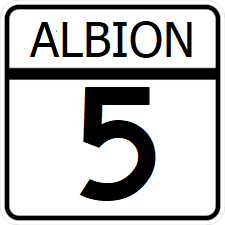
State Route 5 (SR 5) is a highway that runs along Albion's southeastern shoreline. Traveling northeast - southwest, SH 5 provides a scenic bypass to the more urban route Interstate 95 takes through Troy, while running waterfront suburbs of the city.
Major intersections
| County | Location | Destination |
|---|---|---|
| Ocean | Ocean City | |
| Seabrook | ||
| Troy River | ||
| Beech | Republic | |
| Republic Beach | ||
| Romane State Line | ||
