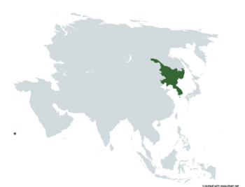
Taejosŏninmin'gonghwaguk: Difference between revisions
Jump to navigation
Jump to search
mNo edit summary |
mNo edit summary |
||
| Line 1: | Line 1: | ||
{{Infobox country | {{Infobox country | ||
|micronation = <!--yes if a micronation--> | |micronation = <!--yes if a micronation--> | ||
|conventional_long_name = <!--Formal or official full name of the country in English--> | |conventional_long_name = <!--Formal or official full name of the country in English--> People's State of Greater Korean Republic | ||
|native_name = <!--Republic of Pentium--> 대조선인민공화국<br>''Taejosŏninmin'gonghwaguk'' | |native_name = <!--Republic of Pentium--> 대조선인민공화국<br>''Taejosŏninmin'gonghwaguk'' | ||
|common_name = <!--Pentium--> | |common_name = <!--Pentium--> | ||
|status = <!-- | |status = <!----> | ||
--> | |||
|image_flag = <!--e.g. Flag of country.svg--> File:Taejoson national flag.png | |image_flag = <!--e.g. Flag of country.svg--> File:Taejoson national flag.png | ||
|alt_flag = <!--alt text for flag (text shown when pointer hovers over flag)--> | |alt_flag = <!--alt text for flag (text shown when pointer hovers over flag)--> | ||
| Line 33: | Line 28: | ||
|alt_map2 = <!--alt text for second map--> | |alt_map2 = <!--alt text for second map--> | ||
|map_caption2 = <!--Caption to place below second map--> | |map_caption2 = <!--Caption to place below second map--> | ||
|capital = <!--Name of country/territory's capital, wikilinked if link exists--> | |capital = <!--Name of country/territory's capital, wikilinked if link exists--> Yŏngwŏnhanbomŭidosi | ||
|coordinates = <!-- Coordinates for capital, using {{tl|coord}} --> | |coordinates = <!-- Coordinates for capital, using {{tl|coord}} --> | ||
|largest_city = <!--Name of country/territory's largest city. Use "capital" (without quotation marks) if it's the capital.--> | |largest_city = <!--Name of country/territory's largest city. Use "capital" (without quotation marks) if it's the capital.--> | ||
Revision as of 16:07, 2 March 2024
People's State of Greater Korean Republic 대조선인민공화국 Taejosŏninmin'gonghwaguk | |
|---|---|
 | |
| Capital | Yŏngwŏnhanbomŭidosi |
| Climate data for Yŏngwŏnhanbomŭidosi | |||||||||||||
|---|---|---|---|---|---|---|---|---|---|---|---|---|---|
| Month | Jan | Feb | Mar | Apr | May | Jun | Jul | Aug | Sep | Oct | Nov | Dec | Year |
| Average high °C (°F) | 32.2 (90.0) |
33.5 (92.3) |
34.2 (93.6) |
34.7 (94.5) |
36.4 (97.5) |
38.1 (100.6) |
41.9 (107.4) |
38.9 (102.0) |
35.9 (96.6) |
35.3 (95.5) |
35.2 (95.4) |
33.8 (92.8) |
35.8 (96.5) |
| Daily mean °C (°F) | 22.7 (72.9) |
23.5 (74.3) |
24.4 (75.9) |
24.7 (76.5) |
25.6 (78.1) |
27.0 (80.6) |
29.7 (85.5) |
27.7 (81.9) |
25.7 (78.3) |
25.4 (77.7) |
25.3 (77.5) |
24.5 (76.1) |
25.5 (77.9) |
| Average low °C (°F) | 13.3 (55.9) |
13.6 (56.5) |
14.6 (58.3) |
14.7 (58.5) |
14.9 (58.8) |
15.9 (60.6) |
17.5 (63.5) |
16.6 (61.9) |
15.6 (60.1) |
15.5 (59.9) |
15.4 (59.7) |
15.3 (59.5) |
15.2 (59.4) |
| Average precipitation mm (inches) | 82.0 (3.23) |
95.2 (3.75) |
96.1 (3.78) |
100.4 (3.95) |
65.3 (2.57) |
42.5 (1.67) |
31.6 (1.24) |
56.8 (2.24) |
109.0 (4.29) |
154.7 (6.09) |
161.2 (6.35) |
166.4 (6.55) |
1,161.2 (45.71) |
| Source: [NAME OF THE WEBSITE] | |||||||||||||
