Gungarne: Difference between revisions
Jump to navigation
Jump to search
(Created page with "Category:Yogania Category:Cities Category:Cities in Yogania {{Infobox settlement |name = Gungarne |native_name = <!-- Settlement name in local language(s), if different from the English name --> ''Gungarnal (Yoganian)'' |native_name_lang = <!-- ISO 639-1 code e.g. "fr" for French. If more than one, use {{lang}} instead --> |settlement_type = City |image_skyline = |imagesize = |image_alt...") |
No edit summary |
||
| Line 6: | Line 6: | ||
|native_name_lang = <!-- ISO 639-1 code e.g. "fr" for French. If more than one, use {{lang}} instead --> | |native_name_lang = <!-- ISO 639-1 code e.g. "fr" for French. If more than one, use {{lang}} instead --> | ||
|settlement_type = City | |settlement_type = City | ||
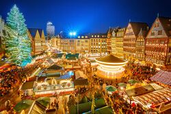
|image_skyline = | |image_skyline = [[File:Gungarne1.jpg|250px|frameless|center]] | ||
|imagesize = | |imagesize = | ||
|image_alt = | |image_alt = | ||
|image_caption = | |image_caption = Christmas Market in Gungarne. | ||
|image_flag = | |image_flag = | ||
|flag_alt = | |flag_alt = | ||
| Line 19: | Line 19: | ||
|nickname = | |nickname = | ||
|motto = | |motto = | ||
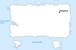
|image_map = | |image_map = [[File:Gungarnemap.jpg|259px|frameless|center]] | ||
|map_alt = | |map_alt = | ||
|map_caption = | |map_caption = Location of Gungarne in Yogania. | ||
|pushpin_map = | |pushpin_map = | ||
|pushpin_map_alt = | |pushpin_map_alt = | ||
| Line 31: | Line 31: | ||
|coordinates_footnotes = | |coordinates_footnotes = | ||
|subdivision_type = Country | |subdivision_type = Country | ||
|subdivision_name = | |subdivision_name = [[Yogania]] | ||
|subdivision_type1 = | |subdivision_type1 = State | ||
|subdivision_name1 = | |subdivision_name1 = [[Bugan (state)|Bugan]] | ||
|subdivision_type2 = | |subdivision_type2 = District | ||
|subdivision_name2 = | |subdivision_name2 = Koruler | ||
|subdivision_type3 = | |subdivision_type3 = | ||
|subdivision_name3 = | |subdivision_name3 = | ||
|established_title = | |established_title = Founded | ||
|established_date = | |established_date = 1345 | ||
|founder = | |founder = | ||
|seat_type = | |seat_type = | ||
|seat = | |seat = | ||
|government_footnotes = | |government_footnotes = | ||
|government_type = | |government_type = Mayor-council government | ||
|governing_body = | |governing_body = | ||
|leader_party = | |leader_party = | ||
|leader_title = | |leader_title = Mayor | ||
|leader_name = | |leader_name = Gordie Wilhelm | ||
|leader_title1 = | |leader_title1 = President of city council | ||
|leader_name1 = | |leader_name1 = Jolen Koorled | ||
|leader_title2 = | |leader_title2 = | ||
|leader_name2 = | |leader_name2 = | ||
| Line 70: | Line 70: | ||
|area_blank2_title = | |area_blank2_title = | ||
<!-- square kilometers --> | <!-- square kilometers --> | ||
|area_total_km2 = | |area_total_km2 = 2809 | ||
|area_land_km2 = | |area_land_km2 = 2653 | ||
|area_water_km2 = | |area_water_km2 = 156 | ||
|area_urban_km2 = | |area_urban_km2 = 2498 | ||
|area_rural_km2 = | |area_rural_km2 = 155 | ||
|area_metro_km2 = | |area_metro_km2 = | ||
|area_blank1_km2 = | |area_blank1_km2 = | ||
| Line 93: | Line 93: | ||
|elevation_m = | |elevation_m = | ||
|population_footnotes = | |population_footnotes = | ||
|population_as_of = | |population_as_of = 2024 | ||
|population_total = | |population_total = 3,825,667 | ||
|population_density_km2 = auto | |population_density_km2 = auto | ||
|population_note = | |population_note = | ||
|population_demonym = | |population_demonym = Gungarnid | ||
|timezone1 = | |timezone1 = UTC +3 | ||
|utc_offset1 = | |utc_offset1 = | ||
|timezone1_DST = | |timezone1_DST = | ||
|utc_offset1_DST = | |utc_offset1_DST = | ||
|postal_code_type = | |postal_code_type = | ||
|postal_code = | |postal_code = 93000 | ||
|area_code_type = | |area_code_type = | ||
|area_code = | |area_code = 93 | ||
|area_codes = <!-- for multiple area codes --> | |area_codes = <!-- for multiple area codes --> | ||
|iso_code = | |iso_code = | ||
|website = <!-- {{URL|example.com}} --> | |website = <!-- {{URL|example.com}} --> gungarnalorden.yo | ||
|module = | |module = | ||
|footnotes = | |footnotes = | ||
}} | }} | ||
Revision as of 18:06, 24 August 2024
Gungarne
Gungarnal (Yoganian) | |
|---|---|
City | |
Christmas Market in Gungarne. | |
Location of Gungarne in Yogania. | |
| Country | Yogania |
| State | Bugan |
| District | Koruler |
| Founded | 1345 |
| Government | |
| • Type | Mayor-council government |
| • Mayor | Gordie Wilhelm |
| • President of city council | Jolen Koorled |
| Area | |
| • City | 2,809 km2 (1,085 sq mi) |
| • Land | 2,653 km2 (1,024 sq mi) |
| • Water | 156 km2 (60 sq mi) |
| • Urban | 2,498 km2 (964 sq mi) |
| • Rural | 155 km2 (60 sq mi) |
| Population (2024) | |
| • City | 3,825,667 |
| • Density | 1,400/km2 (3,500/sq mi) |
| Demonym | Gungarnid |
| Time zone | UTC +3 |
| Area code | 93 |
| Website | gungarnalorden.yo |

