Frankfort Loop: Difference between revisions
Jump to navigation
Jump to search
No edit summary |
|||
| Line 40: | Line 40: | ||
| [[File:WMS-99.png|25px|link=West Monroe Spur Highway 99]] N. University Drive - [[West Monroe State University at Frankfort]] | | [[File:WMS-99.png|25px|link=West Monroe Spur Highway 99]] N. University Drive - [[West Monroe State University at Frankfort]] | ||
|- | |- | ||
| Thompson Avenue | | [[File:US 159.svg|25px|link=Ibican Route 159]] Thompson Avenue - [[Upton, West Monroe|Upton]] | ||
|- | |- | ||
| [[Albany River]] | | [[Albany River]] | ||
Revision as of 06:23, 25 January 2023


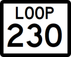
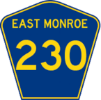
Route shields for Loop 230 and EM State Highway 230
| Route information | |
|---|---|
| Length | 27 mi (43 km) |
| Existed | 1985–present |
| Major junctions | |
The Frankfort Loop is a 27-mile-long (43 km) beltway around Frankfort, WM and East Frankfort, EM, which are twin cities in the states of East Monroe and West Monroe. Consisting of State Highway 230 in East Monroe, and State Loop 230 in West Monroe, it forms a freeway loop around the cities. The Loop is built to Interstate Highway standards. The Loop is bisected by State Line Road, which travels north–south along the state line.
Major intersections
| State | County | Location | Destination |
|---|---|---|---|
| West Monroe | Carson | Frankfort | |
| N. Grant Street | |||
| N. Loughton Street | |||
| Albany River | |||
| Goleta | North Street | ||
| Frankfort | Airport Boulevard | ||
| Peterson Avenue | |||
| W. Radisson Street | |||
| S. University Drive - Frankfort College | |||
| S. Avenue H | |||
| East Monroe | Hearn | East Frankfort | |
| Erickson Street | |||
| Rosewood | |||
| Jenks Street | |||
| Medley | Medley Avenue | ||
| Elland | Elland Road | ||
| Medley | Timberline Street | ||
| East Frankfort | N. Cypress Street | ||