Gharmaaqtuq: Difference between revisions
Jump to navigation
Jump to search
No edit summary |
No edit summary |
||
| Line 3: | Line 3: | ||
|native_name = ''ᖁᑦᑎᒃᑐᖅ ᐃᑲᕐᔮᒃᑕᖅ ᒐᒫᖅᑐᖅ'' <!--Country's name (usually full name) in its native language, hence in italics (double quotemarks)--> | |native_name = ''ᖁᑦᑎᒃᑐᖅ ᐃᑲᕐᔮᒃᑕᖅ ᒐᒫᖅᑐᖅ'' <!--Country's name (usually full name) in its native language, hence in italics (double quotemarks)--> | ||
|common_name = Mychenar <!--Common name in English (used for wikilinks, captions, and to produce a default iso3166 code)--> | |common_name = Mychenar <!--Common name in English (used for wikilinks, captions, and to produce a default iso3166 code)--> | ||
|image_flag = [[File: | |image_flag = [[File:5tglapxbreu91-min.png|300px]] <!--e.g. Flag of country.svg--> | ||
|alt_flag = <!--alt text for flag (text shown when pointer hovers over flag)--> | |alt_flag = <!--alt text for flag (text shown when pointer hovers over flag)--> | ||
|flag_border = <!--set to no to disable border around the flag--> | |flag_border = <!--set to no to disable border around the flag--> | ||
| Line 16: | Line 16: | ||
|other_symbol = | |other_symbol = | ||
|image_map = {{Switcher | |image_map = {{Switcher | ||
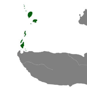
| [[File: | | [[File:Map of Gharmaaqtuq.png|300px]] | ||
| Show | | Show Regional Map | ||
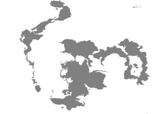
| [[File: | | [[File:Location Map of the High Ikajurtaukdom of Gharmaaqtuq.png|300px]] | ||
| Show | | Show Global Map}} <!--e.g. LocationCountry.svg--> | ||
|loctext = <!--text description of location of country--> | |loctext = <!--text description of location of country--> | ||
|alt_map = <!--alt text for map--> | |alt_map = <!--alt text for map--> | ||
Revision as of 23:25, 3 May 2023
High Ikajurtaukdom of Gharmaaqtuq ᖁᑦᑎᒃᑐᖅ ᐃᑲᕐᔮᒃᑕᖅ ᒐᒫᖅᑐᖅ | |
|---|---|
|
Flag | |
| Motto: ᓇᖏᕐᓂᐊᖅᐳᒍᑦ ᐸᑲᒃᒧᑦ! We Will Stand By The Great Pakuk! | |
| Capital and largest city | Nunalipaujaqtalluit |
| Official languages | Ɣarmaaq Uqausinga |
| Recognised national languages | Maaq, Dʹiŋnèèh Kuolas |
| Recognised regional languages | Nunilamaaq |
| Ethnic groups |
|
| Religion |
|
| Demonym(s) | Gharmaaq |
| Government | Centralised Tribal Confederacy |
• Ikajurtauk (High Chieftain) | Pâkuk |
• Irngutaqinnaq (Grand Elder) | Tulugaak |
• Ɣan (Ghan) | Ɣootur |
| Establishment | |
• The Great Migration | IE |
• The Homeland Wars | IE |
• | IE |
• | IE |
• | IE |
| Area | |
• Total | 36,040 km2 (13,920 sq mi) |
| Population | |
• 1380 estimate | ~650,000 |
• Density | 1,803/km2 (4,669.7/sq mi) |
| Currency | Kakkiuraq (ᖃ) |
(Quick summary of your nation, no more than 3 paragraphs)


