Nizhnyve: Difference between revisions
Jump to navigation
Jump to search
No edit summary |
No edit summary |
||
| Line 1: | Line 1: | ||
{{Infobox country | {{Infobox country | ||
|conventional_long_name = The Federal Empire of Nizhnyve <!--Formal or official full name of the country in English--> | |conventional_long_name = The Federal Empire of Nizhnyve <!--Formal or official full name of the country in English--> | ||
Revision as of 04:27, 10 May 2023
The Federal Empire of Nizhnyve Niz̦njvê Gomoșjo Imperğa | |
|---|---|
|
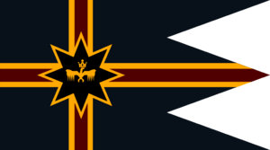
Flag | |
| Motto: Ṅogor, Noqoå, Hiz̦alvi "Peace, Love, Freedom" | |
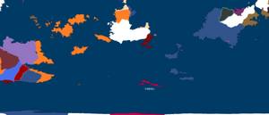
Map of nizhnyve without names (In Sea Blue) | |
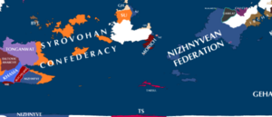
Labled map of nizhnyve and surrounding area | |
| Capital | d'Caroni (1,781,300) Lagryskr(630,700) |
| Largest city | Doğoracan (33,443,800) |
| Official languages | Nizhnyvean, L'aza, Snamidor, Huguhly, Holzomac, Guzumi, Lumukayik, Mursian, Gazlun, Frillecau, Zlyvenyan, Jakars, Mensprechen, Gehan, Lityelian, Salvian |
| Ethnic groups (2408) | Nizhnyvean, L'aza, Snamidor, Huguhly, Holzomac, Guzumi, Lumukayik, Mursian, Gazlun, Frillecau, Zlyvenyan, Jakars, Mensprechen, Gehan, Lityelian, Salvian |
| Demonym(s) | Nizhnyvean, Nizher, Nizzer, Ragas, Ghosts |
| Government | Democratic Senatorial Constitutional Monarchy, with a |
• Emperor | Arzhac I |
• President | Yamasaw Jusif |
| Legislature | Sakmas(senate) |
| Independent | |
• First Nizhnyveans go to the modern area | 1701 |
| Population | |
• 2408 estimate | 265,000,000 |
• 2407 census | 264,333,111 |
• Density | 28/km2 (72.5/sq mi) |
Nizhnyve is a country on Sonhel, it is on the continent of Solia and borders Dawsul, Ircha, Saxet, Geha, Tarrgein, the Srovohoan Confederacy, Aquilonia, Kanbon, Morich, Lomanistan, Konirema and the quasi-independent state of the International port city of Ngagaroth. It also is very close to The Empire of Kilmar and Tauclund. It is the largest country on Sonhel by land area, around 9.9 million km^2 and has a massive population of 265 million people.


