Scheduled Maintenance
The wiki will be going down for routine maintenance on Friday, October 4th, 2024, at approximately 3:30 PM Central Time (15:30) or 1:30 PM Pacific Time. The site may be inaccessible during this time and the database will be locked from editing. We expect the maintenance to take about thirty minutes. We strongly encourage joining our Discord for updates.
Gungarne: Difference between revisions
Jump to navigation
Jump to search
(Created page with "Category:Yogania Category:Cities Category:Cities in Yogania {{Infobox settlement |name = Gungarne |native_name = <!-- Settlement name in local language(s), if different from the English name --> ''Gungarnal (Yoganian)'' |native_name_lang = <!-- ISO 639-1 code e.g. "fr" for French. If more than one, use {{lang}} instead --> |settlement_type = City |image_skyline = |imagesize = |image_alt...") |
No edit summary |
||
| Line 6: | Line 6: | ||
|native_name_lang = <!-- ISO 639-1 code e.g. "fr" for French. If more than one, use {{lang}} instead --> | |native_name_lang = <!-- ISO 639-1 code e.g. "fr" for French. If more than one, use {{lang}} instead --> | ||
|settlement_type = City | |settlement_type = City | ||
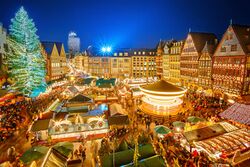
|image_skyline = | |image_skyline = [[File:Gungarne1.jpg|250px|frameless|center]] | ||
|imagesize = | |imagesize = | ||
|image_alt = | |image_alt = | ||
|image_caption = | |image_caption = Christmas Market in Gungarne. | ||
|image_flag = | |image_flag = | ||
|flag_alt = | |flag_alt = | ||
| Line 19: | Line 19: | ||
|nickname = | |nickname = | ||
|motto = | |motto = | ||
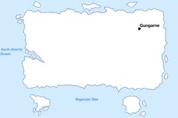
|image_map = | |image_map = [[File:Gungarnemap.jpg|259px|frameless|center]] | ||
|map_alt = | |map_alt = | ||
|map_caption = | |map_caption = Location of Gungarne in Yogania. | ||
|pushpin_map = | |pushpin_map = | ||
|pushpin_map_alt = | |pushpin_map_alt = | ||
| Line 31: | Line 31: | ||
|coordinates_footnotes = | |coordinates_footnotes = | ||
|subdivision_type = Country | |subdivision_type = Country | ||
|subdivision_name = | |subdivision_name = [[Yogania]] | ||
|subdivision_type1 = | |subdivision_type1 = State | ||
|subdivision_name1 = | |subdivision_name1 = [[Bugan (state)|Bugan]] | ||
|subdivision_type2 = | |subdivision_type2 = District | ||
|subdivision_name2 = | |subdivision_name2 = Koruler | ||
|subdivision_type3 = | |subdivision_type3 = | ||
|subdivision_name3 = | |subdivision_name3 = | ||
|established_title = | |established_title = Founded | ||
|established_date = | |established_date = 1345 | ||
|founder = | |founder = | ||
|seat_type = | |seat_type = | ||
|seat = | |seat = | ||
|government_footnotes = | |government_footnotes = | ||
|government_type = | |government_type = Mayor-council government | ||
|governing_body = | |governing_body = | ||
|leader_party = | |leader_party = | ||
|leader_title = | |leader_title = Mayor | ||
|leader_name = | |leader_name = Gordie Wilhelm | ||
|leader_title1 = | |leader_title1 = President of city council | ||
|leader_name1 = | |leader_name1 = Jolen Koorled | ||
|leader_title2 = | |leader_title2 = | ||
|leader_name2 = | |leader_name2 = | ||
| Line 70: | Line 70: | ||
|area_blank2_title = | |area_blank2_title = | ||
<!-- square kilometers --> | <!-- square kilometers --> | ||
|area_total_km2 = | |area_total_km2 = 2809 | ||
|area_land_km2 = | |area_land_km2 = 2653 | ||
|area_water_km2 = | |area_water_km2 = 156 | ||
|area_urban_km2 = | |area_urban_km2 = 2498 | ||
|area_rural_km2 = | |area_rural_km2 = 155 | ||
|area_metro_km2 = | |area_metro_km2 = | ||
|area_blank1_km2 = | |area_blank1_km2 = | ||
| Line 93: | Line 93: | ||
|elevation_m = | |elevation_m = | ||
|population_footnotes = | |population_footnotes = | ||
|population_as_of = | |population_as_of = 2024 | ||
|population_total = | |population_total = 3,825,667 | ||
|population_density_km2 = auto | |population_density_km2 = auto | ||
|population_note = | |population_note = | ||
|population_demonym = | |population_demonym = Gungarnid | ||
|timezone1 = | |timezone1 = UTC +3 | ||
|utc_offset1 = | |utc_offset1 = | ||
|timezone1_DST = | |timezone1_DST = | ||
|utc_offset1_DST = | |utc_offset1_DST = | ||
|postal_code_type = | |postal_code_type = | ||
|postal_code = | |postal_code = 93000 | ||
|area_code_type = | |area_code_type = | ||
|area_code = | |area_code = 93 | ||
|area_codes = <!-- for multiple area codes --> | |area_codes = <!-- for multiple area codes --> | ||
|iso_code = | |iso_code = | ||
|website = <!-- {{URL|example.com}} --> | |website = <!-- {{URL|example.com}} --> gungarnalorden.yo | ||
|module = | |module = | ||
|footnotes = | |footnotes = | ||
}} | }} | ||
Revision as of 18:06, 24 August 2024
Gungarne
Gungarnal (Yoganian) | |
|---|---|
City | |
Christmas Market in Gungarne. | |
Location of Gungarne in Yogania. | |
| Country | Yogania |
| State | Bugan |
| District | Koruler |
| Founded | 1345 |
| Government | |
| • Type | Mayor-council government |
| • Mayor | Gordie Wilhelm |
| • President of city council | Jolen Koorled |
| Area | |
| • City | 2,809 km2 (1,085 sq mi) |
| • Land | 2,653 km2 (1,024 sq mi) |
| • Water | 156 km2 (60 sq mi) |
| • Urban | 2,498 km2 (964 sq mi) |
| • Rural | 155 km2 (60 sq mi) |
| Population (2024) | |
| • City | 3,825,667 |
| • Density | 1,400/km2 (3,500/sq mi) |
| Demonym | Gungarnid |
| Time zone | UTC +3 |
| Area code | 93 |
| Website | gungarnalorden.yo |

