Ambox notice.png
Scheduled Maintenance
The wiki will be going down for routine maintenance on Wednesday, July 17th, 2024, at approximately 1:00 PM Central Time (13:00) or 11:00 Pacific Time. The site may be inaccessible during this time and the database will be locked from editing. We expect the maintenance to take about one hour. We strongly encourage joining our Discord for updates.

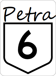
Petra State Highway 6

Revision as of 06:19, 11 May 2024 by Jwill96 (talk | contribs)
(diff) ← Older revision | Latest revision (diff) | Newer revision → (diff)
Jump to navigation Jump to search
PT-6.png
Route information
Length243 mi (391 km)
Existed1921–present
Major junctions
South endPT-1.png in Smryna
 
  • I-41.svg
  • I-55.svg
  • US 61.svg
North endUS 259.svgPT-54.png in Luttrell

Petra State Highway 6 is a minor east-west highway serving rural southeastern Petra.

Major intersections

County Location Destination
Marlow Smyrna PT-1.png - Jamestown, Dover
Crewe Greenville South PT-5.png - McDonald
North PT-5.png - Mechanisburg
Abbott Knoxville PT-10.png - Dunlap, Witt
Westwood Alcoa I-41.svg - Collegedale, Houston
Amherst PT-33.png - Kensington, Cleveland
I-55.svg - Beaumont, Houston
US 61.svg - Trenton, Houston
Madison River
River Maryville PT-16.png - Kensington
Gregory Luttrell US 259.svgPT-54.png - Varnell, Trenton, Baileyton