Salonika
Salonika
Σαλονίκα 𐡎𐡀𐡋𐡅𐡍𐡉𐡊𐡀 | |
|---|---|
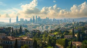
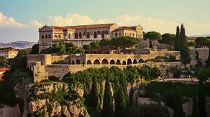
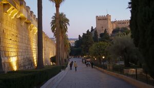
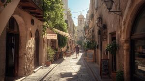
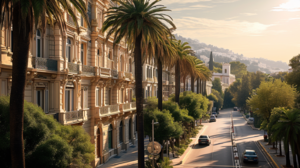
Salonika's commercial district Salonika's North Gate multi-colored villas in the city's southern hills Elefthería circle Saint Geṓrgios Cathedral | |
| Country | |
| Founded | 640 BC |
| Government | |
| • Type | Estates-General |
| • Body | Estates of Salonika |
| • Hypatos | Emilios Frangopoulos |
| Area | |
| • City | 18,242 km2 (7,043 sq mi) |
| Elevation | 2 m (7 ft) |
| Population (2024) | |
| • City | 42,320,500 |
| • Density | 2,300/km2 (6,000/sq mi) |
| • Metro | 162,520,000 |
| Time zone | UTC+1 (Kingston Mean Time) |
Salonika (Willinkian: Σαλονίκα) (Mariac: 𐡎𐡀𐡋𐡅𐡍𐡉𐡊𐡀) is the de facto and historical capital, as well as most populous city of Willink. Salonika is a port situated on the Karpophoros Peninsula, a 200 kilometer long landmass extending outward from the southern extension of Vóreios mountain range toward the Fospontis Sea. With a population of over 42 million persons and an urban area encompassing some 204 million, Salonika is the largest and most important city in the central Fospontia region of Willink, the tenth largest urban amalgamation in eastern Haven, as well as the traditional seat of the Willinkian Basileus and the Willinkian Orthodox Church.
Salonika is believed to have been founded around 640 BC, and had attained prominence as a significant Norian polis of some 50,000 people by 300 BC; it was later incorporated into the Kingdom of Fospontia and Kingdom of Fillinkis, alternating as the capital with the cities of Epidaurum and Botrys from 200 BC to 1400 AD; in the 1400s in assumed position as the permanent seat of government. As the principle internal seaport of the Fospontis Sea, the city thereafter experienced massive population growth, swelling to over two million residents and becoming one of Haven's largest cities by the 16th century. One of the oldest capitals of Haven, Salonika has constituted one of region's most important centers of finance, trade, art, architecture and science for centuries, and is considered an alpha world city by the Pacitalian affairs publication The Economist.
Toponym
The name Salonika is thought to derive from the name of the Willinkian continent, Thalassia, as well as Nika, referencing the cities' idea geographic location abreast a large sheltered bay. It is also referenced as Salonica in Doomani sources. The oldest written account of the name in its traditional form dates to 518 BC.
History
Evidence of neolithic occupation of the current site of the city points to settlement in the year 1200 BC, but there is no mention of any large settlements in the Kanis record reflective of the site. The current city is believed to have been founded by colonists sailing east from Myrina in 640 BC; the coast where the ancient city was established was sheltered from the Fospontis Sea and possessive of a convenient, shallow harbor which permitted the construction of expansive quays to unload goods. Eventually, the ancient city was further linked with Norian city-states to the west via the construction of the Grand Coastal Road. Located roughly midpoint the Fospontis, Salonika developed into an early important port and emporium, providing the link to the isolated eastern city-state of Ismaros and seclusion from Vatae tribal polities in the north given the vast mountain ranges inland the coast.
The ancient core of the city lies on the northern coast of the Karapophoros peninsula; the original city walls, dating from the 5th century BC exist in several small segments, but were mostly built over by the turn of the millennium. The extant city walls cover a much larger footprint, and date from the fifteenth century by which the city had expanded tremendously in every direction. Several important pre-Christian sites remain within the confines of the ancient walls, including the city's public baths, asklepieion, and partial elements of the basilica.
Administration
Local Administration
Salonika does not possess a government per se; it consists of the historical City of Salonika, whose boundaries are confined to the original city walls, and various dēmos, subdivisions hosting their own voluntary municipal corporations. The main body politic of these associations is the Estates of Salonika, a deliberative body encompassing both corporate entities and individual property owners. The city estates generally are responsible for what would be approximated as urban planning by means of a system of market urbanism, including collective provision of street maintenance and utilities through merchant and landlord associations, provision of emergency services, and voluntary zoning and protection of historic buildings through restrictive covenant on allowable property usage. Salonika is thought to be one of the largest cities in the world without zoning laws and without government provision of policing or roads.
National Administration
Geography
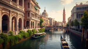
The original geographic footprint of the city of Salonika encompassed a shallow harbor and surrounding acreage on the northern shore of the Karpophoros peninsula, with tracts of farmland surrounding the ancient city walls. Ceaseless outward expansion has led the city footprint to envelop virtually the entire western half of the peninsula, as well as several historic towns which were incorporated into the city in the 18th century. The city's landscape is marked by intervening plains and hills, vast swaths of historic parkland, and various segments of beach shores and cliffed outcroppings to the sea. Salonika possesses a voluminous artificial reservoir, in the vicinity of the Salonika city palace, which feeds a system of historic canals that carry water toward districts situated closer to the urban center of the city.
Much of the old city center is densely populated and consists of narrow streets and medieval boulevards interrupted by urban plazas; the outer ring districts often provide much greater swaths of green space. During the city's expansion in the 19th and early 20th century, large tracts of parks, water features, and monumental outdoor spaces were constructed as part of a beautification rivalry with Praetonian city of Kingston and the Cravanian city of Laurana.
The city itself encompasses a total area of 18,000 square kilometers, extending roughly 150 kilometers east-west and 120 kilometers north-south; with a population density of 2,351 persons per square kilometer, and a population exceeding 40 million, it is one of nineteen cities in mainland Willink to be considered a megacity for statistical purposes. Salonika possesses a hot summer Mediterranean climate, with hot, dry summers and mild winters marked by increased rainfall. Salonika has experienced sporadic snowfall, the most recent instances being in 2017. Generally, temperatures rarely fall below below 65.0 °F (18.3 °C), and the summer daily mean temperature charts at 80 °F (26.6 °C).
Demographics
Economy
The Salonika megalopolis is one of the wealthiest urban amalgamations in Haven; its gross metropolitan product totals some 23.6 trillion dollars, an output rivaling many large nations. Salonika is an important center of finance, diplomacy, manufacturing, and tourism. Salonika is an significant city in the development of economic thought and the emergence of capitalism, as well as one of the first cities in Haven to possess large foreign quarters after the establishment of supra-regional trade routes in the 1500s. As the seat of Willink's financial infrastructure, Salonika is the largest banking center in Eastern Haven, home to the largest number of banks in Willink, as well as the location of the largest precious metals exchange in Haven, Antallaktírio Metállon. Salonika is renowned for is many ancient trade houses, guilds and trade federations, whose modern-day counterparts facilitate trade policy, dispute resolution, and infrastructure development. Leveraging Díkaio's legal flexibility, Salonika is a regional hub for arbitrage trading, speculative finance, and ratification of complex commercial agreements and contracts.
Transport
Salonika possesses a highly developed and expansive transportation network, encompassing four major international airports, a large underground network, numerous light rail and elevated rail networks, trams, bus lines, ring highways, and waterway transports.
Airports
Railways
Water
Roads
Education
Culture
Landmarks
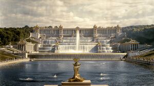
Salonika's half-millennium prominence as a leading regional center is bolstered by its rich collection of monumental architecture, collection of historic skyscrapers, array of large churches, and vast park spaces. The city's largest, most notable monument is the enormous Thekla Fountain, considered a beaux-arts masterpiece executed on a grand scale, and one of the largest fountain complexes in the known world.
Another important symbol of the city is the 88 story Anatolikoi Emporoi, an early high rise that upon completion in 1911 was the tallest building in Haven, and figures as one of the most popular tourist attractions in what is considered the original footprint of the city center.
Sports and Recreation
Sister cities
Salonika possesses numerous sister cities, most prominent among them being Kingston (Praetonia), Seaburg (Hamptonshire), Laurana (Cravan), Jesselton (Questers), and Duntåvsbyen (Chevrokia).
