New Marenesia
Dominion of New Marenesia Nusantara (East-Arhoman) | |
|---|---|
| Motto: “Excelsior” | |
| Capital | Newark |
| Official languages | Anglic East-Arhoman NM Sign Language |
| Demonym(s) | New Marenesian |
| Government | Unitary parliamentary constitutional monarchy |
• Monarch | Creighton III |
• Premier | Philip Doyle |
| Legislature | Senate |
| Currency | New Marenesian Nomisma |
The Dominion came into independence as a unitary parliamentary constitutional monarchy after adopting the Statute of Godstone and having accepted the full external autonomy from Great Anglia. Yet, New Marenesia is still a constitutional monarchy under King Creighton III. The executive branch is led by the directly elected Premier. While the unicameral, Senate has its seats are allocated by population.
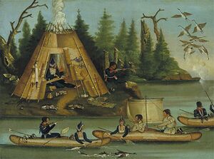
Ethnically, the original New Marenesians were the Nusantaran Islanders. A group native to the region, widely known for the seafaring and navigating prowess, having traded as far away as Europa. In 1500, Captain Henry Brownlow made landfall and introduced the Anglians to what they would rename and colonize as New Marenesia. Over the coming centuries, thanks to inclusive democratic values and lenient immigration laws, the island nation is now a melting pot of nationalities.
Today, the Dominion is an advanced market economy and a wurldwide leader in foreign direct investment, with foreign companies paying 80% of New Marenesia’s corporate taxes. The country is rich in natural resources including petroleum, hydropower, fish, forests, and minerals. Through heavy taxation, the nation is able to provide a robust welfare state for its citizens.
Geography
New Marenesia is located in the southern hemisphere and is comprised of three main islands Tumasik, Haru and Seran. Seran, the eastern island is the largest landmass in the Dominion with the New Marenesian Alps running down its length. The Range is comprised of 18 peaks higher than 3,000m and terminates in deep fjords. Haru, the southwestern island is less mountainous but, has substantial volcanic activity. The nation’s largest lake, Lake Teluk Rohis located in one such volcanic caldera. Urban development on Tumasik, the northwestern island is centered around Brownlow Bay. It’s deep and sheltered waters have long made it a strategic position in both defense and trade. What remains of undeveloped terrain on the island is hilly and has been preserved as National Parks. Because the nation is an archipelago it has extensive marine resources. Additionally, the ocean moderates New Marenesia’s humid continental climate.
History
Indigenous New Marenesians are mainly comprised of Nusantaran Islanders who themselves are descendants of the original Azano-Marenesian explorers. The earlist evidence of settlement in the region dates to 50,000 BCE during the Second Migration of the Azano-Marenesian people. Over the millennias that followed the population developed into the unique Nusantaran Islanders. The islanders would later form suku (tribes) which had dynamic relations ranging from cooperation to hostility.
In late 1500 when the Great Anglian explorer Captain Henry Brownlow made the first Europan landfall on Tumasik. After Brownlow was killed by a hostile suku, no further Europans visited the islands until 1627 when Europan and Argic whalers started visiting the islands. After trading with the whalers for foreign technologies and intersuku arms race began, culminating in the Musket Wars. The Musket Wars were between 1659 and 1698 and resulted in the death of approximately 35,000 Nusantaran warriors. At the start of the 18th century Catholic missionaries settled on the islands and by the end of the century had converted the majority of the population. Between the Musket Wars and diseases brought by the missionaries, more than 40% of pre-contact Nusantaran population had died.
