File:Baygtonia Regional Map.png
Jump to navigation
Jump to search

Size of this preview: 300 × 600 pixels. Other resolution: 760 × 1,520 pixels.
Original file (760 × 1,520 pixels, file size: 73 KB, MIME type: image/png)
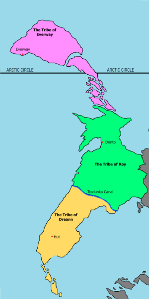
The Regional Map showing where each of the United Tribes of Bayton calls home.
File history
Click on a date/time to view the file as it appeared at that time.
| Date/Time | Thumbnail | Dimensions | User | Comment | |
|---|---|---|---|---|---|
| current | 01:11, 29 March 2020 | | 760 × 1,520 (73 KB) | Baytonia (talk | contribs) |
You cannot overwrite this file.
File usage
There are no pages that use this file.