Eilínótt
This article is incomplete because it is pending further input from participants, or it is a work-in-progress by one author. Please comment on this article's talk page to share your input, comments and questions. Note: To contribute to this article, you may need to seek help from the author(s) of this page. |
The Eternal Kingdom of Night Eilíft Næturríki | |
|---|---|
| Capital and city | Sæeilítur |
| Official languages | Næturræða |
| Also spoken | Ostlander • Trinovantan |
| Ethnic groups | Næturfrændi |
| Demonym(s) | EilínóttI |
| Government | Hereditary monarchy |
• Konungur | Ásgeir Indriðison Freyr (Ásgeir III) |
• Regent | Baldur Leifurson Vídalín |
| Establishment | |
• Discovery by Trinovantan | 897 CE |
• Part of the Trinovantan Empire | 973 CE |
• Independence from Trinovantum | 1804 CE |
| Population | |
• 2020 census | 351,974 |
| GDP (nominal) | estimate |
• Total | 20.8 billion |
• Per capita | 59,095 |
| Currency | Dökkmynt (ლ) |
| Date format | mm/dd/yyyy |
| Driving side | right |
| Calling code | +999 |
Etymology
History
Geography
Government
Government Ministries
Political parties
Political divisions
Military
Law Enforcement
Economy
Infrastructure
Roadways
Route 1, or the Ringway, (Næturræða: Hringvegur), and originally called the Ringstraße, was completed in 1978 by the occupation government of Ostlichtor. The existing unpaved road system of Eilínótt proved inadequate for rapidly moving material and supplies around the island, and in 1974, shortly after taking possession of the island, the Ostlander government authorized the construction of a single highway that would circle the island connecting all inhabited costal locations. Some effort was made between 1979 and 1982 by the occupation government to pave roadways between the several small interior settlements of the island. These efforts ended in 1982 when control of the island was retuned to the Eilínótti people. Efforts to continue improving roadway infrastructure continued through the 1980s and 1990s, with the interior settlement of Schneeschuh being the last settlement to be linked to the rest of the nation by paved roads in 1995
Demographics
Largest cities and towns in Eilínótt
2020 National Census | |||||||||
|---|---|---|---|---|---|---|---|---|---|
| Rank | [[s of Eilínótt|]] | Pop. | |||||||
 Sæeilítur  Myrkurbær |
1 | Sæeilítur | Höfuðborgarsvæði | 131,136 |  Stórreykjabær  Fyrstaijós | ||||
| 2 | Myrkurbær | Vestursvæði | 35,966 | ||||||
| 3 | Stórreykjabær | Vestursvæði | 29,409 | ||||||
| 4 | Fyrstaijós | Austursvæði | 18,542 | ||||||
| 5 | Miðnætursól | Austursvæði | 17,555 | ||||||
| 6 | Daluríss | Austursvæði | 12,912 | ||||||
| 7 | Síðastaljósið | Vestursvæði | 10,225 | ||||||
| 8 | Reykjasteina | Vestursvæði | 7,564 | ||||||
| 9 | Stórlindir | Austursvæði | 4,575 | ||||||
| 10 | Grýttarsléttur | Austursvæði | 3,319 | ||||||
Culture
Hring Myrkurs
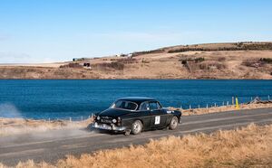
The Hring Myrkurs, or Circle of Darkness, is a motorspot road race held every year in which competitors race around the island of Eilínótt, utilizing the nations circular highway ring. Initially, the race was held in one day, lasting a total of 12-13 hours, with designated resting points along the route. However, as the population and motorway traffic of Eilínótt increased, the race was scaled back to designated sections of the highway being utilized for a single race per day. Modernly, the race is a week long affair, with racers participating in a single race per day lasting 1-3 hours.


